Property Record
3 Blanch Farm Rd, Greenville, NH 03048


NEARBY LISTINGS FOR SALE OR LEASE
-
-
View all Greenville listings for sale on LoopNet.com
Property Detail
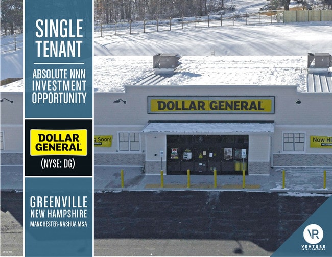
3 Blanch Farm Rd
GRVL-000001-000000-000045
Hillsborough
Commercialbuilding
New Hampshire
X
45
25017C0035F
2 AC
2024
Hillsborough
2024
Boston
018501
Manchester-Nashua, NH
9,258 SF
DEMOGRAPHICS near 3 Blanch Farm Rd
1 Mile
3 Mile
5 Mile
2024 Total Population
903
3,978
10,884
2029 Population
919
4,007
10,956
Pop Growth 2024-2029
+ 1.77%
+ 0.73%
+ 0.66%
Average Age
44
43
42
2024 Total Households
379
1,581
4,096
HH Growth 2024-2029
+ 1.85%
+ 0.63%
+ 0.59%
Median Household Inc
$84,444
$88,520
$95,205
Avg Household Size
2.40
2.50
2.70
2024 Avg HH Vehicles
2.00
2.00
2.00
Median Home Value
$89,772
$267,371
$314,638
Median Year Built
1978
1976
1979
Nearby Places
Map Layers
Map Styles
 Street
 Aerial
- Restaurants
- Banks
- Shops
- Fitness
- Groceries
PUBLIC TRANSPORTATION
AIRPORT
Manchester Boston Regional
DRIVE
WALK
Distance
Manchester Boston Regional
60 min
32.9 mi
Freight Ports
Port of Boston
DRIVE
WALK
Distance
Port of Boston
92 min
54.2 mi
SALE & LEASE HISTORY
LISTING DATE
SALE/LEASE

Nov 05, 2018
For Sale
Nearby Properties
Address
Land Use
TOTAL SIZE
Lot Size
Zoning
Address
Land Use
TOTAL SIZE
Lot Size
Zoning
72,489 SF
114.26 AC
RD R
Address
Land Use
TOTAL SIZE
Lot Size
Zoning
74,751 SF
16.30 AC
VD2 V
Address
Land Use
TOTAL SIZE
Lot Size
Zoning
2,285 SF
67 AC
COMM/I
Address
Land Use
TOTAL SIZE
Lot Size
Zoning
32,286 SF
2.70 AC
DOWNTO
Address
Land Use
TOTAL SIZE
Lot Size
Zoning
Address
Land Use
TOTAL SIZE
Lot Size
Zoning
11,626 SF
32 AC
IND DI
Address
Land Use
TOTAL SIZE
Lot Size
Zoning
4,417 SF
5.29 AC
RES DI
Address
Land Use
TOTAL SIZE
Lot Size
Zoning
13,200 SF
5.20 AC
COMM/I
Address
Land Use
TOTAL SIZE
Lot Size
Zoning
24,374 SF
6.32 AC
HP
Address
Land Use
TOTAL SIZE
Lot Size
Zoning
4,604 SF
1 AC
RES DI
Address
Land Use
TOTAL SIZE
Lot Size
Zoning
16,616 SF
0.79 AC
DOWNTO
Address
Land Use
TOTAL SIZE
Lot Size
Zoning
41,787 SF
17.62 AC
COMM D
Address
Land Use
TOTAL SIZE
Lot Size
Zoning
66,656 SF
11.30 AC
IND DI
Address
Land Use
TOTAL SIZE
Lot Size
Zoning
1,871 SF
3.30 AC
COMM D
Address
Land Use
TOTAL SIZE
Lot Size
Zoning
9,933 SF
0.93 AC
COMM/I
Address
Land Use
TOTAL SIZE
Lot Size
Zoning
1,344 SF
12 AC
IND DI
Address
Land Use
TOTAL SIZE
Lot Size
Zoning
23,495 SF
4.40 AC
RD R
Address
Land Use
TOTAL SIZE
Lot Size
Zoning
8,635 SF
2.01 AC
COMM/I
Address
Land Use
TOTAL SIZE
Lot Size
Zoning
78,699 SF
9 AC
RD R
Address
Land Use
TOTAL SIZE
Lot Size
Zoning
24,077 SF
6.10 AC
COMM D
Address
Land Use
TOTAL SIZE
Lot Size
Zoning
31,281 SF
7.60 AC
VD1 V
Address
Land Use
TOTAL SIZE
Lot Size
Zoning
5,582 SF
9.40 AC
RD R
Address
Land Use
TOTAL SIZE
Lot Size
Zoning
784 SF
7.67 AC
COMM D
Address
Land Use
TOTAL SIZE
Lot Size
Zoning
2,011 SF
2.35 AC
COMM/I
Address
Land Use
TOTAL SIZE
Lot Size
Zoning
8,027 SF
0.56 AC
DOWNTO
Address
Land Use
TOTAL SIZE
Lot Size
Zoning
10,038 SF
0.24 AC
DOWNTO
Address
Land Use
TOTAL SIZE
Lot Size
Zoning
14,072 SF
17.68 AC
RD R
Address
Land Use
TOTAL SIZE
Lot Size
Zoning
4,437 SF
47.23 AC
GRAF
Address
Land Use
TOTAL SIZE
Lot Size
Zoning
10 AC
COMM/I
The World's #1 Commercial Real Estate Marketplace
Connect with us
© 2025 CoStar Group
The information above has been obtained from sources believed reliable. While we do not doubt its accuracy we have not verified it and make no guarantee, warranty or representation about it. It is your responsibility to independently confirm its accuracy and completeness. Any projections, opinions, assumptions, or estimates used are for example only and do not represent the current or future performance of the property. The value of this transaction to you depends on tax and other factors which should be evaluated by your tax, financial, and legal advisors. You and your advisors should conduct a careful, independent investigation of the property to determine to your satisfaction the suitability of the property for your needs.