Property Record
3 Cockatoo Dr, Placida, FL 33946
Property Detail
3 Cockatoo Dr
Punta Gorda, FL
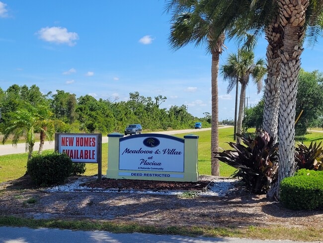
ROTONDA MEADOWS BLK81 LT 5 1421/1945 2258/571 3154/1126 3479/1683
412133307010
CHARLOTTE
Residentialacreage
Florida
RSF5
5
AE The base floodplain where base flood elevations are provided. AE Zones are now used on new format FIRMs instead of A1-A30 Zones.
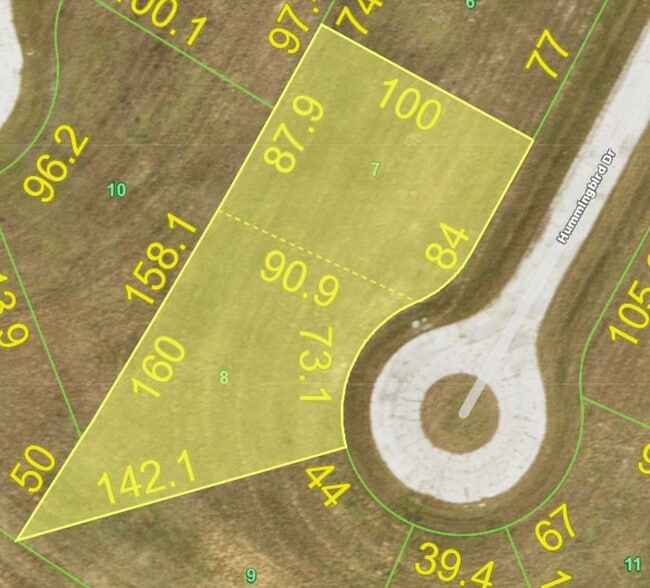
0.18 AC
2024
Charlotte County
2025
Southwest Florida
030504
NEARBY LISTINGS FOR SALE OR LEASE
DEMOGRAPHICS near 3 Cockatoo Dr
1 mile
3 mile
5 mile
2025 Total Population
1,527
11,167
31,017
2030 Population
1,809
12,674
34,656
Pop Growth 2025-2030
+ 18.47%
+ 13.50%
+ 11.73%
Average Age
61
59
58
2025 Total Households
761
5,205
14,834
HH Growth 2025-2030
+ 18.53%
+ 13.43%
+ 11.62%
Median Household Inc
$93,848
$95,940
$82,937
Avg Household Size
2.00
2.10
2.10
2025 Avg HH Vehicles
2.00
2.00
2.00
Median Home Value
$531,077
$491,383
$436,043
Median Year Built
2010
2008
2000
Nearby Places
Map Layers
Map Styles
 Street
 Aerial
Layers
 Traffic
 Biking
Places
Listings with unknown addresses are not visible on the map
- Restaurants
- Banks
- Shops
- Fitness
- Groceries
PUBLIC TRANSPORTATION
AIRPORT
Punta Gorda
Drive
Walk
Distance
Punta Gorda
49 min
26.8 mi
Freight Ports
Port Manatee
Drive
Walk
Distance
Port Manatee
99 min
68.8 mi
SALE & LEASE HISTORY
LISTING DATE
SALE/LEASE

May 28, 2024
For Sale
Nearby Properties
Address
Land Use
TOTAL SIZE
Lot Size
Zoning
Address
Land Use
TOTAL SIZE
Lot Size
Zoning
42,935 SF
167.66 AC
RE1
Address
Land Use
TOTAL SIZE
Lot Size
Zoning
1,200 SF
29.50 AC
CG
Address
Land Use
TOTAL SIZE
Lot Size
Zoning
6,476 SF
17.26 AC
II
Address
Land Use
TOTAL SIZE
Lot Size
Zoning
4,776 SF
20 AC
II
Address
Land Use
TOTAL SIZE
Lot Size
Zoning
2,940 SF
332.40 AC
RSF5
Address
Land Use
TOTAL SIZE
Lot Size
Zoning
20,650 SF
1.61 AC
CG
Address
Land Use
TOTAL SIZE
Lot Size
Zoning
1,430 SF
5.98 AC
CG
Address
Land Use
TOTAL SIZE
Lot Size
Zoning
576 SF
5 AC
II
Address
Land Use
TOTAL SIZE
Lot Size
Zoning
11,550 SF
1.18 AC
CG
Address
Land Use
TOTAL SIZE
Lot Size
Zoning
11,708 SF
9.99 AC
II
Address
Land Use
TOTAL SIZE
Lot Size
Zoning
13.29 AC
CG
Address
Land Use
TOTAL SIZE
Lot Size
Zoning
7.71 AC
CG
Address
Land Use
TOTAL SIZE
Lot Size
Zoning
630 SF
10 AC
II
Address
Land Use
TOTAL SIZE
Lot Size
Zoning
10.21 AC
II
Address
Land Use
TOTAL SIZE
Lot Size
Zoning
2,612 SF
6.76 AC
II
Address
Land Use
TOTAL SIZE
Lot Size
Zoning
224 SF
8.23 AC
II
Address
Land Use
TOTAL SIZE
Lot Size
Zoning
1,368 SF
7.46 AC
II
Address
Land Use
TOTAL SIZE
Lot Size
Zoning
32,500 SF
5 AC
II
Address
Land Use
TOTAL SIZE
Lot Size
Zoning
7.37 AC
II
Address
Land Use
TOTAL SIZE
Lot Size
Zoning
1,363 SF
5 AC
II
Address
Land Use
TOTAL SIZE
Lot Size
Zoning
18.79 AC
PKR
Address
Land Use
TOTAL SIZE
Lot Size
Zoning
560 SF
119.96 AC
AG
Address
Land Use
TOTAL SIZE
Lot Size
Zoning
13,696 SF
1.21 AC
CG
Address
Land Use
TOTAL SIZE
Lot Size
Zoning
5.41 AC
II
Address
Land Use
TOTAL SIZE
Lot Size
Zoning
7,174 SF
4.01 AC
II
Address
Land Use
TOTAL SIZE
Lot Size
Zoning
5 AC
II
Address
Land Use
TOTAL SIZE
Lot Size
Zoning
5 AC
II
Address
Land Use
TOTAL SIZE
Lot Size
Zoning
5 AC
II
Address
Land Use
TOTAL SIZE
Lot Size
Zoning
5 AC
II
Address
Land Use
TOTAL SIZE
Lot Size
Zoning
5 AC
II
The World's #1 Commercial Real Estate Marketplace
Connect with us
© 2026 CoStar Group
The information above has been obtained from sources believed reliable. While we do not doubt its accuracy we have not verified it and make no guarantee, warranty or representation about it. It is your responsibility to independently confirm its accuracy and completeness. Any projections, opinions, assumptions, or estimates used are for example only and do not represent the current or future performance of the property. The value of this transaction to you depends on tax and other factors which should be evaluated by your tax, financial, and legal advisors. You and your advisors should conduct a careful, independent investigation of the property to determine to your satisfaction the suitability of the property for your needs.