Property Record
3 Eden Ln, Whippany, NJ 07981
Save to a Folder
{{folder.Name}}
{{folder.ListingIds.length}} Properties
{{folder.ListingIds.length}} Property
Create a New Folder
Property Detail
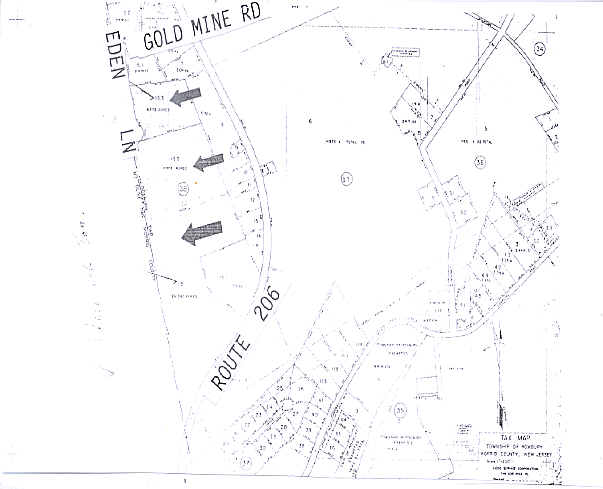
3 Eden Ln
Newark, NJ
INCL BLK 9001 LOTS 12 - 14
36-09001-0000-00014
MORRIS
Vacantlandnec
New Jersey
OR-5
12
2024
6.77 AC
2026
Western Morris
046104
Northern New Jersey
NEARBY LISTINGS FOR SALE OR LEASE
DEMOGRAPHICS near 3 Eden Ln
1 mile
3 mile
5 mile
2025 Total Population
1,631
39,081
80,695
2030 Population
1,675
40,081
82,553
Pop Growth 2025-2030
+ 2.70%
+ 2.56%
+ 2.30%
Average Age
41
42
42
2025 Total Households
532
15,139
30,893
HH Growth 2025-2030
+ 2.63%
+ 2.48%
+ 2.27%
Median Household Inc
$190,819
$124,355
$123,537
Avg Household Size
3.00
2.50
2.60
2025 Avg HH Vehicles
2.00
2.00
2.00
Median Home Value
$605,903
$453,509
$429,298
Median Year Built
1977
1975
1972
Nearby Places
Map Layers
Map Styles
 Street
 Aerial
Layers
 Traffic
 Biking
Places
Listings with unknown addresses are not visible on the map
- Restaurants
- Banks
- Shops
- Fitness
- Groceries
PUBLIC TRANSPORTATION
COMMUTER RAIL
Morristown (Morris & Essex Morristown Line - NJ Transit Commuter Rail (NJ Transit))
Drive
Walk
Distance
Morristown (Morris & Essex Morristown Line - NJ Transit Commuter Rail (NJ Transit))
6 min
3.7 mi
Convent Station (Morris & Essex Morristown Line - NJ Transit Commuter Rail (NJ Transit))
Drive
Walk
Distance
Convent Station (Morris & Essex Morristown Line - NJ Transit Commuter Rail (NJ Transit))
9 min
4.6 mi
AIRPORT
Newark Liberty International
Drive
Walk
Distance
Newark Liberty International
28 min
22.0 mi
LaGuardia
Drive
Walk
Distance
LaGuardia
58 min
42.1 mi
Freight Ports
Maher Terminal
Drive
Walk
Distance
Maher Terminal
30 min
22.5 mi
Nearby Properties
Address
Land Use
TOTAL SIZE
Lot Size
Zoning
Address
Land Use
TOTAL SIZE
Lot Size
Zoning
701 SF
111.59 AC
SED
Address
Land Use
TOTAL SIZE
Lot Size
Zoning
48.76 AC
OBRL
Address
Land Use
TOTAL SIZE
Lot Size
Zoning
63.53 AC
OLPD
Address
Land Use
TOTAL SIZE
Lot Size
Zoning
596 SF
64.81 AC
OBRL
Address
Land Use
TOTAL SIZE
Lot Size
Zoning
64.80 AC
C-4
Address
Land Use
TOTAL SIZE
Lot Size
Zoning
72,698 SF
133.64 AC
U
Address
Land Use
TOTAL SIZE
Lot Size
Zoning
9.80 AC
Address
Land Use
TOTAL SIZE
Lot Size
Zoning
10.94 AC
Address
Land Use
TOTAL SIZE
Lot Size
Zoning
43.60 AC
C-4
Address
Land Use
TOTAL SIZE
Lot Size
Zoning
Address
Land Use
TOTAL SIZE
Lot Size
Zoning
18.42 AC
RM
Address
Land Use
TOTAL SIZE
Lot Size
Zoning
4.52 AC
ROL
Address
Land Use
TOTAL SIZE
Lot Size
Zoning
577,851 SF
35.90 AC
SD5A
Address
Land Use
TOTAL SIZE
Lot Size
Zoning
10.42 AC
Address
Land Use
TOTAL SIZE
Lot Size
Zoning
27.20 AC
PODS
Address
Land Use
TOTAL SIZE
Lot Size
Zoning
Address
Land Use
TOTAL SIZE
Lot Size
Zoning
13.10 AC
R-25
Address
Land Use
TOTAL SIZE
Lot Size
Zoning
304,213 SF
21.73 AC
PODS
Address
Land Use
TOTAL SIZE
Lot Size
Zoning
88,345 SF
15.67 AC
R-7
Address
Land Use
TOTAL SIZE
Lot Size
Zoning
377,114 SF
40.64 AC
SD10
Address
Land Use
TOTAL SIZE
Lot Size
Zoning
58.20 AC
I
Address
Land Use
TOTAL SIZE
Lot Size
Zoning
203,590 SF
24.98 AC
SD10
Address
Land Use
TOTAL SIZE
Lot Size
Zoning
11.80 AC
I/B
Address
Land Use
TOTAL SIZE
Lot Size
Zoning
13.45 AC
B10W
Address
Land Use
TOTAL SIZE
Lot Size
Zoning
46.46 AC
B-3
Address
Land Use
TOTAL SIZE
Lot Size
Zoning
6.64 AC
Address
Land Use
TOTAL SIZE
Lot Size
Zoning
25.14 AC
I-B3
Address
Land Use
TOTAL SIZE
Lot Size
Zoning
200,360 SF
16.20 AC
OL-5
Address
Land Use
TOTAL SIZE
Lot Size
Zoning
18.29 AC
C-1
Address
Land Use
TOTAL SIZE
Lot Size
Zoning
The World's #1 Commercial Real Estate Marketplace
Connect with us
© 2026 CoStar Group
The information above has been obtained from sources believed reliable. While we do not doubt its accuracy we have not verified it and make no guarantee, warranty or representation about it. It is your responsibility to independently confirm its accuracy and completeness. Any projections, opinions, assumptions, or estimates used are for example only and do not represent the current or future performance of the property. The value of this transaction to you depends on tax and other factors which should be evaluated by your tax, financial, and legal advisors. You and your advisors should conduct a careful, independent investigation of the property to determine to your satisfaction the suitability of the property for your needs.