Property Record
3 Main St, Shirley, MA 01464
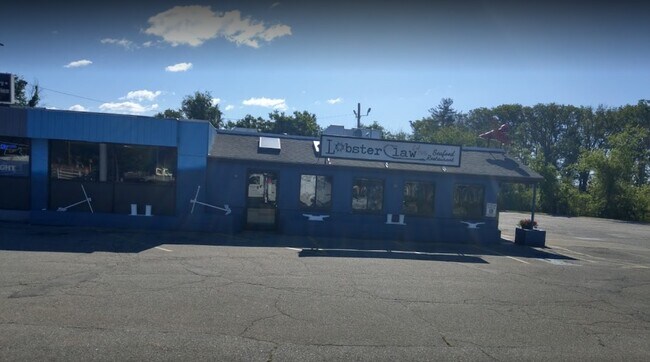

Property Detail
3 Main St
SHIR-000016-D000000-000003
Middlesex
Apartment
Massachusetts
SV
3
AE The base floodplain where base flood elevations are provided. AE Zones are now used on new format FIRMs instead of A1-A30 Zones.
0.41 AC
2025
Wilmington/Reading
2025
Boston
388200
Boston-Cambridge-Newton, MA-NH
7,395 SF
NEARBY LISTINGS FOR SALE OR LEASE
DEMOGRAPHICS near 3 Main St
1 mile
3 mile
5 mile
2025 Total Population
3,907
40,974
127,604
2030 Population
4,051
42,528
132,279
Pop Growth 2025-2030
+ 3.69%
+ 3.79%
+ 3.66%
Average Age
43
42
42
2025 Total Households
1,378
14,766
47,060
HH Growth 2025-2030
+ 3.85%
+ 3.98%
+ 3.79%
Median Household Inc
$138,020
$159,120
$147,129
Avg Household Size
2.70
2.70
2.60
2025 Avg HH Vehicles
2.00
2.00
2.00
Median Home Value
$847,517
$781,795
$763,788
Median Year Built
1972
1966
1968
Nearby Places
Map Layers
Map Styles
 Street
 Aerial
Layers
 Traffic
 Biking
Places
Listings with unknown addresses are not visible on the map
- Restaurants
- Banks
- Shops
- Fitness
- Groceries
PUBLIC TRANSPORTATION
COMMUTER RAIL
Shirley (Fitchburg/South Acton Line - Massachusetts Bay Transportation Authority Commuter Rail (Purple Line))
Drive
Walk
Distance
Shirley (Fitchburg/South Acton Line - Massachusetts Bay Transportation Authority Commuter Rail (Purple Line))
12 min
6.4 mi
Ayer (Fitchburg/South Acton Line - Massachusetts Bay Transportation Authority Commuter Rail (Purple Line))
Drive
Walk
Distance
Ayer (Fitchburg/South Acton Line - Massachusetts Bay Transportation Authority Commuter Rail (Purple Line))
12 min
6.4 mi
AIRPORT
Manchester Boston Regional
Drive
Walk
Distance
Manchester Boston Regional
51 min
29.3 mi
Worcester Regional
Drive
Walk
Distance
Worcester Regional
57 min
35.9 mi
Freight Ports
Port of Boston
Drive
Walk
Distance
Port of Boston
69 min
43.6 mi
Nearby Properties
Address
Land Use
TOTAL SIZE
Lot Size
Zoning
Address
Land Use
TOTAL SIZE
Lot Size
Zoning
35.63 AC
O
Address
Land Use
TOTAL SIZE
Lot Size
Zoning
15.98 AC
O
Address
Land Use
TOTAL SIZE
Lot Size
Zoning
8.44 AC
B1
Address
Land Use
TOTAL SIZE
Lot Size
Zoning
14.90 AC
RA
Address
Land Use
TOTAL SIZE
Lot Size
Zoning
130 AC
RA
Address
Land Use
TOTAL SIZE
Lot Size
Zoning
36,400 SF
4.26 AC
A2
Address
Land Use
TOTAL SIZE
Lot Size
Zoning
13,786 SF
2.79 AC
RA
Address
Land Use
TOTAL SIZE
Lot Size
Zoning
74,320 SF
10.75 AC
LI
Address
Land Use
TOTAL SIZE
Lot Size
Zoning
75,480 SF
7.98 AC
LI
Address
Land Use
TOTAL SIZE
Lot Size
Zoning
13,117 SF
4.04 AC
RA
Address
Land Use
TOTAL SIZE
Lot Size
Zoning
49,791 SF
3.14 AC
RA
Address
Land Use
TOTAL SIZE
Lot Size
Zoning
10,795 SF
5.02 AC
RA
Address
Land Use
TOTAL SIZE
Lot Size
Zoning
11,516 SF
0.50 AC
RA
Address
Land Use
TOTAL SIZE
Lot Size
Zoning
16,410 SF
3.62 AC
RA
Address
Land Use
TOTAL SIZE
Lot Size
Zoning
14,645 SF
2.84 AC
RA
Address
Land Use
TOTAL SIZE
Lot Size
Zoning
41,750 SF
3.46 AC
LI
Address
Land Use
TOTAL SIZE
Lot Size
Zoning
12.11 AC
RA
Address
Land Use
TOTAL SIZE
Lot Size
Zoning
7,051 SF
1.55 AC
RA
Address
Land Use
TOTAL SIZE
Lot Size
Zoning
24,136 SF
4.30 AC
LI
Address
Land Use
TOTAL SIZE
Lot Size
Zoning
13.40 AC
M1
Address
Land Use
TOTAL SIZE
Lot Size
Zoning
13.80 AC
RA
Address
Land Use
TOTAL SIZE
Lot Size
Zoning
13,945 SF
5.14 AC
A2
Address
Land Use
TOTAL SIZE
Lot Size
Zoning
35,585 SF
4.02 AC
GB
Address
Land Use
TOTAL SIZE
Lot Size
Zoning
8,967 SF
0.33 AC
RA
Address
Land Use
TOTAL SIZE
Lot Size
Zoning
497 AC
RA
Address
Land Use
TOTAL SIZE
Lot Size
Zoning
497 AC
RA
Address
Land Use
TOTAL SIZE
Lot Size
Zoning
29,492 SF
2.49 AC
LI
Address
Land Use
TOTAL SIZE
Lot Size
Zoning
35.20 AC
IND
Address
Land Use
TOTAL SIZE
Lot Size
Zoning
78.46 AC
B1
Address
Land Use
TOTAL SIZE
Lot Size
Zoning
20,016 SF
2.25 AC
GB
The World's #1 Commercial Real Estate Marketplace
Connect with us
© 2026 CoStar Group
The information above has been obtained from sources believed reliable. While we do not doubt its accuracy we have not verified it and make no guarantee, warranty or representation about it. It is your responsibility to independently confirm its accuracy and completeness. Any projections, opinions, assumptions, or estimates used are for example only and do not represent the current or future performance of the property. The value of this transaction to you depends on tax and other factors which should be evaluated by your tax, financial, and legal advisors. You and your advisors should conduct a careful, independent investigation of the property to determine to your satisfaction the suitability of the property for your needs.