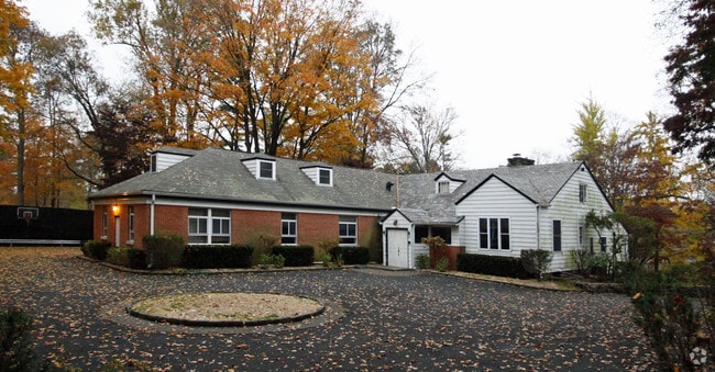
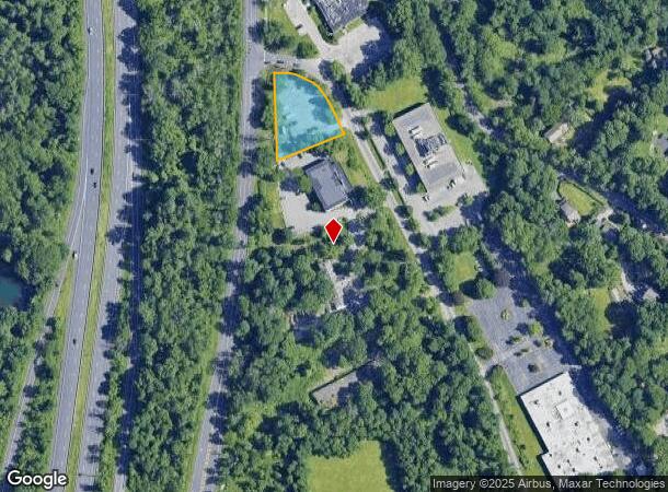
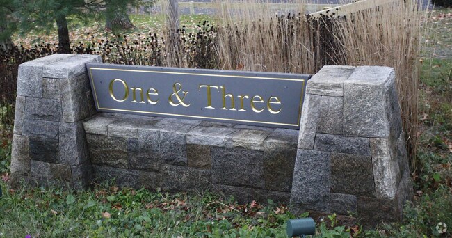
Property Record
3 New King St, West Harrison, NY 10604
NEARBY LISTINGS FOR SALE OR LEASE
Property Detail
3 New King St
3800-118-000-00002-000-0002-004-0000
Westchester
Industrialacreage
New York
X
4.000
09001C0479F
0.68 AC
2025
East I-287 Corridor
2024
Westchester/So Connecticut
012303
New York-Jersey City-White Plains, NY-NJ
DEMOGRAPHICS near 3 New King St
1 Mile
3 Mile
5 Mile
2024 Total Population
324
10,951
114,660
2029 Population
327
10,883
113,517
Pop Growth 2024-2029
+ 0.93%
(0.62%)
(1.00%)
Average Age
45
43
42
2024 Total Households
103
3,652
43,029
HH Growth 2024-2029
0.00%
(0.82%)
(1.02%)
Median Household Inc
$205,556
$213,534
$136,843
Avg Household Size
2.90
2.90
2.50
2024 Avg HH Vehicles
3.00
2.00
2.00
Median Home Value
$1,135,811
$1,046,128
$755,037
Median Year Built
1990
1979
1965
Nearby Places
- Restaurants
- Banks
- Shops
- Fitness
- Groceries
PUBLIC TRANSPORTATION
COMMUTER RAIL
North White Plains Station (Harlem Line - Metro-North Commuter Railroad Company (Metro-North))
DRIVE
WALK
Distance
North White Plains Station (Harlem Line - Metro-North Commuter Railroad Company (Metro-North))
11 min
6.0 mi
Valhalla Station (Harlem Line - Metro-North Commuter Railroad Company (Metro-North))
DRIVE
WALK
Distance
Valhalla Station (Harlem Line - Metro-North Commuter Railroad Company (Metro-North))
12 min
7.5 mi
AIRPORT
Westchester County
DRIVE
WALK
Distance
Westchester County
4 min
2.0 mi
LaGuardia
DRIVE
WALK
Distance
LaGuardia
46 min
29.0 mi
Freight Ports
NY - Red Hook Container Terminal
DRIVE
WALK
Distance
NY - Red Hook Container Terminal
60 min
39.5 mi
Nearby Properties
Address
Land Use
TOTAL SIZE
Lot Size
Zoning
Address
Land Use
TOTAL SIZE
Lot Size
Zoning
63,800 SF
103.69 AC
RA-4
Address
Land Use
TOTAL SIZE
Lot Size
Zoning
109.17 AC
RA-4
Address
Land Use
TOTAL SIZE
Lot Size
Zoning
113.12 AC
OB-1 OFFC
Address
Land Use
TOTAL SIZE
Lot Size
Zoning
73,572 SF
27.12 AC
RA-4
Address
Land Use
TOTAL SIZE
Lot Size
Zoning
164,312 SF
4.92 AC
Z-4 AIRPRT
Address
Land Use
TOTAL SIZE
Lot Size
Zoning
85,338 SF
25.19 AC
OB-1 OFFC
Address
Land Use
TOTAL SIZE
Lot Size
Zoning
5,075 SF
169.63 AC
RA-4
Address
Land Use
TOTAL SIZE
Lot Size
Zoning
477.23 AC
Address
Land Use
TOTAL SIZE
Lot Size
Zoning
22.39 AC
RA-4
Address
Land Use
TOTAL SIZE
Lot Size
Zoning
199.55 AC
RA-4
Address
Land Use
TOTAL SIZE
Lot Size
Zoning
343,295 SF
3.68 AC
OB-1 OFFC
Address
Land Use
TOTAL SIZE
Lot Size
Zoning
4,378 SF
154.27 AC
RA-4
Address
Land Use
TOTAL SIZE
Lot Size
Zoning
88,129 SF
18.68 AC
OB-1 OFFC
Address
Land Use
TOTAL SIZE
Lot Size
Zoning
273 AC
RA-4
Address
Land Use
TOTAL SIZE
Lot Size
Zoning
19,711 SF
10.25 AC
RA-4
Address
Land Use
TOTAL SIZE
Lot Size
Zoning
39,572 SF
9.49 AC
OB-3 OFFC
Address
Land Use
TOTAL SIZE
Lot Size
Zoning
24,360 SF
20.65 AC
RA-2
Address
Land Use
TOTAL SIZE
Lot Size
Zoning
Address
Land Use
TOTAL SIZE
Lot Size
Zoning
45,648 SF
0.93 AC
OB-1 OFFC
Address
Land Use
TOTAL SIZE
Lot Size
Zoning
46,168 SF
0.89 AC
OB-1 OFFC
Address
Land Use
TOTAL SIZE
Lot Size
Zoning
96,340 SF
15.89 AC
RA-4
Address
Land Use
TOTAL SIZE
Lot Size
Zoning
12,368 SF
8.04 AC
RA-4
Address
Land Use
TOTAL SIZE
Lot Size
Zoning
11.97 AC
RA-4
Address
Land Use
TOTAL SIZE
Lot Size
Zoning
19,456 SF
10.78 AC
OB-1 OFFC
Address
Land Use
TOTAL SIZE
Lot Size
Zoning
30,881 SF
0.61 AC
OB-1 OFFC
Address
Land Use
TOTAL SIZE
Lot Size
Zoning
32,067 SF
0.59 AC
OB-1 OFFC
Address
Land Use
TOTAL SIZE
Lot Size
Zoning
4,895 SF
9.26 AC
RA-2
Address
Land Use
TOTAL SIZE
Lot Size
Zoning
10.89 AC
RA-4
Address
Land Use
TOTAL SIZE
Lot Size
Zoning
14.85 AC
RA-4
Address
Land Use
TOTAL SIZE
Lot Size
Zoning
3,081 SF
157.60 AC
RA-4
The World's #1 Commercial Real Estate Marketplace
Connect with us
© 2025 CoStar Group
The information above has been obtained from sources believed reliable. While we do not doubt its accuracy we have not verified it and make no guarantee, warranty or representation about it. It is your responsibility to independently confirm its accuracy and completeness. Any projections, opinions, assumptions, or estimates used are for example only and do not represent the current or future performance of the property. The value of this transaction to you depends on tax and other factors which should be evaluated by your tax, financial, and legal advisors. You and your advisors should conduct a careful, independent investigation of the property to determine to your satisfaction the suitability of the property for your needs.