Property Record
3 Park St, Rehoboth, MA 02769

Property Detail
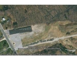
3 Park St
REHO-000069-000000-000099A
BRISTOL
Departmentstore
Massachusetts
A Areas with a 1% annual chance of flooding and a 26% chance of flooding over the life of a 30-year mortgage.
4.11 AC
2025
Attleboro/New Bedford
2025
Boston
633100
Providence-Warwick, RI-MA
16,596 SF
NEARBY LISTINGS FOR SALE OR LEASE
DEMOGRAPHICS near 3 Park St
1 mile
3 mile
5 mile
2025 Total Population
2,673
27,380
67,144
2030 Population
2,741
28,056
68,586
Pop Growth 2025-2030
+ 2.54%
+ 2.47%
+ 2.15%
Average Age
43
41
42
2025 Total Households
1,023
10,547
25,566
HH Growth 2025-2030
+ 2.64%
+ 2.53%
+ 2.16%
Median Household Inc
$102,282
$89,719
$99,870
Avg Household Size
2.60
2.50
2.60
2025 Avg HH Vehicles
2.00
2.00
2.00
Median Home Value
$467,168
$459,759
$484,227
Median Year Built
1978
1970
1974
Nearby Places
Map Layers
Map Styles
 Street
 Aerial
Layers
 Traffic
 Biking
Places
Listings with unknown addresses are not visible on the map
- Restaurants
- Banks
- Shops
- Fitness
- Groceries
PUBLIC TRANSPORTATION
COMMUTER RAIL
Attleboro (Providence/Stoughton Line - Massachusetts Bay Transportation Authority Commuter Rail (Purple Line))
Drive
Walk
Distance
Attleboro (Providence/Stoughton Line - Massachusetts Bay Transportation Authority Commuter Rail (Purple Line))
10 min
3.5 mi
South Attleboro (Providence/Stoughton Line - Massachusetts Bay Transportation Authority Commuter Rail (Purple Line))
Drive
Walk
Distance
South Attleboro (Providence/Stoughton Line - Massachusetts Bay Transportation Authority Commuter Rail (Purple Line))
18 min
6.7 mi
AIRPORT
Rhode Island Tf Green International
Drive
Walk
Distance
Rhode Island Tf Green International
43 min
23.8 mi
General Edward Lawrence Logan International
Drive
Walk
Distance
General Edward Lawrence Logan International
60 min
44.4 mi
Nearby Properties
Address
Land Use
TOTAL SIZE
Lot Size
Zoning
Address
Land Use
TOTAL SIZE
Lot Size
Zoning
10.40 AC
Address
Land Use
TOTAL SIZE
Lot Size
Zoning
228,377 SF
24.19 AC
IND
Address
Land Use
TOTAL SIZE
Lot Size
Zoning
228,377 SF
24.19 AC
IND
Address
Land Use
TOTAL SIZE
Lot Size
Zoning
146,400 SF
1.50 AC
CB
Address
Land Use
TOTAL SIZE
Lot Size
Zoning
11,110 SF
25.74 AC
Address
Land Use
TOTAL SIZE
Lot Size
Zoning
110,362 SF
16.70 AC
Address
Land Use
TOTAL SIZE
Lot Size
Zoning
70,663 SF
8.80 AC
Address
Land Use
TOTAL SIZE
Lot Size
Zoning
76,785 SF
1.17 AC
GB
Address
Land Use
TOTAL SIZE
Lot Size
Zoning
164,001 SF
22.80 AC
Address
Land Use
TOTAL SIZE
Lot Size
Zoning
17,797 SF
79.97 AC
Address
Land Use
TOTAL SIZE
Lot Size
Zoning
108,382 SF
20.80 AC
Address
Land Use
TOTAL SIZE
Lot Size
Zoning
5,760 SF
23.95 AC
Address
Land Use
TOTAL SIZE
Lot Size
Zoning
76,295 SF
3.66 AC
I
Address
Land Use
TOTAL SIZE
Lot Size
Zoning
13,555 SF
14.70 AC
I
Address
Land Use
TOTAL SIZE
Lot Size
Zoning
44,486 SF
0.14 AC
Address
Land Use
TOTAL SIZE
Lot Size
Zoning
178,800 SF
13.74 AC
Address
Land Use
TOTAL SIZE
Lot Size
Zoning
87,546 SF
1.60 AC
Address
Land Use
TOTAL SIZE
Lot Size
Zoning
12,864 SF
9.25 AC
Address
Land Use
TOTAL SIZE
Lot Size
Zoning
62,746 SF
1.28 AC
CB
Address
Land Use
TOTAL SIZE
Lot Size
Zoning
97,720 SF
15 AC
PHB
Address
Land Use
TOTAL SIZE
Lot Size
Zoning
29,553 SF
1.70 AC
I
Address
Land Use
TOTAL SIZE
Lot Size
Zoning
999 SF
39.70 AC
Address
Land Use
TOTAL SIZE
Lot Size
Zoning
5.73 AC
Address
Land Use
TOTAL SIZE
Lot Size
Zoning
209,169 SF
17.88 AC
Address
Land Use
TOTAL SIZE
Lot Size
Zoning
48,350 SF
5.10 AC
SRD
Address
Land Use
TOTAL SIZE
Lot Size
Zoning
193,964 SF
4.13 AC
Address
Land Use
TOTAL SIZE
Lot Size
Zoning
22,952 SF
0.89 AC
CB
Address
Land Use
TOTAL SIZE
Lot Size
Zoning
96,106 SF
6.10 AC
I
Address
Land Use
TOTAL SIZE
Lot Size
Zoning
46,634 SF
0.95 AC
Address
Land Use
TOTAL SIZE
Lot Size
Zoning
53,593 SF
1.60 AC
The World's #1 Commercial Real Estate Marketplace
Connect with us
© 2026 CoStar Group
The information above has been obtained from sources believed reliable. While we do not doubt its accuracy we have not verified it and make no guarantee, warranty or representation about it. It is your responsibility to independently confirm its accuracy and completeness. Any projections, opinions, assumptions, or estimates used are for example only and do not represent the current or future performance of the property. The value of this transaction to you depends on tax and other factors which should be evaluated by your tax, financial, and legal advisors. You and your advisors should conduct a careful, independent investigation of the property to determine to your satisfaction the suitability of the property for your needs.