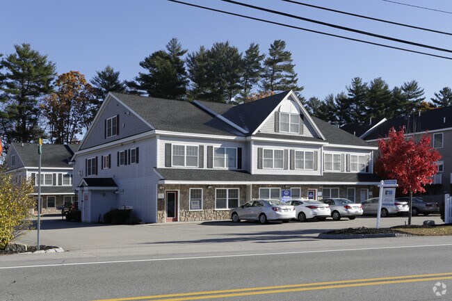
Property Record
46 Dover Point Rd, Dover, NH 03820
NEARBY LISTINGS FOR SALE OR LEASE
Property Detail
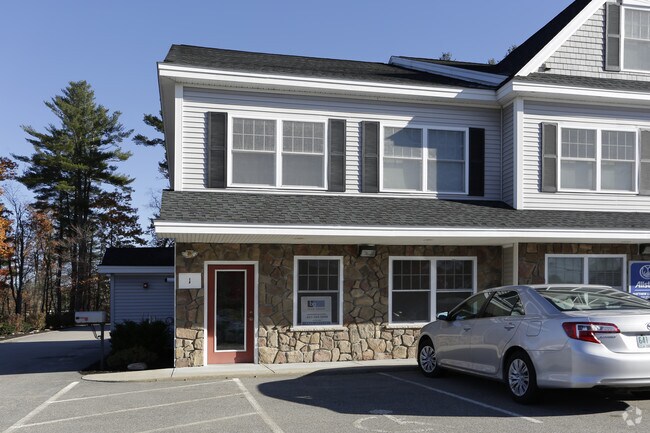
46 Dover Point Rd
DOVR-000023-000000-K000000
Strafford
Taxexempt
New Hampshire
X
0.76 AC
33017C0340E
Strafford County
2024
Boston
2024
Boston-Cambridge-Newton, MA-NH
081200
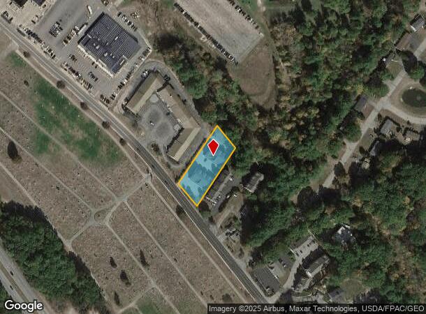
DEMOGRAPHICS near 46 Dover Point Rd
1 Mile
3 Mile
5 Mile
2024 Total Population
4,063
29,190
53,867
2029 Population
4,241
30,611
56,391
Pop Growth 2024-2029
+ 4.38%
+ 4.87%
+ 4.69%
Average Age
44
41
39
2024 Total Households
1,847
13,481
21,898
HH Growth 2024-2029
+ 4.60%
+ 5.01%
+ 5.00%
Median Household Inc
$122,122
$97,190
$102,638
Avg Household Size
2.20
2.10
2.30
2024 Avg HH Vehicles
2.00
2.00
2.00
Median Home Value
$387,930
$384,714
$386,329
Median Year Built
1983
1974
1975
Nearby Places
Map Layers
Map Styles
 Street
 Aerial
- Restaurants
- Banks
- Shops
- Fitness
- Groceries
PUBLIC TRANSPORTATION
COMMUTER RAIL
Dover (Downeaster - Amtrak)
DRIVE
WALK
Distance
Dover (Downeaster - Amtrak)
7 min
2.7 mi
Durham (Downeaster - Amtrak)
DRIVE
WALK
Distance
Durham (Downeaster - Amtrak)
15 min
6.4 mi
AIRPORT
Portsmouth International at Pease
DRIVE
WALK
Distance
Portsmouth International at Pease
15 min
7.9 mi
Freight Ports
Portland, ME
DRIVE
WALK
Distance
Portland, ME
73 min
51.3 mi
Nearby Properties
Address
Land Use
TOTAL SIZE
Lot Size
Zoning
Address
Land Use
TOTAL SIZE
Lot Size
Zoning
24.83 AC
R-20
Address
Land Use
TOTAL SIZE
Lot Size
Zoning
1.26 AC
CBD-G
Address
Land Use
TOTAL SIZE
Lot Size
Zoning
0.67 AC
VD
Address
Land Use
TOTAL SIZE
Lot Size
Zoning
20.03 AC
R-20
Address
Land Use
TOTAL SIZE
Lot Size
Zoning
3.66 AC
IT
Address
Land Use
TOTAL SIZE
Lot Size
Zoning
50.52 AC
RM-SU*
Address
Land Use
TOTAL SIZE
Lot Size
Zoning
3.40 AC
CBD-M
Address
Land Use
TOTAL SIZE
Lot Size
Zoning
11.80 AC
R-12*
Address
Land Use
TOTAL SIZE
Lot Size
Zoning
26.40 AC
IT*
Address
Land Use
TOTAL SIZE
Lot Size
Zoning
46.90 AC
R-40
Address
Land Use
TOTAL SIZE
Lot Size
Zoning
3.35 AC
CBD-G
Address
Land Use
TOTAL SIZE
Lot Size
Zoning
3.66 AC
C
Address
Land Use
TOTAL SIZE
Lot Size
Zoning
7.92 AC
R-12
Address
Land Use
TOTAL SIZE
Lot Size
Zoning
15.46 AC
G
Address
Land Use
TOTAL SIZE
Lot Size
Zoning
0.22 AC
CBD-G
Address
Land Use
TOTAL SIZE
Lot Size
Zoning
4.15 AC
R-12
Address
Land Use
TOTAL SIZE
Lot Size
Zoning
11.08 AC
RM-U
Address
Land Use
TOTAL SIZE
Lot Size
Zoning
11.47 AC
IT
Address
Land Use
TOTAL SIZE
Lot Size
Zoning
35.86 AC
R-40
Address
Land Use
TOTAL SIZE
Lot Size
Zoning
7.33 AC
G
Address
Land Use
TOTAL SIZE
Lot Size
Zoning
9.29 AC
R-12*
Address
Land Use
TOTAL SIZE
Lot Size
Zoning
38.27 AC
RM-U
Address
Land Use
TOTAL SIZE
Lot Size
Zoning
6.81 AC
CM
Address
Land Use
TOTAL SIZE
Lot Size
Zoning
11 AC
R-20
Address
Land Use
TOTAL SIZE
Lot Size
Zoning
0.74 AC
CBD-G
Address
Land Use
TOTAL SIZE
Lot Size
Zoning
57.28 AC
IT
Address
Land Use
TOTAL SIZE
Lot Size
Zoning
19 AC
RM-SU
Address
Land Use
TOTAL SIZE
Lot Size
Zoning
3.01 AC
IT
Address
Land Use
TOTAL SIZE
Lot Size
Zoning
0.75 AC
CBD-G
Address
Land Use
TOTAL SIZE
Lot Size
Zoning
1.29 AC
CBD-G
The World's #1 Commercial Real Estate Marketplace
Connect with us
© 2025 CoStar Group
The information above has been obtained from sources believed reliable. While we do not doubt its accuracy we have not verified it and make no guarantee, warranty or representation about it. It is your responsibility to independently confirm its accuracy and completeness. Any projections, opinions, assumptions, or estimates used are for example only and do not represent the current or future performance of the property. The value of this transaction to you depends on tax and other factors which should be evaluated by your tax, financial, and legal advisors. You and your advisors should conduct a careful, independent investigation of the property to determine to your satisfaction the suitability of the property for your needs.