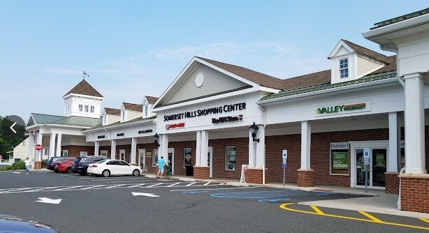
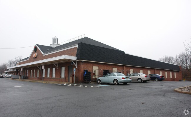
Property Record
75 Washington Valley Rd, Bedminster, NJ 07921

Property Detail
75 Washington Valley Rd
Lakewood-New Brunswick, NJ
ADDITIONAL LOTS: 13
01-00058-0000-00014
Somerset
Bartavern
New Jersey
VN
14
B and X Area of moderate flood hazard, usually the area between the limits of the 100-year and 500-year floods.
3.88 AC
2024
Route 78 East
2025
Northern New Jersey
052906
NEARBY LISTINGS FOR SALE OR LEASE
DEMOGRAPHICS near 75 Washington Valley Rd
1 mile
3 mile
5 mile
2025 Total Population
7,353
24,340
66,634
2030 Population
7,639
25,170
69,216
Pop Growth 2025-2030
+ 3.89%
+ 3.41%
+ 3.87%
Average Age
46
44
43
2025 Total Households
3,859
9,691
24,954
HH Growth 2025-2030
+ 4.04%
+ 3.58%
+ 4.00%
Median Household Inc
$122,983
$167,834
$170,526
Avg Household Size
1.90
2.50
2.60
2025 Avg HH Vehicles
2.00
2.00
2.00
Median Home Value
$465,361
$706,879
$693,695
Median Year Built
1986
1986
1985
Nearby Places
Map Layers
Map Styles
 Street
 Aerial
Transit
 Traffic
 Biking
Places
Listings with unknown addresses are not visible on the map
- Restaurants
- Banks
- Shops
- Fitness
- Groceries
Nearby Properties
Address
Land Use
TOTAL SIZE
Lot Size
Zoning
Address
Land Use
TOTAL SIZE
Lot Size
Zoning
Address
Land Use
TOTAL SIZE
Lot Size
Zoning
196.68 AC
OR
Address
Land Use
TOTAL SIZE
Lot Size
Zoning
2.82 AC
SED
Address
Land Use
TOTAL SIZE
Lot Size
Zoning
23.08 AC
OR
Address
Land Use
TOTAL SIZE
Lot Size
Zoning
12.74 AC
PUD
Address
Land Use
TOTAL SIZE
Lot Size
Zoning
13.94 AC
PUD
Address
Land Use
TOTAL SIZE
Lot Size
Zoning
19.96 AC
GCM
Address
Land Use
TOTAL SIZE
Lot Size
Zoning
146.60 AC
SED
Address
Land Use
TOTAL SIZE
Lot Size
Zoning
1.21 AC
SED
Address
Land Use
TOTAL SIZE
Lot Size
Zoning
243.82 AC
R10
Address
Land Use
TOTAL SIZE
Lot Size
Zoning
2,848 SF
22.47 AC
ORVM
Address
Land Use
TOTAL SIZE
Lot Size
Zoning
10.06 AC
R40
Address
Land Use
TOTAL SIZE
Lot Size
Zoning
17.63 AC
OR
Address
Land Use
TOTAL SIZE
Lot Size
Zoning
Address
Land Use
TOTAL SIZE
Lot Size
Zoning
25.64 AC
E2
Address
Land Use
TOTAL SIZE
Lot Size
Zoning
30.52 AC
R50
Address
Land Use
TOTAL SIZE
Lot Size
Zoning
2,726 SF
10.01 AC
VN
Address
Land Use
TOTAL SIZE
Lot Size
Zoning
12.94 AC
SED
Address
Land Use
TOTAL SIZE
Lot Size
Zoning
49,786 SF
13.84 AC
VN2
Address
Land Use
TOTAL SIZE
Lot Size
Zoning
126,360 SF
36.03 AC
E3
Address
Land Use
TOTAL SIZE
Lot Size
Zoning
62,250 SF
14.43 AC
E2
Address
Land Use
TOTAL SIZE
Lot Size
Zoning
93,035 SF
41.85 AC
R1
Address
Land Use
TOTAL SIZE
Lot Size
Zoning
12 AC
P3
Address
Land Use
TOTAL SIZE
Lot Size
Zoning
128,856 SF
7.98 AC
E3
Address
Land Use
TOTAL SIZE
Lot Size
Zoning
22.33 AC
R40
Address
Land Use
TOTAL SIZE
Lot Size
Zoning
31.95 AC
R3
Address
Land Use
TOTAL SIZE
Lot Size
Zoning
134,778 SF
13.71 AC
E2
Address
Land Use
TOTAL SIZE
Lot Size
Zoning
28.41 AC
E2
Address
Land Use
TOTAL SIZE
Lot Size
Zoning
10,266 SF
3 AC
R10
Address
Land Use
TOTAL SIZE
Lot Size
Zoning
3.90 AC
PUD
The World's #1 Commercial Real Estate Marketplace
Connect with us
© 2026 CoStar Group
The information above has been obtained from sources believed reliable. While we do not doubt its accuracy we have not verified it and make no guarantee, warranty or representation about it. It is your responsibility to independently confirm its accuracy and completeness. Any projections, opinions, assumptions, or estimates used are for example only and do not represent the current or future performance of the property. The value of this transaction to you depends on tax and other factors which should be evaluated by your tax, financial, and legal advisors. You and your advisors should conduct a careful, independent investigation of the property to determine to your satisfaction the suitability of the property for your needs.