Property Record
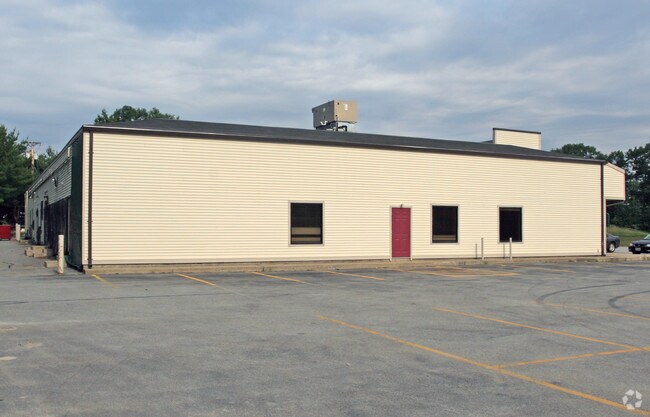
3 Wake Robin Rd, Lincoln, RI 02865


Property Detail
3 Wake Robin Rd
LINC-000028-000100-000000
Providence
Commercialbuilding
Rhode Island
BL05
10.0
B and X Area of moderate flood hazard, usually the area between the limits of the 100-year and 500-year floods.
2.14 AC
2025
Lincoln
2025
Providence
011600
Providence-Warwick, RI-MA
17,461 SF
NEARBY LISTINGS FOR SALE OR LEASE
DEMOGRAPHICS near 3 Wake Robin Rd
1 mile
3 mile
5 mile
2025 Total Population
2,378
24,246
115,215
2030 Population
2,475
25,262
119,367
Pop Growth 2025-2030
+ 4.08%
+ 4.19%
+ 3.60%
Average Age
47
44
42
2025 Total Households
1,053
9,932
46,095
HH Growth 2025-2030
+ 3.99%
+ 4.15%
+ 3.66%
Median Household Inc
$128,237
$123,258
$93,117
Avg Household Size
2.20
2.40
2.40
2025 Avg HH Vehicles
2.00
2.00
2.00
Median Home Value
$634,692
$465,725
$423,205
Median Year Built
1985
1974
1967
Nearby Places
Map Layers
Map Styles
 Street
 Aerial
Layers
 Traffic
 Biking
Places
Listings with unknown addresses are not visible on the map
- Restaurants
- Banks
- Shops
- Fitness
- Groceries
PUBLIC TRANSPORTATION
COMMUTER RAIL
Drive
Walk
Distance
12 min
7.9 mi
South Attleboro (Providence/Stoughton Line - Massachusetts Bay Transportation Authority Commuter Rail (Purple Line))
Drive
Walk
Distance
South Attleboro (Providence/Stoughton Line - Massachusetts Bay Transportation Authority Commuter Rail (Purple Line))
16 min
8.9 mi
AIRPORT
Rhode Island Tf Green International
Drive
Walk
Distance
Rhode Island Tf Green International
28 min
17.4 mi
Worcester Regional
Drive
Walk
Distance
Worcester Regional
52 min
36.3 mi
Freight Ports
Port of Davisville, RI
Drive
Walk
Distance
Port of Davisville, RI
44 min
30.1 mi
Nearby Properties
Address
Land Use
TOTAL SIZE
Lot Size
Zoning
Address
Land Use
TOTAL SIZE
Lot Size
Zoning
79.96 AC
PC
Address
Land Use
TOTAL SIZE
Lot Size
Zoning
29.60 AC
PC
Address
Land Use
TOTAL SIZE
Lot Size
Zoning
200.05 AC
RA40
Address
Land Use
TOTAL SIZE
Lot Size
Zoning
32.17 AC
PC
Address
Land Use
TOTAL SIZE
Lot Size
Zoning
41.01 AC
30
Address
Land Use
TOTAL SIZE
Lot Size
Zoning
140,678 SF
37.04 AC
RA40
Address
Land Use
TOTAL SIZE
Lot Size
Zoning
26.54 AC
90
Address
Land Use
TOTAL SIZE
Lot Size
Zoning
55.86 AC
BL05
Address
Land Use
TOTAL SIZE
Lot Size
Zoning
38.50 AC
RA40
Address
Land Use
TOTAL SIZE
Lot Size
Zoning
247,708 SF
12.14 AC
ML05
Address
Land Use
TOTAL SIZE
Lot Size
Zoning
54.49 AC
RS20
Address
Land Use
TOTAL SIZE
Lot Size
Zoning
4.60 AC
60
Address
Land Use
TOTAL SIZE
Lot Size
Zoning
315.90 AC
I
Address
Land Use
TOTAL SIZE
Lot Size
Zoning
115,802 SF
10.30 AC
PC
Address
Land Use
TOTAL SIZE
Lot Size
Zoning
Address
Land Use
TOTAL SIZE
Lot Size
Zoning
285,678 SF
25 AC
ML05
Address
Land Use
TOTAL SIZE
Lot Size
Zoning
175,122 SF
22.44 AC
ML05
Address
Land Use
TOTAL SIZE
Lot Size
Zoning
10.27 AC
ML05
Address
Land Use
TOTAL SIZE
Lot Size
Zoning
56,451 SF
5 AC
C
Address
Land Use
TOTAL SIZE
Lot Size
Zoning
119,776 SF
17.33 AC
ML05
Address
Land Use
TOTAL SIZE
Lot Size
Zoning
109,549 SF
19.27 AC
PC
Address
Land Use
TOTAL SIZE
Lot Size
Zoning
123,800 SF
8.31 AC
Address
Land Use
TOTAL SIZE
Lot Size
Zoning
105,384 SF
17.07 AC
120
Address
Land Use
TOTAL SIZE
Lot Size
Zoning
10.09 AC
RG7
Address
Land Use
TOTAL SIZE
Lot Size
Zoning
48,216 SF
9.01 AC
ML05
Address
Land Use
TOTAL SIZE
Lot Size
Zoning
9.73 AC
RG7
Address
Land Use
TOTAL SIZE
Lot Size
Zoning
74,147 SF
19.64 AC
RS12
Address
Land Use
TOTAL SIZE
Lot Size
Zoning
79,634 SF
8.79 AC
BL05
Address
Land Use
TOTAL SIZE
Lot Size
Zoning
132,005 SF
17.07 AC
ML05
Address
Land Use
TOTAL SIZE
Lot Size
Zoning
64,156 SF
3 AC
PD
The World's #1 Commercial Real Estate Marketplace
Connect with us
© 2026 CoStar Group
The information above has been obtained from sources believed reliable. While we do not doubt its accuracy we have not verified it and make no guarantee, warranty or representation about it. It is your responsibility to independently confirm its accuracy and completeness. Any projections, opinions, assumptions, or estimates used are for example only and do not represent the current or future performance of the property. The value of this transaction to you depends on tax and other factors which should be evaluated by your tax, financial, and legal advisors. You and your advisors should conduct a careful, independent investigation of the property to determine to your satisfaction the suitability of the property for your needs.