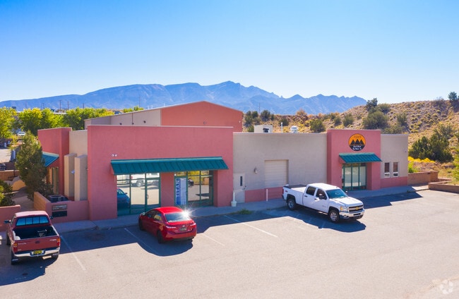
Property Record
30 E Frontage Rd, Placitas, NM 87043


Property Detail
30 E Frontage Rd
Albuquerque, NM
LEGAL: S: 32 T: 13N R: 4E SUBD: LANDS OF BAIEY OLSON REED LLC LOT: B1
1-020-073-501-520
SANDOVAL
Vacantlandnec
New Mexico
B and X Area of moderate flood hazard, usually the area between the limits of the 100-year and 500-year floods.
b1
2024
2.95 AC
2025
East Outlying
011101
Albuquerque
15,806 SF
NEARBY LISTINGS FOR SALE OR LEASE
-
-
View all Placitas listings for sale on LoopNet.com
DEMOGRAPHICS near 30 E Frontage Rd
1 mile
3 mile
5 mile
2025 Total Population
2,142
16,755
36,415
2030 Population
2,266
18,128
38,854
Pop Growth 2025-2030
+ 5.79%
+ 8.19%
+ 6.70%
Average Age
45
46
44
2025 Total Households
842
6,653
13,988
HH Growth 2025-2030
+ 5.70%
+ 7.82%
+ 6.61%
Median Household Inc
$77,778
$64,509
$86,876
Avg Household Size
2.40
2.40
2.50
2025 Avg HH Vehicles
2.00
2.00
2.00
Median Home Value
$357,983
$323,254
$354,133
Median Year Built
1985
2000
2001
Nearby Places
Map Layers
Map Styles
 Street
 Aerial
Layers
 Traffic
 Biking
Places
Listings with unknown addresses are not visible on the map
- Restaurants
- Banks
- Shops
- Fitness
- Groceries
PUBLIC TRANSPORTATION
COMMUTER RAIL
Sandoval County/U.S. 550 Rail Runner Station (NMRX - Rio Metro Regional Transit District)
Drive
Walk
Distance
Sandoval County/U.S. 550 Rail Runner Station (NMRX - Rio Metro Regional Transit District)
3 min
1.4 mi
Downtown Bernalillo Rail Runner Station (NMRX - Rio Metro Regional Transit District)
Drive
Walk
Distance
Downtown Bernalillo Rail Runner Station (NMRX - Rio Metro Regional Transit District)
5 min
3.1 mi
AIRPORT
Albuquerque International Sunport
Drive
Walk
Distance
Albuquerque International Sunport
41 min
23.6 mi
Freight Ports
Tulsa Port Of Catoosa
Drive
Walk
Distance
Tulsa Port Of Catoosa
705 min
674.9 mi
SALE & LEASE HISTORY
LISTING DATE
SALE/LEASE

May 28, 2019
For Sale
Nearby Properties
Address
Land Use
TOTAL SIZE
Lot Size
Zoning
Address
Land Use
TOTAL SIZE
Lot Size
Zoning
146,718 SF
56.01 AC
Address
Land Use
TOTAL SIZE
Lot Size
Zoning
117,159 SF
5.97 AC
Address
Land Use
TOTAL SIZE
Lot Size
Zoning
94,863 SF
12.12 AC
Address
Land Use
TOTAL SIZE
Lot Size
Zoning
126,581 SF
10.98 AC
Address
Land Use
TOTAL SIZE
Lot Size
Zoning
126,435 SF
5.88 AC
Address
Land Use
TOTAL SIZE
Lot Size
Zoning
102,963 SF
12.99 AC
Address
Land Use
TOTAL SIZE
Lot Size
Zoning
219,662 SF
20.71 AC
Address
Land Use
TOTAL SIZE
Lot Size
Zoning
76,842 SF
14.02 AC
Address
Land Use
TOTAL SIZE
Lot Size
Zoning
105,065 SF
4.26 AC
Address
Land Use
TOTAL SIZE
Lot Size
Zoning
86,089 SF
14.29 AC
Address
Land Use
TOTAL SIZE
Lot Size
Zoning
73,287 SF
3.15 AC
Address
Land Use
TOTAL SIZE
Lot Size
Zoning
57,960 SF
5.28 AC
Address
Land Use
TOTAL SIZE
Lot Size
Zoning
58,121 SF
4.35 AC
Address
Land Use
TOTAL SIZE
Lot Size
Zoning
153,238 SF
11.31 AC
Address
Land Use
TOTAL SIZE
Lot Size
Zoning
106,706 SF
9.78 AC
Address
Land Use
TOTAL SIZE
Lot Size
Zoning
Address
Land Use
TOTAL SIZE
Lot Size
Zoning
63,613 SF
6.82 AC
Address
Land Use
TOTAL SIZE
Lot Size
Zoning
265,897 SF
62.04 AC
Address
Land Use
TOTAL SIZE
Lot Size
Zoning
118,218 SF
4.52 AC
Address
Land Use
TOTAL SIZE
Lot Size
Zoning
12,535 SF
12.30 AC
Address
Land Use
TOTAL SIZE
Lot Size
Zoning
62,274 SF
11.28 AC
Address
Land Use
TOTAL SIZE
Lot Size
Zoning
36,830 SF
3.94 AC
Address
Land Use
TOTAL SIZE
Lot Size
Zoning
Address
Land Use
TOTAL SIZE
Lot Size
Zoning
17,198 SF
6.05 AC
Address
Land Use
TOTAL SIZE
Lot Size
Zoning
24,298 SF
3.01 AC
Address
Land Use
TOTAL SIZE
Lot Size
Zoning
19,252 SF
2.92 AC
Address
Land Use
TOTAL SIZE
Lot Size
Zoning
70,736 SF
3.79 AC
Address
Land Use
TOTAL SIZE
Lot Size
Zoning
5,816 SF
1.69 AC
The World's #1 Commercial Real Estate Marketplace
Connect with us
© 2026 CoStar Group
The information above has been obtained from sources believed reliable. While we do not doubt its accuracy we have not verified it and make no guarantee, warranty or representation about it. It is your responsibility to independently confirm its accuracy and completeness. Any projections, opinions, assumptions, or estimates used are for example only and do not represent the current or future performance of the property. The value of this transaction to you depends on tax and other factors which should be evaluated by your tax, financial, and legal advisors. You and your advisors should conduct a careful, independent investigation of the property to determine to your satisfaction the suitability of the property for your needs.