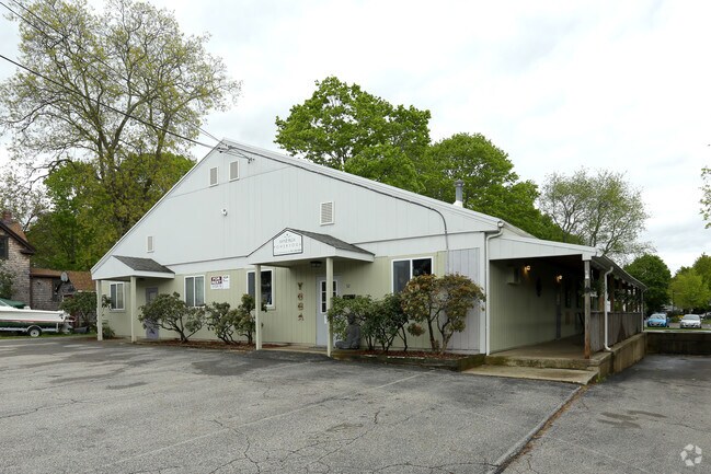
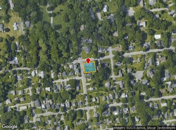
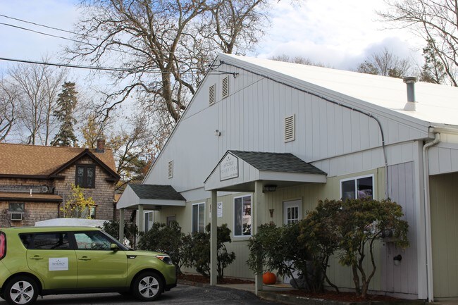
Property Record
30 Bay Rd, Barrington, RI 02806
NEARBY LISTINGS FOR SALE OR LEASE
Property Detail
30 Bay Rd
Providence-Warwick, RI-MA
Bristol
BARR-000009-000000-000009
Rhode Island
Sfr
0.24 AC
X
Bristol County
44001C0007H
Providence
3,129 SF
DEMOGRAPHICS near 30 Bay Rd
1 Mile
3 Mile
5 Mile
2024 Total Population
7,361
44,766
144,839
2029 Population
7,419
44,918
144,855
Pop Growth 2024-2029
+ 0.79%
+ 0.34%
+ 0.01%
Average Age
44
44
42
2024 Total Households
2,981
18,679
59,293
HH Growth 2024-2029
+ 0.81%
+ 0.31%
+ 0.02%
Median Household Inc
$100,224
$97,009
$79,367
Avg Household Size
2.40
2.40
2.40
2024 Avg HH Vehicles
2.00
2.00
2.00
Median Home Value
$412,277
$366,740
$329,783
Median Year Built
1957
1956
1956
Nearby Places
Map Layers
Map Styles
 Street
 Aerial
- Restaurants
- Banks
- Shops
- Fitness
- Groceries
PUBLIC TRANSPORTATION
AIRPORT
Rhode Island Tf Green International
DRIVE
WALK
Distance
Rhode Island Tf Green International
31 min
18.3 mi
Freight Ports
Port of Davisville, RI
DRIVE
WALK
Distance
Port of Davisville, RI
47 min
30.7 mi
SALE & LEASE HISTORY
LISTING DATE
SALE/LEASE

Jul 13, 2017
For Lease
Nearby Properties
Address
Land Use
TOTAL SIZE
Lot Size
Zoning
Address
Land Use
TOTAL SIZE
Lot Size
Zoning
187,151 SF
29.41 AC
RE
Address
Land Use
TOTAL SIZE
Lot Size
Zoning
367,305 SF
8.23 AC
WF
Address
Land Use
TOTAL SIZE
Lot Size
Zoning
17,500 SF
5.92 AC
WF
Address
Land Use
TOTAL SIZE
Lot Size
Zoning
183,710 SF
30.50 AC
RE
Address
Land Use
TOTAL SIZE
Lot Size
Zoning
110,031 SF
5.07 AC
EH
Address
Land Use
TOTAL SIZE
Lot Size
Zoning
25.24 AC
R10
Address
Land Use
TOTAL SIZE
Lot Size
Zoning
2.71 AC
B
Address
Land Use
TOTAL SIZE
Lot Size
Zoning
140,460 SF
12.50 AC
R10
Address
Land Use
TOTAL SIZE
Lot Size
Zoning
5.40 AC
WB
Address
Land Use
TOTAL SIZE
Lot Size
Zoning
4.39 AC
B
Address
Land Use
TOTAL SIZE
Lot Size
Zoning
1.97 AC
R10
Address
Land Use
TOTAL SIZE
Lot Size
Zoning
4.40 AC
B
Address
Land Use
TOTAL SIZE
Lot Size
Zoning
138.20 AC
RE
Address
Land Use
TOTAL SIZE
Lot Size
Zoning
218.86 AC
C
Address
Land Use
TOTAL SIZE
Lot Size
Zoning
7.90 AC
RE
Address
Land Use
TOTAL SIZE
Lot Size
Zoning
199,796 SF
9.11 AC
RB
Address
Land Use
TOTAL SIZE
Lot Size
Zoning
31,338 SF
0.95 AC
GI
Address
Land Use
TOTAL SIZE
Lot Size
Zoning
2.88 AC
B
Address
Land Use
TOTAL SIZE
Lot Size
Zoning
19,144 SF
7.29 AC
R40
Address
Land Use
TOTAL SIZE
Lot Size
Zoning
79,010 SF
2.71 AC
EH
Address
Land Use
TOTAL SIZE
Lot Size
Zoning
39,150 SF
10.10 AC
C
Address
Land Use
TOTAL SIZE
Lot Size
Zoning
31,588 SF
18.21 AC
RE
Address
Land Use
TOTAL SIZE
Lot Size
Zoning
29,058 SF
21.97 AC
R40
Address
Land Use
TOTAL SIZE
Lot Size
Zoning
48,986 SF
10.33 AC
RE
Address
Land Use
TOTAL SIZE
Lot Size
Zoning
4.80 AC
GB
Address
Land Use
TOTAL SIZE
Lot Size
Zoning
19,799 SF
13.36 AC
GI
Address
Land Use
TOTAL SIZE
Lot Size
Zoning
4,398 SF
2.91 AC
R40
Address
Land Use
TOTAL SIZE
Lot Size
Zoning
120,540 SF
6.33 AC
M
Address
Land Use
TOTAL SIZE
Lot Size
Zoning
28,160 SF
11.36 AC
OSA
Address
Land Use
TOTAL SIZE
Lot Size
Zoning
68,144 SF
7.74 AC
M
The World's #1 Commercial Real Estate Marketplace
Connect with us
© 2025 CoStar Group
The information above has been obtained from sources believed reliable. While we do not doubt its accuracy we have not verified it and make no guarantee, warranty or representation about it. It is your responsibility to independently confirm its accuracy and completeness. Any projections, opinions, assumptions, or estimates used are for example only and do not represent the current or future performance of the property. The value of this transaction to you depends on tax and other factors which should be evaluated by your tax, financial, and legal advisors. You and your advisors should conduct a careful, independent investigation of the property to determine to your satisfaction the suitability of the property for your needs.