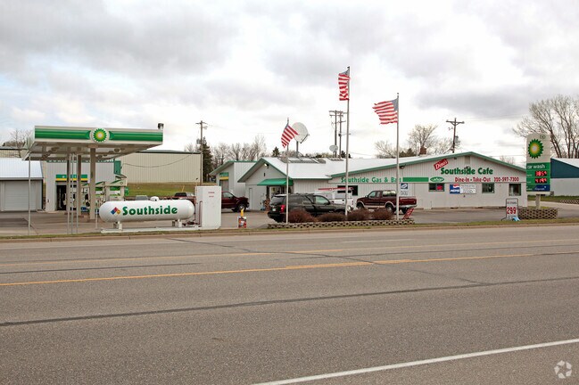
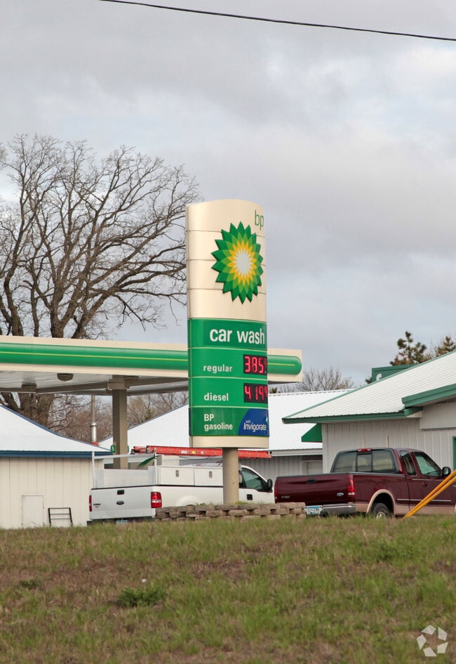
Property Record
30 4Th St Sw, Richmond, MN 56368

NEARBY LISTINGS FOR SALE OR LEASE
-
-
View all Richmond listings for sale on LoopNet.com
Property Detail
30 4Th St Sw
Minneapolis/St Paul
Townsite Of Richmond
St. Cloud, MN
BLK 67 LESS PART W OF FOLL. LINE, BEG N82D E 97.90' FROM INTER OF S LINE OF RR WITH W LINE OF VAC. ELIZABETH STR. - S148' TO
74410520005
Stearns
Carwash
Minnesota
2025
1
2025
1 AC
011102
Stearns County
4,573 SF
DEMOGRAPHICS near 30 4Th St Sw
1 Mile
3 Mile
5 Mile
2024 Total Population
1,836
4,290
11,122
2029 Population
1,903
4,524
11,651
Pop Growth 2024-2029
+ 3.65%
+ 5.45%
+ 4.76%
Average Age
41
43
42
2024 Total Households
719
1,708
4,416
HH Growth 2024-2029
+ 3.89%
+ 5.68%
+ 4.96%
Median Household Inc
$74,437
$86,342
$86,099
Avg Household Size
2.50
2.50
2.50
2024 Avg HH Vehicles
2.00
2.00
2.00
Median Home Value
$235,193
$280,098
$272,007
Median Year Built
1976
1977
1981
Nearby Places
Map Layers
Map Styles
 Street
 Aerial
- Restaurants
- Banks
- Shops
- Fitness
- Groceries
Nearby Properties
Address
Land Use
TOTAL SIZE
Lot Size
Zoning
Address
Land Use
TOTAL SIZE
Lot Size
Zoning
189,532 SF
93.75 AC
Address
Land Use
TOTAL SIZE
Lot Size
Zoning
68,266 SF
20 AC
Address
Land Use
TOTAL SIZE
Lot Size
Zoning
6,600 SF
74.64 AC
Address
Land Use
TOTAL SIZE
Lot Size
Zoning
31,014 SF
2.25 AC
Address
Land Use
TOTAL SIZE
Lot Size
Zoning
32,100 SF
4.37 AC
Address
Land Use
TOTAL SIZE
Lot Size
Zoning
2,548 SF
3.58 AC
Address
Land Use
TOTAL SIZE
Lot Size
Zoning
29,220 SF
8.57 AC
Address
Land Use
TOTAL SIZE
Lot Size
Zoning
16,612 SF
20.90 AC
Address
Land Use
TOTAL SIZE
Lot Size
Zoning
23,150 SF
3.43 AC
Address
Land Use
TOTAL SIZE
Lot Size
Zoning
5.93 AC
Address
Land Use
TOTAL SIZE
Lot Size
Zoning
240 AC
2B
Address
Land Use
TOTAL SIZE
Lot Size
Zoning
1,470 SF
160 AC
2A
Address
Land Use
TOTAL SIZE
Lot Size
Zoning
18,027 SF
1.62 AC
Address
Land Use
TOTAL SIZE
Lot Size
Zoning
27,750 SF
3.69 AC
Address
Land Use
TOTAL SIZE
Lot Size
Zoning
28,446 SF
1.55 AC
Address
Land Use
TOTAL SIZE
Lot Size
Zoning
14,310 SF
4.65 AC
Address
Land Use
TOTAL SIZE
Lot Size
Zoning
1,916 SF
7.45 AC
Address
Land Use
TOTAL SIZE
Lot Size
Zoning
2,178 SF
117.31 AC
RPMKT
Address
Land Use
TOTAL SIZE
Lot Size
Zoning
30,950 SF
10.10 AC
Address
Land Use
TOTAL SIZE
Lot Size
Zoning
118.60 AC
RPMKT
Address
Land Use
TOTAL SIZE
Lot Size
Zoning
8,640 SF
19.25 AC
Address
Land Use
TOTAL SIZE
Lot Size
Zoning
3,076 SF
67.06 AC
Address
Land Use
TOTAL SIZE
Lot Size
Zoning
15,840 SF
3 AC
Address
Land Use
TOTAL SIZE
Lot Size
Zoning
1,222 SF
100 AC
2B
Address
Land Use
TOTAL SIZE
Lot Size
Zoning
8,220 SF
0.96 AC
Address
Land Use
TOTAL SIZE
Lot Size
Zoning
8,021 SF
3.70 AC
Address
Land Use
TOTAL SIZE
Lot Size
Zoning
118.61 AC
RPMKT
The World's #1 Commercial Real Estate Marketplace
Connect with us
© 2026 CoStar Group
The information above has been obtained from sources believed reliable. While we do not doubt its accuracy we have not verified it and make no guarantee, warranty or representation about it. It is your responsibility to independently confirm its accuracy and completeness. Any projections, opinions, assumptions, or estimates used are for example only and do not represent the current or future performance of the property. The value of this transaction to you depends on tax and other factors which should be evaluated by your tax, financial, and legal advisors. You and your advisors should conduct a careful, independent investigation of the property to determine to your satisfaction the suitability of the property for your needs.