Property Record
30 Bowman St, Mansfield, OH 44903


Property Detail
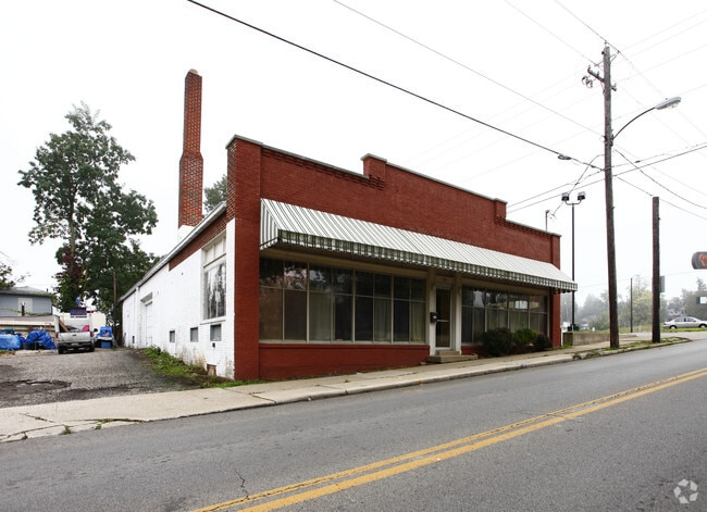
30 Bowman St
027-03-037-02-000
955 CT PT & 949 W CT PT 54 X 99
Officebuilding
Richland
B and X Area of moderate flood hazard, usually the area between the limits of the 100-year and 500-year floods.
Ohio
2024
0.12 AC
2025
Richland County
003100
Cleveland
6,250 SF
Mansfield, OH
NEARBY LISTINGS FOR SALE OR LEASE
DEMOGRAPHICS near 30 Bowman St
1 mile
3 mile
5 mile
2025 Total Population
13,189
51,330
73,440
2030 Population
13,371
51,305
73,230
Pop Growth 2025-2030
+ 1.38%
(0.05%)
(0.29%)
Average Age
38
41
42
2025 Total Households
5,555
20,450
29,945
HH Growth 2025-2030
+ 1.33%
(0.14%)
(0.35%)
Median Household Inc
$35,739
$44,260
$50,334
Avg Household Size
2.20
2.10
2.20
2025 Avg HH Vehicles
1.00
1.00
2.00
Median Home Value
$78,752
$116,657
$149,639
Median Year Built
1948
1956
1961
Nearby Places
Map Layers
Map Styles
 Street
 Aerial
Layers
 Traffic
 Biking
Places
Listings with unknown addresses are not visible on the map
- Restaurants
- Banks
- Shops
- Fitness
- Groceries
Nearby Properties
Address
Land Use
TOTAL SIZE
Lot Size
Zoning
Address
Land Use
TOTAL SIZE
Lot Size
Zoning
456.50 AC
Address
Land Use
TOTAL SIZE
Lot Size
Zoning
492,672 SF
6.83 AC
Address
Land Use
TOTAL SIZE
Lot Size
Zoning
354,710 SF
7.07 AC
Address
Land Use
TOTAL SIZE
Lot Size
Zoning
139,809 SF
0.99 AC
Address
Land Use
TOTAL SIZE
Lot Size
Zoning
0.06 AC
Address
Land Use
TOTAL SIZE
Lot Size
Zoning
148,135 SF
6.89 AC
Address
Land Use
TOTAL SIZE
Lot Size
Zoning
2.31 AC
Address
Land Use
TOTAL SIZE
Lot Size
Zoning
318,366 SF
26.16 AC
Address
Land Use
TOTAL SIZE
Lot Size
Zoning
92,587 SF
48.78 AC
Address
Land Use
TOTAL SIZE
Lot Size
Zoning
52.67 AC
Address
Land Use
TOTAL SIZE
Lot Size
Zoning
15,490 SF
89.80 AC
Address
Land Use
TOTAL SIZE
Lot Size
Zoning
32,728 SF
56.23 AC
Address
Land Use
TOTAL SIZE
Lot Size
Zoning
48,602 SF
14.66 AC
Address
Land Use
TOTAL SIZE
Lot Size
Zoning
58,960 SF
2.30 AC
Address
Land Use
TOTAL SIZE
Lot Size
Zoning
66,940 SF
12.40 AC
Address
Land Use
TOTAL SIZE
Lot Size
Zoning
1.69 AC
Address
Land Use
TOTAL SIZE
Lot Size
Zoning
76,069 SF
8 AC
Address
Land Use
TOTAL SIZE
Lot Size
Zoning
47.90 AC
Address
Land Use
TOTAL SIZE
Lot Size
Zoning
44,718 SF
0.47 AC
Address
Land Use
TOTAL SIZE
Lot Size
Zoning
30,306 SF
5.63 AC
Address
Land Use
TOTAL SIZE
Lot Size
Zoning
63,442 SF
5.51 AC
Address
Land Use
TOTAL SIZE
Lot Size
Zoning
161,297 SF
8.12 AC
Address
Land Use
TOTAL SIZE
Lot Size
Zoning
106,361 SF
5.06 AC
Address
Land Use
TOTAL SIZE
Lot Size
Zoning
88,556 SF
12.32 AC
Address
Land Use
TOTAL SIZE
Lot Size
Zoning
2,948 SF
10.62 AC
Address
Land Use
TOTAL SIZE
Lot Size
Zoning
21,337 SF
11.30 AC
Address
Land Use
TOTAL SIZE
Lot Size
Zoning
82,695 SF
40.16 AC
Address
Land Use
TOTAL SIZE
Lot Size
Zoning
80,956 SF
17.24 AC
Address
Land Use
TOTAL SIZE
Lot Size
Zoning
16,578 SF
8.23 AC
Address
Land Use
TOTAL SIZE
Lot Size
Zoning
75,157 SF
0.41 AC
The World's #1 Commercial Real Estate Marketplace
Connect with us
© 2026 CoStar Group
The information above has been obtained from sources believed reliable. While we do not doubt its accuracy we have not verified it and make no guarantee, warranty or representation about it. It is your responsibility to independently confirm its accuracy and completeness. Any projections, opinions, assumptions, or estimates used are for example only and do not represent the current or future performance of the property. The value of this transaction to you depends on tax and other factors which should be evaluated by your tax, financial, and legal advisors. You and your advisors should conduct a careful, independent investigation of the property to determine to your satisfaction the suitability of the property for your needs.