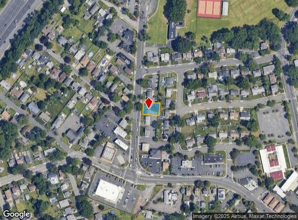
Property Record
30 Brant Ave, Clark, NJ 07066
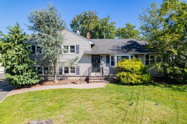
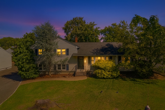
This Property Is For Sale
Current Lease Availabilities
NEARBY LISTINGS FOR SALE OR LEASE
Property Detail
30 Brant Ave
02-00133-0000-00003
Clark Estates Sec 1
Commercialnec
Union
X
New Jersey
34023C0056F
3
2024
0.17 AC
2025
Parkway Cranford Corridor
036200
Northern New Jersey
2,086 SF
Newark, NJ-PA
DEMOGRAPHICS near 30 Brant Ave
1 Mile
3 Mile
5 Mile
2024 Total Population
12,109
159,033
398,616
2029 Population
12,009
157,784
394,373
Pop Growth 2024-2029
(0.83%)
(0.79%)
(1.06%)
Average Age
43
41
41
2024 Total Households
4,597
58,508
141,044
HH Growth 2024-2029
(1.02%)
(0.90%)
(1.16%)
Median Household Inc
$106,590
$103,460
$104,942
Avg Household Size
2.60
2.60
2.70
2024 Avg HH Vehicles
2.00
2.00
2.00
Median Home Value
$458,178
$454,480
$446,630
Median Year Built
1957
1958
1958
Nearby Places
Map Layers
Map Styles
 Street
 Aerial
- Restaurants
- Banks
- Shops
- Fitness
- Groceries
PUBLIC TRANSPORTATION
COMMUTER RAIL
Rahway (North Jersey Coast Line - NJ Transit Commuter Rail (NJ Transit), Northeast Corridor Line - NJ Transit Commuter Rail (NJ Transit))
DRIVE
WALK
Distance
Rahway (North Jersey Coast Line - NJ Transit Commuter Rail (NJ Transit), Northeast Corridor Line - NJ Transit Commuter Rail (NJ Transit))
5 min
2.2 mi
Cranford (Raritan Valley Line - NJ Transit Commuter Rail (NJ Transit))
DRIVE
WALK
Distance
Cranford (Raritan Valley Line - NJ Transit Commuter Rail (NJ Transit))
7 min
2.5 mi
AIRPORT
Newark Liberty International
DRIVE
WALK
Distance
Newark Liberty International
19 min
13.5 mi
LaGuardia
DRIVE
WALK
Distance
LaGuardia
55 min
32.7 mi
John F Kennedy International
DRIVE
WALK
Distance
John F Kennedy International
60 min
36.3 mi
Freight Ports
New York Container Terminal
DRIVE
WALK
Distance
New York Container Terminal
16 min
9.2 mi
Nearby Properties
Address
Land Use
TOTAL SIZE
Lot Size
Zoning
Address
Land Use
TOTAL SIZE
Lot Size
Zoning
10 SF
0.64 AC
Address
Land Use
TOTAL SIZE
Lot Size
Zoning
37 AC
Address
Land Use
TOTAL SIZE
Lot Size
Zoning
1 SF
37 AC
Address
Land Use
TOTAL SIZE
Lot Size
Zoning
78.47 AC
Address
Land Use
TOTAL SIZE
Lot Size
Zoning
Address
Land Use
TOTAL SIZE
Lot Size
Zoning
10.11 AC
Address
Land Use
TOTAL SIZE
Lot Size
Zoning
8.43 AC
Address
Land Use
TOTAL SIZE
Lot Size
Zoning
29.03 AC
IL
Address
Land Use
TOTAL SIZE
Lot Size
Zoning
151.20 AC
O
Address
Land Use
TOTAL SIZE
Lot Size
Zoning
9.42 AC
Address
Land Use
TOTAL SIZE
Lot Size
Zoning
159,434 SF
11.93 AC
IL
Address
Land Use
TOTAL SIZE
Lot Size
Zoning
19.90 AC
P
Address
Land Use
TOTAL SIZE
Lot Size
Zoning
Address
Land Use
TOTAL SIZE
Lot Size
Zoning
10.15 AC
RA
Address
Land Use
TOTAL SIZE
Lot Size
Zoning
5,645 SF
91.16 AC
O
Address
Land Use
TOTAL SIZE
Lot Size
Zoning
4.13 AC
Address
Land Use
TOTAL SIZE
Lot Size
Zoning
23.60 AC
OSCPQP
Address
Land Use
TOTAL SIZE
Lot Size
Zoning
3.87 AC
CG
Address
Land Use
TOTAL SIZE
Lot Size
Zoning
31,002 SF
3.64 AC
Address
Land Use
TOTAL SIZE
Lot Size
Zoning
8.77 AC
Address
Land Use
TOTAL SIZE
Lot Size
Zoning
5.18 AC
Address
Land Use
TOTAL SIZE
Lot Size
Zoning
8.84 AC
Address
Land Use
TOTAL SIZE
Lot Size
Zoning
23.96 AC
Address
Land Use
TOTAL SIZE
Lot Size
Zoning
Address
Land Use
TOTAL SIZE
Lot Size
Zoning
10.16 AC
Address
Land Use
TOTAL SIZE
Lot Size
Zoning
7.63 AC
Address
Land Use
TOTAL SIZE
Lot Size
Zoning
8.40 AC
Address
Land Use
TOTAL SIZE
Lot Size
Zoning
79,864 SF
6.58 AC
Address
Land Use
TOTAL SIZE
Lot Size
Zoning
9.98 AC
RA
Address
Land Use
TOTAL SIZE
Lot Size
Zoning
102,200 SF
6.68 AC
RA
The World's #1 Commercial Real Estate Marketplace
Connect with us
© 2025 CoStar Group
The information above has been obtained from sources believed reliable. While we do not doubt its accuracy we have not verified it and make no guarantee, warranty or representation about it. It is your responsibility to independently confirm its accuracy and completeness. Any projections, opinions, assumptions, or estimates used are for example only and do not represent the current or future performance of the property. The value of this transaction to you depends on tax and other factors which should be evaluated by your tax, financial, and legal advisors. You and your advisors should conduct a careful, independent investigation of the property to determine to your satisfaction the suitability of the property for your needs.