Property Record
30 Cushing Dr, Wrentham, MA 02093

Property Detail
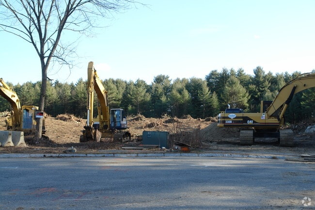
30 Cushing Dr
WREN-000013O-000002-000005
Norfolk
Industrialgeneral
Massachusetts
C-1 80
5
A Areas with a 1% annual chance of flooding and a 26% chance of flooding over the life of a 30-year mortgage.
9.83 AC
2024
I-95 Corridor South
2025
Boston
441203
Boston-Cambridge-Newton, MA-NH
5,400 SF
NEARBY LISTINGS FOR SALE OR LEASE
DEMOGRAPHICS near 30 Cushing Dr
1 mile
3 mile
5 mile
2025 Total Population
1,633
22,266
68,723
2030 Population
1,685
23,008
70,876
Pop Growth 2025-2030
+ 3.18%
+ 3.33%
+ 3.13%
Average Age
43
42
42
2025 Total Households
614
8,053
25,526
HH Growth 2025-2030
+ 3.09%
+ 3.46%
+ 3.26%
Median Household Inc
$144,297
$143,062
$134,727
Avg Household Size
2.60
2.70
2.60
2025 Avg HH Vehicles
2.00
2.00
2.00
Median Home Value
$683,706
$707,710
$704,708
Median Year Built
1973
1977
1979
Nearby Places
Map Layers
Map Styles
 Street
 Aerial
Layers
 Traffic
 Biking
Places
Listings with unknown addresses are not visible on the map
- Restaurants
- Banks
- Shops
- Fitness
- Groceries
PUBLIC TRANSPORTATION
COMMUTER RAIL
Norfolk (Franklin Line - Massachusetts Bay Transportation Authority Commuter Rail (Purple Line))
Drive
Walk
Distance
Norfolk (Franklin Line - Massachusetts Bay Transportation Authority Commuter Rail (Purple Line))
7 min
3.4 mi
Foxboro (Special Events Only) (Foxboro Line (Special Events Only) - Massachusetts Bay Transportation Authority Commuter Rail (Purple Line))
Drive
Walk
Distance
Foxboro (Special Events Only) (Foxboro Line (Special Events Only) - Massachusetts Bay Transportation Authority Commuter Rail (Purple Line))
8 min
3.6 mi
AIRPORT
General Edward Lawrence Logan International
Drive
Walk
Distance
General Edward Lawrence Logan International
49 min
29.3 mi
Rhode Island Tf Green International
Drive
Walk
Distance
Rhode Island Tf Green International
52 min
33.4 mi
Worcester Regional
Drive
Walk
Distance
Worcester Regional
65 min
44.1 mi
Freight Ports
Port of Boston
Drive
Walk
Distance
Port of Boston
47 min
27.2 mi
Nearby Properties
Address
Land Use
TOTAL SIZE
Lot Size
Zoning
Address
Land Use
TOTAL SIZE
Lot Size
Zoning
Address
Land Use
TOTAL SIZE
Lot Size
Zoning
14,317 SF
411.17 AC
R-43
Address
Land Use
TOTAL SIZE
Lot Size
Zoning
231,487 SF
33.15 AC
R-30
Address
Land Use
TOTAL SIZE
Lot Size
Zoning
19,742 SF
58.34 AC
R-43
Address
Land Use
TOTAL SIZE
Lot Size
Zoning
41.28 AC
Address
Land Use
TOTAL SIZE
Lot Size
Zoning
83,014 SF
129.67 AC
Address
Land Use
TOTAL SIZE
Lot Size
Zoning
126,484 SF
1.61 AC
Address
Land Use
TOTAL SIZE
Lot Size
Zoning
125,778 SF
35.60 AC
Address
Land Use
TOTAL SIZE
Lot Size
Zoning
59,390 SF
5.69 AC
Address
Land Use
TOTAL SIZE
Lot Size
Zoning
814.08 AC
Address
Land Use
TOTAL SIZE
Lot Size
Zoning
7.86 AC
Address
Land Use
TOTAL SIZE
Lot Size
Zoning
3,024 SF
12.47 AC
C-1 80
Address
Land Use
TOTAL SIZE
Lot Size
Zoning
202,800 SF
20.33 AC
Address
Land Use
TOTAL SIZE
Lot Size
Zoning
74,159 SF
4.21 AC
Address
Land Use
TOTAL SIZE
Lot Size
Zoning
11.97 AC
Address
Land Use
TOTAL SIZE
Lot Size
Zoning
10,984 SF
8.52 AC
B-1 10
Address
Land Use
TOTAL SIZE
Lot Size
Zoning
132,952 SF
13.64 AC
Address
Land Use
TOTAL SIZE
Lot Size
Zoning
246,854 SF
31.90 AC
Address
Land Use
TOTAL SIZE
Lot Size
Zoning
91,216 SF
1.18 AC
Address
Land Use
TOTAL SIZE
Lot Size
Zoning
117,428 SF
2.81 AC
Address
Land Use
TOTAL SIZE
Lot Size
Zoning
38.97 AC
Address
Land Use
TOTAL SIZE
Lot Size
Zoning
4.13 AC
Address
Land Use
TOTAL SIZE
Lot Size
Zoning
1,536 SF
63.73 AC
Address
Land Use
TOTAL SIZE
Lot Size
Zoning
117,777 SF
2.97 AC
Address
Land Use
TOTAL SIZE
Lot Size
Zoning
19,290 SF
1.50 AC
Address
Land Use
TOTAL SIZE
Lot Size
Zoning
5.05 AC
Address
Land Use
TOTAL SIZE
Lot Size
Zoning
95,260 SF
12.80 AC
Address
Land Use
TOTAL SIZE
Lot Size
Zoning
500.40 AC
Address
Land Use
TOTAL SIZE
Lot Size
Zoning
47.53 AC
Address
Land Use
TOTAL SIZE
Lot Size
Zoning
130,854 SF
11.79 AC
C-1 80
The World's #1 Commercial Real Estate Marketplace
Connect with us
© 2026 CoStar Group
The information above has been obtained from sources believed reliable. While we do not doubt its accuracy we have not verified it and make no guarantee, warranty or representation about it. It is your responsibility to independently confirm its accuracy and completeness. Any projections, opinions, assumptions, or estimates used are for example only and do not represent the current or future performance of the property. The value of this transaction to you depends on tax and other factors which should be evaluated by your tax, financial, and legal advisors. You and your advisors should conduct a careful, independent investigation of the property to determine to your satisfaction the suitability of the property for your needs.