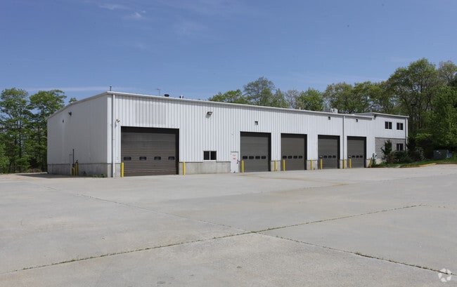
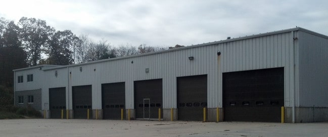
Property Record
30 Fargo Rd, Waterford, CT 06385
NEARBY LISTINGS FOR SALE OR LEASE
Property Detail
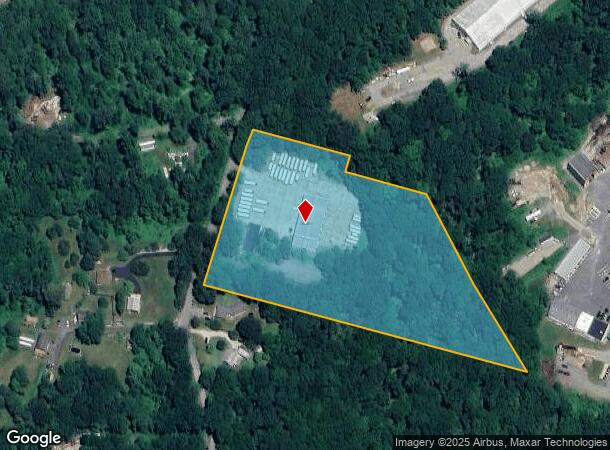
30 Fargo Rd
WATE-000061-000000-002300
New London
Industrialgeneral
Connecticut
X
2300
09011C0343G
7.66 AC
2025
New London
2025
Hartford
693700
Norwich-New London-Willimantic, CT
DEMOGRAPHICS near 30 Fargo Rd
1 Mile
3 Mile
5 Mile
2024 Total Population
285
10,129
61,492
2029 Population
281
10,056
61,339
Pop Growth 2024-2029
(1.40%)
(0.72%)
(0.25%)
Average Age
43
43
41
2024 Total Households
109
4,021
23,772
HH Growth 2024-2029
(1.83%)
(0.75%)
(0.25%)
Median Household Inc
$135,416
$106,732
$74,529
Avg Household Size
2.60
2.40
2.30
2024 Avg HH Vehicles
2.00
2.00
2.00
Median Home Value
$285,555
$315,411
$275,182
Median Year Built
1975
1972
1964
Nearby Places
Map Layers
Map Styles
 Street
 Aerial
- Restaurants
- Banks
- Shops
- Fitness
- Groceries
PUBLIC TRANSPORTATION
COMMUTER RAIL
New London (Shore Line East - Shore Line East)
DRIVE
WALK
Distance
New London (Shore Line East - Shore Line East)
11 min
5.3 mi
Freight Ports
Port of New Haven
DRIVE
WALK
Distance
Port of New Haven
55 min
42.8 mi
Nearby Properties
Address
Land Use
TOTAL SIZE
Lot Size
Zoning
Address
Land Use
TOTAL SIZE
Lot Size
Zoning
61.04 AC
CA
Address
Land Use
TOTAL SIZE
Lot Size
Zoning
21.84 AC
C-2
Address
Land Use
TOTAL SIZE
Lot Size
Zoning
41.89 AC
SDD
Address
Land Use
TOTAL SIZE
Lot Size
Zoning
47,148 SF
101.29 AC
IP-1
Address
Land Use
TOTAL SIZE
Lot Size
Zoning
69,658 SF
16.31 AC
VR-10
Address
Land Use
TOTAL SIZE
Lot Size
Zoning
68,244 SF
25.67 AC
R-40
Address
Land Use
TOTAL SIZE
Lot Size
Zoning
56.50 AC
C-R
Address
Land Use
TOTAL SIZE
Lot Size
Zoning
70,318 SF
5.20 AC
C-G
Address
Land Use
TOTAL SIZE
Lot Size
Zoning
79,469 SF
17.98 AC
IP-1
Address
Land Use
TOTAL SIZE
Lot Size
Zoning
70.27 AC
R-40
Address
Land Use
TOTAL SIZE
Lot Size
Zoning
201,755 SF
58.13 AC
C-R
Address
Land Use
TOTAL SIZE
Lot Size
Zoning
68,045 SF
15.56 AC
IP-1
Address
Land Use
TOTAL SIZE
Lot Size
Zoning
50,024 SF
10.35 AC
I-G
Address
Land Use
TOTAL SIZE
Lot Size
Zoning
98,670 SF
15.45 AC
C-G
Address
Land Use
TOTAL SIZE
Lot Size
Zoning
127,574 SF
18.96 AC
C-R
Address
Land Use
TOTAL SIZE
Lot Size
Zoning
105,371 SF
11.50 AC
I-G
Address
Land Use
TOTAL SIZE
Lot Size
Zoning
28.40 AC
RU120
Address
Land Use
TOTAL SIZE
Lot Size
Zoning
45,288 SF
22.70 AC
I-G
Address
Land Use
TOTAL SIZE
Lot Size
Zoning
104,040 SF
2.13 AC
C-2
Address
Land Use
TOTAL SIZE
Lot Size
Zoning
510,106 SF
30.11 AC
C-R
Address
Land Use
TOTAL SIZE
Lot Size
Zoning
43,682 SF
4.62 AC
NB
Address
Land Use
TOTAL SIZE
Lot Size
Zoning
61,372 SF
2.73 AC
SDD
Address
Land Use
TOTAL SIZE
Lot Size
Zoning
44,576 SF
5.43 AC
SDD
Address
Land Use
TOTAL SIZE
Lot Size
Zoning
26,955 SF
13.88 AC
I-G
Address
Land Use
TOTAL SIZE
Lot Size
Zoning
67,000 SF
20.14 AC
C-G
Address
Land Use
TOTAL SIZE
Lot Size
Zoning
5.78 AC
I-G
Address
Land Use
TOTAL SIZE
Lot Size
Zoning
1,524 SF
16.64 AC
I-MF
Address
Land Use
TOTAL SIZE
Lot Size
Zoning
34,800 SF
2.74 AC
C-2
Address
Land Use
TOTAL SIZE
Lot Size
Zoning
71,316 SF
8.01 AC
IP-3
Address
Land Use
TOTAL SIZE
Lot Size
Zoning
9.77 AC
I-G
The World's #1 Commercial Real Estate Marketplace
Connect with us
© 2026 CoStar Group
The information above has been obtained from sources believed reliable. While we do not doubt its accuracy we have not verified it and make no guarantee, warranty or representation about it. It is your responsibility to independently confirm its accuracy and completeness. Any projections, opinions, assumptions, or estimates used are for example only and do not represent the current or future performance of the property. The value of this transaction to you depends on tax and other factors which should be evaluated by your tax, financial, and legal advisors. You and your advisors should conduct a careful, independent investigation of the property to determine to your satisfaction the suitability of the property for your needs.