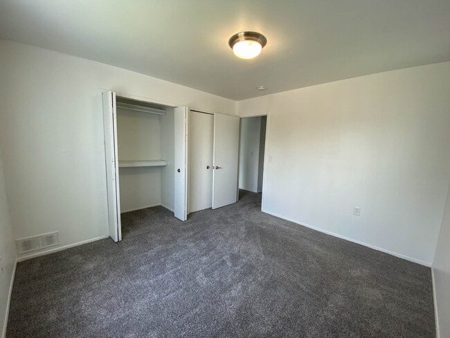
Property Record
30 Gale Blvd, Melvindale, MI 48122
NEARBY LISTINGS FOR SALE OR LEASE
Property Detail
30 Gale Blvd
Detroit-Warren-Dearborn, MI
Assessors Melvindale
47-011-05-0013-002
HH13A 14 17 TO 21 LOT 13 EXC THE NWLY PT DESC AS BEG AT NELY COR OF SAID LOT TH S69DEG 58M 53S W 1034.20FT TH S20DEG 01M 07S E 96.46FT TH S59 DEG 54M 50S E 182.0FT TH S75DEG 41M 31S E 145.0FT TH S14DEG 18M 29S W 25.0FT TH S75DEG 41M 31S E 149.43FT TH
Multifamilydwelling
Wayne
X
Michigan
26163C0264E
0013
2025
6.62 AC
2025
Melvindale
578600
Detroit
126,078 SF
DEMOGRAPHICS near 30 Gale Blvd
1 Mile
3 Mile
5 Mile
2024 Total Population
14,425
106,160
288,038
2029 Population
13,818
102,407
277,154
Pop Growth 2024-2029
(4.21%)
(3.54%)
(3.78%)
Average Age
38
39
38
2024 Total Households
5,483
41,436
108,095
HH Growth 2024-2029
(4.25%)
(3.55%)
(3.76%)
Median Household Inc
$50,991
$54,213
$55,026
Avg Household Size
2.60
2.50
2.60
2024 Avg HH Vehicles
2.00
2.00
2.00
Median Home Value
$102,116
$127,096
$139,789
Median Year Built
1953
1953
1953
Nearby Places
Map Layers
Map Styles
 Street
 Aerial
- Restaurants
- Banks
- Shops
- Fitness
- Groceries
PUBLIC TRANSPORTATION
COMMUTER RAIL
Dearborn (Wolverine - Amtrak)
DRIVE
WALK
Distance
Dearborn (Wolverine - Amtrak)
11 min
4.8 mi
AIRPORT
Detroit Metro Wayne County
DRIVE
WALK
Distance
Detroit Metro Wayne County
23 min
15.2 mi
Windsor International
DRIVE
WALK
Distance
Windsor International
35 min
18.9 mi
Freight Ports
Port of Toledo
DRIVE
WALK
Distance
Port of Toledo
66 min
53.1 mi
Nearby Properties
Address
Land Use
TOTAL SIZE
Lot Size
Zoning
Address
Land Use
TOTAL SIZE
Lot Size
Zoning
590,116 SF
388.80 AC
ID
Address
Land Use
TOTAL SIZE
Lot Size
Zoning
373,209 SF
349 AC
IC
Address
Land Use
TOTAL SIZE
Lot Size
Zoning
675,440 SF
66.32 AC
IB
Address
Land Use
TOTAL SIZE
Lot Size
Zoning
1,209,711 SF
69.44 AC
IB
Address
Land Use
TOTAL SIZE
Lot Size
Zoning
590,893 SF
51.81 AC
IB
Address
Land Use
TOTAL SIZE
Lot Size
Zoning
229,368 SF
1 AC
C 6A
Address
Land Use
TOTAL SIZE
Lot Size
Zoning
304,206 SF
29.53 AC
RC
Address
Land Use
TOTAL SIZE
Lot Size
Zoning
2,822,007 SF
75.54 AC
ID
Address
Land Use
TOTAL SIZE
Lot Size
Zoning
357,640 SF
13.89 AC
C 6C
Address
Land Use
TOTAL SIZE
Lot Size
Zoning
135,775 SF
18.39 AC
BC
Address
Land Use
TOTAL SIZE
Lot Size
Zoning
1,076,924 SF
125.54 AC
ID
Address
Land Use
TOTAL SIZE
Lot Size
Zoning
108,960 SF
5.23 AC
OS
Address
Land Use
TOTAL SIZE
Lot Size
Zoning
678,368 SF
48.99 AC
RD RESEARC
Address
Land Use
TOTAL SIZE
Lot Size
Zoning
219,434 SF
23.91 AC
BC
Address
Land Use
TOTAL SIZE
Lot Size
Zoning
102,646 SF
77.55 AC
ID
Address
Land Use
TOTAL SIZE
Lot Size
Zoning
198,237 SF
11.07 AC
RE
Address
Land Use
TOTAL SIZE
Lot Size
Zoning
Address
Land Use
TOTAL SIZE
Lot Size
Zoning
107,772 SF
8 AC
BC
Address
Land Use
TOTAL SIZE
Lot Size
Zoning
32,608 SF
46.51 AC
BC
Address
Land Use
TOTAL SIZE
Lot Size
Zoning
77,974 SF
1 AC
C 6A
Address
Land Use
TOTAL SIZE
Lot Size
Zoning
111,008 SF
26.62 AC
IB
Address
Land Use
TOTAL SIZE
Lot Size
Zoning
205,632 SF
1 AC
C 6A
Address
Land Use
TOTAL SIZE
Lot Size
Zoning
169,200 SF
19.92 AC
RD RESEARC
Address
Land Use
TOTAL SIZE
Lot Size
Zoning
637,176 SF
39.11 AC
C 6C
Address
Land Use
TOTAL SIZE
Lot Size
Zoning
196,801 SF
38.32 AC
M5
Address
Land Use
TOTAL SIZE
Lot Size
Zoning
153,668 SF
9.16 AC
RD
Address
Land Use
TOTAL SIZE
Lot Size
Zoning
111,402 SF
3.17 AC
Address
Land Use
TOTAL SIZE
Lot Size
Zoning
115,159 SF
10.49 AC
BB
Address
Land Use
TOTAL SIZE
Lot Size
Zoning
182,840 SF
11.70 AC
C 6C
Address
Land Use
TOTAL SIZE
Lot Size
Zoning
415,606 SF
18.75 AC
I-1
The World's #1 Commercial Real Estate Marketplace
Connect with us
© 2026 CoStar Group
The information above has been obtained from sources believed reliable. While we do not doubt its accuracy we have not verified it and make no guarantee, warranty or representation about it. It is your responsibility to independently confirm its accuracy and completeness. Any projections, opinions, assumptions, or estimates used are for example only and do not represent the current or future performance of the property. The value of this transaction to you depends on tax and other factors which should be evaluated by your tax, financial, and legal advisors. You and your advisors should conduct a careful, independent investigation of the property to determine to your satisfaction the suitability of the property for your needs.