Property Record
30 Harvey Way, Plattsburgh, NY 12901
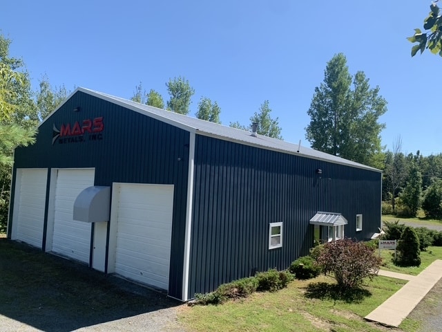

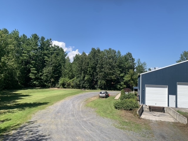
This Property Is For Sale
NEARBY LISTINGS FOR SALE OR LEASE
Property Detail
30 Harvey Way
094600-232-000-0001-012-024-0000
LOT 56 P.O.P.
Servicestation
Clinton
X
New York
36019C0592E
12.024
2025
1.07 AC
2024
Upstate New York Area
103900
Other Market Areas
3,744 SF
Plattsburgh, NY
DEMOGRAPHICS near 30 Harvey Way
1 Mile
3 Mile
5 Mile
2024 Total Population
1,612
12,946
32,108
2029 Population
1,602
12,858
31,928
Pop Growth 2024-2029
(0.62%)
(0.68%)
(0.56%)
Average Age
42
43
42
2024 Total Households
656
5,769
14,663
HH Growth 2024-2029
(0.61%)
(0.71%)
(0.56%)
Median Household Inc
$47,430
$56,256
$55,629
Avg Household Size
2.40
2.10
2.10
2024 Avg HH Vehicles
2.00
2.00
2.00
Median Home Value
$92,539
$141,354
$157,247
Median Year Built
1987
1974
1973
Nearby Places
Map Layers
Map Styles
 Street
 Aerial
- Restaurants
- Banks
- Shops
- Fitness
- Groceries
PUBLIC TRANSPORTATION
COMMUTER RAIL
DRIVE
WALK
Distance
12 min
6.2 mi
AIRPORT
Plattsburgh International
DRIVE
WALK
Distance
Plattsburgh International
13 min
6.1 mi
Patrick Leahy Burlington International
DRIVE
WALK
Distance
Patrick Leahy Burlington International
76 min
36.3 mi
Nearby Properties
Address
Land Use
TOTAL SIZE
Lot Size
Zoning
Address
Land Use
TOTAL SIZE
Lot Size
Zoning
103.84 AC
Address
Land Use
TOTAL SIZE
Lot Size
Zoning
800 SF
776.23 AC
A1
Address
Land Use
TOTAL SIZE
Lot Size
Zoning
131,558 SF
53.50 AC
T5
Address
Land Use
TOTAL SIZE
Lot Size
Zoning
15.80 AC
Address
Land Use
TOTAL SIZE
Lot Size
Zoning
99,232 SF
21.27 AC
SD
Address
Land Use
TOTAL SIZE
Lot Size
Zoning
564.20 AC
A1
Address
Land Use
TOTAL SIZE
Lot Size
Zoning
35,562 SF
204.40 AC
LC_OS
Address
Land Use
TOTAL SIZE
Lot Size
Zoning
128,028 SF
38.20 AC
T4
Address
Land Use
TOTAL SIZE
Lot Size
Zoning
83,261 SF
24.35 AC
T5
Address
Land Use
TOTAL SIZE
Lot Size
Zoning
73,095 SF
6.28 AC
T4
Address
Land Use
TOTAL SIZE
Lot Size
Zoning
167 AC
02 - SINGL
Address
Land Use
TOTAL SIZE
Lot Size
Zoning
101,758 SF
5.64 AC
T5
Address
Land Use
TOTAL SIZE
Lot Size
Zoning
117,847 SF
47.30 AC
00
Address
Land Use
TOTAL SIZE
Lot Size
Zoning
243,951 SF
21 AC
06 - INDUS
Address
Land Use
TOTAL SIZE
Lot Size
Zoning
578,793 SF
75.50 AC
T5
Address
Land Use
TOTAL SIZE
Lot Size
Zoning
218,230 SF
38.92 AC
I
Address
Land Use
TOTAL SIZE
Lot Size
Zoning
87,939 SF
8.20 AC
T5
Address
Land Use
TOTAL SIZE
Lot Size
Zoning
64,343 SF
2.30 AC
C
Address
Land Use
TOTAL SIZE
Lot Size
Zoning
4,992 SF
13.20 AC
03 - MULTI
Address
Land Use
TOTAL SIZE
Lot Size
Zoning
126,842 SF
10 AC
T5
Address
Land Use
TOTAL SIZE
Lot Size
Zoning
62,148 SF
2.66 AC
T4
Address
Land Use
TOTAL SIZE
Lot Size
Zoning
59,670 SF
0.50 AC
03 - MULTI
Address
Land Use
TOTAL SIZE
Lot Size
Zoning
210,800 SF
2.42 AC
I
Address
Land Use
TOTAL SIZE
Lot Size
Zoning
229,741 SF
10.90 AC
06 - INDUS
Address
Land Use
TOTAL SIZE
Lot Size
Zoning
50,078 SF
3.80 AC
T5
Address
Land Use
TOTAL SIZE
Lot Size
Zoning
76,598 SF
14.90 AC
12
Address
Land Use
TOTAL SIZE
Lot Size
Zoning
137,664 SF
4.82 AC
T5
Address
Land Use
TOTAL SIZE
Lot Size
Zoning
131,093 SF
5.84 AC
I
Address
Land Use
TOTAL SIZE
Lot Size
Zoning
73,724 SF
17.30 AC
05 - COMME
Address
Land Use
TOTAL SIZE
Lot Size
Zoning
67,111 SF
10.46 AC
T5
The World's #1 Commercial Real Estate Marketplace
Connect with us
© 2026 CoStar Group
The information above has been obtained from sources believed reliable. While we do not doubt its accuracy we have not verified it and make no guarantee, warranty or representation about it. It is your responsibility to independently confirm its accuracy and completeness. Any projections, opinions, assumptions, or estimates used are for example only and do not represent the current or future performance of the property. The value of this transaction to you depends on tax and other factors which should be evaluated by your tax, financial, and legal advisors. You and your advisors should conduct a careful, independent investigation of the property to determine to your satisfaction the suitability of the property for your needs.