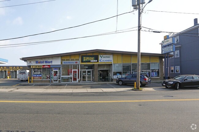
Property Record
30 Main St, Winthrop, MA 02152


Property Detail
30 Main St
Boston-Cambridge-Newton, MA-NH
Suffolk
WINT-000053-000000-000005
Massachusetts
Commercialnec
5
AE The base floodplain where base flood elevations are provided. AE Zones are now used on new format FIRMs instead of A1-A30 Zones.
0.97 AC
2025
Chelsea/Revere
2025
Boston
180400
NEARBY LISTINGS FOR SALE OR LEASE
DEMOGRAPHICS near 30 Main St
1 mile
3 mile
5 mile
2025 Total Population
19,683
149,992
434,129
2030 Population
19,672
151,872
444,957
Pop Growth 2025-2030
(0.06%)
+ 1.25%
+ 2.49%
Average Age
43
39
39
2025 Total Households
7,598
55,534
183,854
HH Growth 2025-2030
(0.03%)
+ 1.55%
+ 2.96%
Median Household Inc
$97,819
$87,517
$110,024
Avg Household Size
2.50
2.60
2.20
2025 Avg HH Vehicles
1.00
1.00
1.00
Median Home Value
$681,134
$636,611
$755,152
Median Year Built
1947
1949
1955
Nearby Places
Map Layers
Map Styles
 Street
 Aerial
Layers
 Traffic
 Biking
Places
Listings with unknown addresses are not visible on the map
- Restaurants
- Banks
- Shops
- Fitness
- Groceries
PUBLIC TRANSPORTATION
TRANSIT/SUBWAY
Orient Heights Station (Blue Line - Massachusetts Bay Transportation Authority Subway (The T))
Drive
Walk
Distance
Orient Heights Station (Blue Line - Massachusetts Bay Transportation Authority Subway (The T))
2 min
16 min
0.9 mi
COMMUTER RAIL
Chelsea (Newburyport/Rockport Line - MBTA)
Drive
Walk
Distance
Chelsea (Newburyport/Rockport Line - MBTA)
10 min
4.0 mi
North Station (Fitchburg/South Acton Line - Massachusetts Bay Transportation Authority Commuter Rail (Purple Line), Haverhill Line - Massachusetts Bay Transportation Authority Commuter Rail (Purple Line), Lowell Line - Massachusetts Bay Transportation Authority Commuter Rail (Purple Line), Newburyport/Rockport Line - Massachusetts Bay Transportation Authority Commuter Rail (Purple Line))
Drive
Walk
Distance
North Station (Fitchburg/South Acton Line - Massachusetts Bay Transportation Authority Commuter Rail (Purple Line), Haverhill Line - Massachusetts Bay Transportation Authority Commuter Rail (Purple Line), Lowell Line - Massachusetts Bay Transportation Authority Commuter Rail (Purple Line), Newburyport/Rockport Line - Massachusetts Bay Transportation Authority Commuter Rail (Purple Line))
10 min
5.0 mi
AIRPORT
General Edward Lawrence Logan International
Drive
Walk
Distance
General Edward Lawrence Logan International
8 min
3.9 mi
Freight Ports
Port of Boston
Drive
Walk
Distance
Port of Boston
14 min
6.6 mi
Nearby Properties
Address
Land Use
TOTAL SIZE
Lot Size
Zoning
Address
Land Use
TOTAL SIZE
Lot Size
Zoning
171,791 SF
166.88 AC
E
Address
Land Use
TOTAL SIZE
Lot Size
Zoning
526,171 SF
8.39 AC
A
Address
Land Use
TOTAL SIZE
Lot Size
Zoning
247,013 SF
1.13 AC
RC2
Address
Land Use
TOTAL SIZE
Lot Size
Zoning
164,959 SF
96.81 AC
E
Address
Land Use
TOTAL SIZE
Lot Size
Zoning
234,450 SF
3.49 AC
I
Address
Land Use
TOTAL SIZE
Lot Size
Zoning
424,000 SF
2.63 AC
RC
Address
Land Use
TOTAL SIZE
Lot Size
Zoning
378,339 SF
3.02 AC
E
Address
Land Use
TOTAL SIZE
Lot Size
Zoning
302,840 SF
5.83 AC
E
Address
Land Use
TOTAL SIZE
Lot Size
Zoning
211,294 SF
1.66 AC
RC2
Address
Land Use
TOTAL SIZE
Lot Size
Zoning
226,431 SF
4.31 AC
HB
Address
Land Use
TOTAL SIZE
Lot Size
Zoning
1.65 AC
RC2
Address
Land Use
TOTAL SIZE
Lot Size
Zoning
237,393 SF
7.15 AC
A
Address
Land Use
TOTAL SIZE
Lot Size
Zoning
6.02 AC
TED
Address
Land Use
TOTAL SIZE
Lot Size
Zoning
230,000 SF
2.01 AC
E
Address
Land Use
TOTAL SIZE
Lot Size
Zoning
362,358 SF
3.44 AC
CTED
Address
Land Use
TOTAL SIZE
Lot Size
Zoning
379,857 SF
7.16 AC
R2
Address
Land Use
TOTAL SIZE
Lot Size
Zoning
65,072 SF
2.18 AC
E
Address
Land Use
TOTAL SIZE
Lot Size
Zoning
422,028 SF
16.10 AC
RB
Address
Land Use
TOTAL SIZE
Lot Size
Zoning
232,943 SF
3.87 AC
Address
Land Use
TOTAL SIZE
Lot Size
Zoning
227,673 SF
1.75 AC
R3
Address
Land Use
TOTAL SIZE
Lot Size
Zoning
154.16 AC
E
Address
Land Use
TOTAL SIZE
Lot Size
Zoning
172,043 SF
1.13 AC
RC1
Address
Land Use
TOTAL SIZE
Lot Size
Zoning
191,523 SF
2.70 AC
Address
Land Use
TOTAL SIZE
Lot Size
Zoning
5,668 SF
20.05 AC
A
Address
Land Use
TOTAL SIZE
Lot Size
Zoning
391,884 SF
108.79 AC
C
Address
Land Use
TOTAL SIZE
Lot Size
Zoning
738 SF
20.71 AC
PORT
Address
Land Use
TOTAL SIZE
Lot Size
Zoning
208,663 SF
2.56 AC
DD
Address
Land Use
TOTAL SIZE
Lot Size
Zoning
449,900 SF
3.38 AC
I
Address
Land Use
TOTAL SIZE
Lot Size
Zoning
303,232 SF
2.52 AC
CTED
Address
Land Use
TOTAL SIZE
Lot Size
Zoning
290,748 SF
7.04 AC
R2
The World's #1 Commercial Real Estate Marketplace
Connect with us
© 2026 CoStar Group
The information above has been obtained from sources believed reliable. While we do not doubt its accuracy we have not verified it and make no guarantee, warranty or representation about it. It is your responsibility to independently confirm its accuracy and completeness. Any projections, opinions, assumptions, or estimates used are for example only and do not represent the current or future performance of the property. The value of this transaction to you depends on tax and other factors which should be evaluated by your tax, financial, and legal advisors. You and your advisors should conduct a careful, independent investigation of the property to determine to your satisfaction the suitability of the property for your needs.