Property Record
30 Memorial Dr, Pinehurst, NC 28374


Property Detail
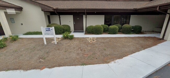
30 Memorial Dr
8563-18-40-7957
LAND PINEHURST MUNI MEMORIAL
Medicalbuilding
MOORE
OP
North Carolina
B and X Area of moderate flood hazard, usually the area between the limits of the 100-year and 500-year floods.
3.28 AC
2025
North Carolina Southeast Area
2025
Other Market Areas
950603
Pinehurst-Southern Pines, NC
5,480 SF
NEARBY LISTINGS FOR SALE OR LEASE
DEMOGRAPHICS near 30 Memorial Dr
1 mile
3 mile
5 mile
2025 Total Population
4,573
23,732
47,867
2030 Population
4,879
25,408
50,902
Pop Growth 2025-2030
+ 6.69%
+ 7.06%
+ 6.34%
Average Age
45
49
46
2025 Total Households
1,938
10,805
21,589
HH Growth 2025-2030
+ 7.02%
+ 7.29%
+ 6.54%
Median Household Inc
$105,595
$101,293
$86,071
Avg Household Size
2.30
2.20
2.20
2025 Avg HH Vehicles
2.00
2.00
2.00
Median Home Value
$440,350
$488,190
$460,457
Median Year Built
1998
1997
1995
Nearby Places
Map Layers
Map Styles
 Street
 Aerial
Layers
 Traffic
 Biking
Places
Listings with unknown addresses are not visible on the map
- Restaurants
- Banks
- Shops
- Fitness
- Groceries
PUBLIC TRANSPORTATION
COMMUTER RAIL
Southern Pines Amtrak Station (Silver Star - Amtrak)
Drive
Walk
Distance
Southern Pines Amtrak Station (Silver Star - Amtrak)
10 min
5.4 mi
Freight Ports
Port of Wilmington
Drive
Walk
Distance
Port of Wilmington
174 min
136.9 mi
Nearby Properties
Address
Land Use
TOTAL SIZE
Lot Size
Zoning
Address
Land Use
TOTAL SIZE
Lot Size
Zoning
3,953 SF
86.18 AC
MULTI
Address
Land Use
TOTAL SIZE
Lot Size
Zoning
30,190 SF
181.04 AC
PPC
Address
Land Use
TOTAL SIZE
Lot Size
Zoning
29,476 SF
22.76 AC
H
Address
Land Use
TOTAL SIZE
Lot Size
Zoning
20,091 SF
12 AC
PPC
Address
Land Use
TOTAL SIZE
Lot Size
Zoning
16.26 AC
PD
Address
Land Use
TOTAL SIZE
Lot Size
Zoning
18.49 AC
Address
Land Use
TOTAL SIZE
Lot Size
Zoning
7,161 SF
0.87 AC
RD
Address
Land Use
TOTAL SIZE
Lot Size
Zoning
132,600 SF
86.18 AC
Address
Land Use
TOTAL SIZE
Lot Size
Zoning
17,091 SF
12.65 AC
R10
Address
Land Use
TOTAL SIZE
Lot Size
Zoning
24,942 SF
39.99 AC
MULTI
Address
Land Use
TOTAL SIZE
Lot Size
Zoning
Address
Land Use
TOTAL SIZE
Lot Size
Zoning
21,138 SF
473.33 AC
RD
Address
Land Use
TOTAL SIZE
Lot Size
Zoning
51,552 SF
33.02 AC
GBCD
Address
Land Use
TOTAL SIZE
Lot Size
Zoning
12.78 AC
Address
Land Use
TOTAL SIZE
Lot Size
Zoning
8.04 AC
Address
Land Use
TOTAL SIZE
Lot Size
Zoning
11.80 AC
Address
Land Use
TOTAL SIZE
Lot Size
Zoning
190.53 AC
Address
Land Use
TOTAL SIZE
Lot Size
Zoning
Address
Land Use
TOTAL SIZE
Lot Size
Zoning
155.66 AC
RD
Address
Land Use
TOTAL SIZE
Lot Size
Zoning
7.62 AC
Address
Land Use
TOTAL SIZE
Lot Size
Zoning
7.45 AC
Address
Land Use
TOTAL SIZE
Lot Size
Zoning
Address
Land Use
TOTAL SIZE
Lot Size
Zoning
26,856 SF
1.52 AC
R10
Address
Land Use
TOTAL SIZE
Lot Size
Zoning
9,417 SF
4.19 AC
OP
Address
Land Use
TOTAL SIZE
Lot Size
Zoning
15,422 SF
35.21 AC
R20
Address
Land Use
TOTAL SIZE
Lot Size
Zoning
4,000 SF
238.22 AC
PDD
Address
Land Use
TOTAL SIZE
Lot Size
Zoning
24,802 SF
3.92 AC
OS
Address
Land Use
TOTAL SIZE
Lot Size
Zoning
7,200 SF
486.56 AC
RS3
Address
Land Use
TOTAL SIZE
Lot Size
Zoning
33,960 SF
18 AC
NC
Address
Land Use
TOTAL SIZE
Lot Size
Zoning
0.87 AC
The World's #1 Commercial Real Estate Marketplace
Connect with us
© 2026 CoStar Group
The information above has been obtained from sources believed reliable. While we do not doubt its accuracy we have not verified it and make no guarantee, warranty or representation about it. It is your responsibility to independently confirm its accuracy and completeness. Any projections, opinions, assumptions, or estimates used are for example only and do not represent the current or future performance of the property. The value of this transaction to you depends on tax and other factors which should be evaluated by your tax, financial, and legal advisors. You and your advisors should conduct a careful, independent investigation of the property to determine to your satisfaction the suitability of the property for your needs.