Property Record
30 Mill St, Assonet, MA 02702
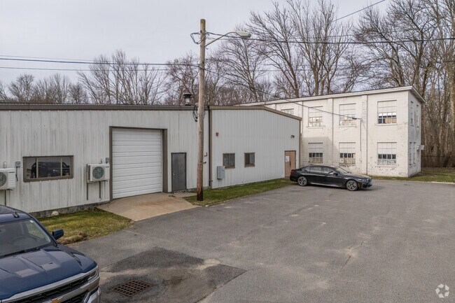

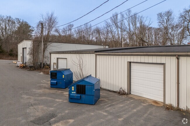
Property Detail
30 Mill St
FREE-000211-000000-000046
BRISTOL
Industrialgeneral
Massachusetts
G
4.26 AC
B and X Area of moderate flood hazard, usually the area between the limits of the 100-year and 500-year floods.
Attleboro/New Bedford
2024
Boston
2025
Providence-Warwick, RI-MA
617101
NEARBY LISTINGS FOR SALE OR LEASE
-
-
View all Assonet listings for sale on LoopNet.com
DEMOGRAPHICS near 30 Mill St
1 mile
3 mile
5 mile
2025 Total Population
1,299
7,869
30,222
2030 Population
1,307
7,967
30,754
Pop Growth 2025-2030
+ 0.62%
+ 1.25%
+ 1.76%
Average Age
43
42
42
2025 Total Households
471
2,746
11,111
HH Growth 2025-2030
+ 0.64%
+ 1.31%
+ 1.89%
Median Household Inc
$135,593
$145,380
$115,939
Avg Household Size
2.70
2.80
2.70
2025 Avg HH Vehicles
2.00
2.00
2.00
Median Home Value
$511,682
$568,314
$515,530
Median Year Built
1979
1981
1982
Nearby Places
Map Layers
Map Styles
 Street
 Aerial
Transit
 Traffic
 Biking
Places
Listings with unknown addresses are not visible on the map
- Restaurants
- Banks
- Shops
- Fitness
- Groceries
PUBLIC TRANSPORTATION
COMMUTER RAIL
Middleborough/Lakeville (Middleborough/Lakeville Line - Massachusetts Bay Transportation Authority Commuter Rail (Purple Line))
Drive
Walk
Distance
Middleborough/Lakeville (Middleborough/Lakeville Line - Massachusetts Bay Transportation Authority Commuter Rail (Purple Line))
18 min
10.0 mi
AIRPORT
Rhode Island Tf Green International
Drive
Walk
Distance
Rhode Island Tf Green International
47 min
30.4 mi
Freight Ports
Port of New Bedford Harbor
Drive
Walk
Distance
Port of New Bedford Harbor
29 min
21.9 mi
SALE & LEASE HISTORY
LISTING DATE
SALE/LEASE

Oct 22, 2023
For Sale
Nearby Properties
Address
Land Use
TOTAL SIZE
Lot Size
Zoning
Address
Land Use
TOTAL SIZE
Lot Size
Zoning
174.51 AC
I
Address
Land Use
TOTAL SIZE
Lot Size
Zoning
387.83 AC
I
Address
Land Use
TOTAL SIZE
Lot Size
Zoning
65.74 AC
B
Address
Land Use
TOTAL SIZE
Lot Size
Zoning
108,692 SF
10.80 AC
R1
Address
Land Use
TOTAL SIZE
Lot Size
Zoning
39,944 SF
47.07 AC
I2
Address
Land Use
TOTAL SIZE
Lot Size
Zoning
34.88 AC
G
Address
Land Use
TOTAL SIZE
Lot Size
Zoning
2,295.68 AC
OSR
Address
Land Use
TOTAL SIZE
Lot Size
Zoning
65,800 SF
24.31 AC
I2
Address
Land Use
TOTAL SIZE
Lot Size
Zoning
649 AC
OSR
Address
Land Use
TOTAL SIZE
Lot Size
Zoning
7,867 SF
27 AC
R1
Address
Land Use
TOTAL SIZE
Lot Size
Zoning
3.99 AC
G
Address
Land Use
TOTAL SIZE
Lot Size
Zoning
613 AC
Address
Land Use
TOTAL SIZE
Lot Size
Zoning
2.50 AC
B
Address
Land Use
TOTAL SIZE
Lot Size
Zoning
90 AC
G
Address
Land Use
TOTAL SIZE
Lot Size
Zoning
5.70 AC
R
Address
Land Use
TOTAL SIZE
Lot Size
Zoning
39 AC
G
Address
Land Use
TOTAL SIZE
Lot Size
Zoning
4.96 AC
I
Address
Land Use
TOTAL SIZE
Lot Size
Zoning
8,185 SF
10.01 AC
Address
Land Use
TOTAL SIZE
Lot Size
Zoning
2,520 SF
3.13 AC
B
Address
Land Use
TOTAL SIZE
Lot Size
Zoning
4,000 SF
26 AC
OSR
Address
Land Use
TOTAL SIZE
Lot Size
Zoning
57,900 SF
10.20 AC
I
Address
Land Use
TOTAL SIZE
Lot Size
Zoning
134.03 AC
G
Address
Land Use
TOTAL SIZE
Lot Size
Zoning
16,851 SF
2.59 AC
B
Address
Land Use
TOTAL SIZE
Lot Size
Zoning
9,022 SF
16.75 AC
G
Address
Land Use
TOTAL SIZE
Lot Size
Zoning
4.93 AC
I
Address
Land Use
TOTAL SIZE
Lot Size
Zoning
11.40 AC
G
Address
Land Use
TOTAL SIZE
Lot Size
Zoning
4.18 AC
I
Address
Land Use
TOTAL SIZE
Lot Size
Zoning
24,000 SF
7.62 AC
I
Address
Land Use
TOTAL SIZE
Lot Size
Zoning
8,729 SF
1.10 AC
R
The World's #1 Commercial Real Estate Marketplace
Connect with us
© 2026 CoStar Group
The information above has been obtained from sources believed reliable. While we do not doubt its accuracy we have not verified it and make no guarantee, warranty or representation about it. It is your responsibility to independently confirm its accuracy and completeness. Any projections, opinions, assumptions, or estimates used are for example only and do not represent the current or future performance of the property. The value of this transaction to you depends on tax and other factors which should be evaluated by your tax, financial, and legal advisors. You and your advisors should conduct a careful, independent investigation of the property to determine to your satisfaction the suitability of the property for your needs.