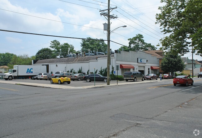
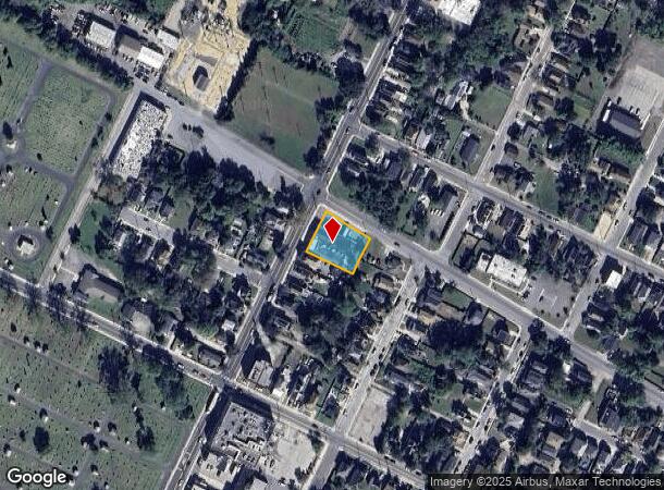
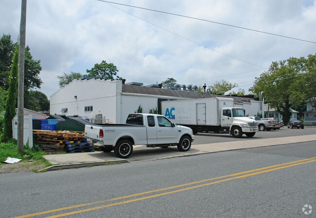
Property Record
30 N New Rd, Pleasantville, NJ 08232
NEARBY LISTINGS FOR SALE OR LEASE
Property Detail
30 N New Rd
19-00098-0000-00012
L22&23
Vacantlandnec
Atlantic
ARE
New Jersey
34001C0319F
12
2024
0.40 AC
2025
Atlantic City/Hammonton
011901
Philadelphia
7,500 SF
Atlantic City-Hammonton, NJ
DEMOGRAPHICS near 30 N New Rd
1 Mile
3 Mile
5 Mile
2024 Total Population
11,909
36,661
103,691
2029 Population
11,586
35,646
103,698
Pop Growth 2024-2029
(2.71%)
(2.77%)
+ 0.01%
Average Age
37
39
42
2024 Total Households
3,862
13,084
39,288
HH Growth 2024-2029
(3.50%)
(3.57%)
(0.05%)
Median Household Inc
$44,944
$56,476
$71,796
Avg Household Size
2.80
2.60
2.50
2024 Avg HH Vehicles
1.00
2.00
2.00
Median Home Value
$157,763
$189,352
$254,787
Median Year Built
1959
1969
1969
Nearby Places
Map Layers
Map Styles
 Street
 Aerial
- Restaurants
- Banks
- Shops
- Fitness
- Groceries
PUBLIC TRANSPORTATION
COMMUTER RAIL
Absecon (Atlantic City Line - NJ Transit Commuter Rail (NJ Transit))
DRIVE
WALK
Distance
Absecon (Atlantic City Line - NJ Transit Commuter Rail (NJ Transit))
6 min
3.1 mi
Atlantic City (Atlantic City Line - NJ Transit Commuter Rail (NJ Transit))
DRIVE
WALK
Distance
Atlantic City (Atlantic City Line - NJ Transit Commuter Rail (NJ Transit))
12 min
7.1 mi
AIRPORT
Atlantic City International
DRIVE
WALK
Distance
Atlantic City International
33 min
9.6 mi
Freight Ports
Broadway Terminal - Pier 5
DRIVE
WALK
Distance
Broadway Terminal - Pier 5
64 min
50.7 mi
Nearby Properties
Address
Land Use
TOTAL SIZE
Lot Size
Zoning
Address
Land Use
TOTAL SIZE
Lot Size
Zoning
40.29 AC
IND
Address
Land Use
TOTAL SIZE
Lot Size
Zoning
14,775 SF
35 AC
RCD
Address
Land Use
TOTAL SIZE
Lot Size
Zoning
Address
Land Use
TOTAL SIZE
Lot Size
Zoning
114,270 SF
28.60 AC
R-1
Address
Land Use
TOTAL SIZE
Lot Size
Zoning
144,062 SF
19.86 AC
R-1
Address
Land Use
TOTAL SIZE
Lot Size
Zoning
4,320 SF
0.84 AC
UEZC
Address
Land Use
TOTAL SIZE
Lot Size
Zoning
9,318 SF
1.38 AC
UEZC
Address
Land Use
TOTAL SIZE
Lot Size
Zoning
17,312 SF
14.95 AC
MF
Address
Land Use
TOTAL SIZE
Lot Size
Zoning
5.56 AC
R-50
Address
Land Use
TOTAL SIZE
Lot Size
Zoning
19.43 AC
R-C
Address
Land Use
TOTAL SIZE
Lot Size
Zoning
1.95 AC
UEZC
Address
Land Use
TOTAL SIZE
Lot Size
Zoning
7.86 AC
UEZR
Address
Land Use
TOTAL SIZE
Lot Size
Zoning
20.90 AC
RCD
Address
Land Use
TOTAL SIZE
Lot Size
Zoning
Address
Land Use
TOTAL SIZE
Lot Size
Zoning
10,000 SF
1.57 AC
UEZC
Address
Land Use
TOTAL SIZE
Lot Size
Zoning
1.44 AC
UEZR
Address
Land Use
TOTAL SIZE
Lot Size
Zoning
214.50 AC
R-1
Address
Land Use
TOTAL SIZE
Lot Size
Zoning
14.09 AC
DC
Address
Land Use
TOTAL SIZE
Lot Size
Zoning
2,541 SF
19.88 AC
UEZC
Address
Land Use
TOTAL SIZE
Lot Size
Zoning
34.80 AC
RCD
Address
Land Use
TOTAL SIZE
Lot Size
Zoning
Address
Land Use
TOTAL SIZE
Lot Size
Zoning
2,740 SF
0.89 AC
UEZC
Address
Land Use
TOTAL SIZE
Lot Size
Zoning
2.85 AC
R-50
Address
Land Use
TOTAL SIZE
Lot Size
Zoning
1,796 SF
11.10 AC
MF
Address
Land Use
TOTAL SIZE
Lot Size
Zoning
Address
Land Use
TOTAL SIZE
Lot Size
Zoning
17.72 AC
RCD
Address
Land Use
TOTAL SIZE
Lot Size
Zoning
1.64 AC
UEZC
Address
Land Use
TOTAL SIZE
Lot Size
Zoning
3.81 AC
RCD
Address
Land Use
TOTAL SIZE
Lot Size
Zoning
29.20 AC
Address
Land Use
TOTAL SIZE
Lot Size
Zoning
13.43 AC
UEZC
The World's #1 Commercial Real Estate Marketplace
Connect with us
© 2025 CoStar Group
The information above has been obtained from sources believed reliable. While we do not doubt its accuracy we have not verified it and make no guarantee, warranty or representation about it. It is your responsibility to independently confirm its accuracy and completeness. Any projections, opinions, assumptions, or estimates used are for example only and do not represent the current or future performance of the property. The value of this transaction to you depends on tax and other factors which should be evaluated by your tax, financial, and legal advisors. You and your advisors should conduct a careful, independent investigation of the property to determine to your satisfaction the suitability of the property for your needs.