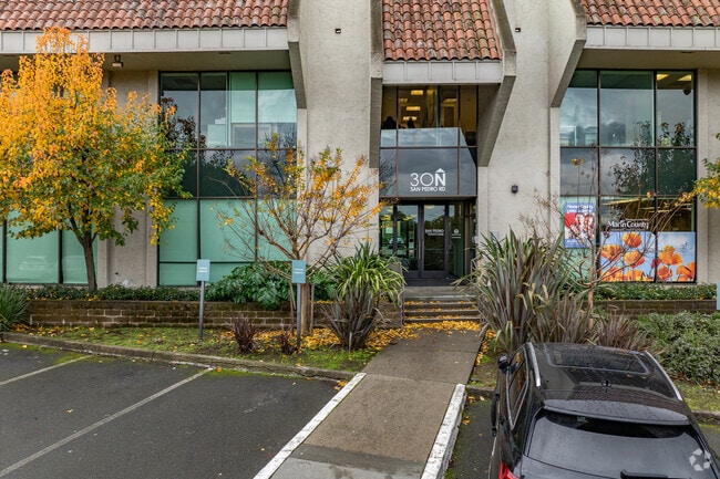
Property Record
30 N San Pedro Rd, San Rafael, CA 94903


NEARBY LISTINGS FOR SALE OR LEASE
Property Detail
30 N San Pedro Rd
San Rafael, CA
Portion Golf Links Tract
179-301-29
PARCEL MAPS 22 PG 17 LOT 2
Commercialnec
Marin
X
California
06041C0457E
2
2025
1.61 AC
2025
San Rafael/Larkspur
106002
North Bay/Santa Rosa
24,480 SF
DEMOGRAPHICS near 30 N San Pedro Rd
1 Mile
3 Mile
5 Mile
2024 Total Population
9,473
85,295
133,320
2029 Population
9,220
82,729
129,609
Pop Growth 2024-2029
(2.67%)
(3.01%)
(2.78%)
Average Age
46
44
45
2024 Total Households
3,886
32,834
52,634
HH Growth 2024-2029
(2.55%)
(2.99%)
(2.80%)
Median Household Inc
$94,675
$111,530
$114,729
Avg Household Size
2.30
2.50
2.40
2024 Avg HH Vehicles
2.00
2.00
2.00
Median Home Value
$1,012,929
$1,076,812
$1,076,610
Median Year Built
1969
1962
1964
Nearby Places
Map Layers
Map Styles
 Street
 Aerial
- Restaurants
- Banks
- Shops
- Fitness
- Groceries
PUBLIC TRANSPORTATION
COMMUTER RAIL
DRIVE
WALK
Distance
4 min
17 min
0.9 mi
DRIVE
WALK
Distance
6 min
2.6 mi
AIRPORT
San Francisco International
DRIVE
WALK
Distance
San Francisco International
54 min
33.3 mi
Metro Oakland International
DRIVE
WALK
Distance
Metro Oakland International
46 min
33.5 mi
Freight Ports
Port of Richmond
DRIVE
WALK
Distance
Port of Richmond
24 min
14.1 mi
SALE & LEASE HISTORY
LISTING DATE
SALE/LEASE

Sep 24, 2016
For Sale
Oct 16, 2017
For Lease
Oct 07, 2016
For Lease
Feb 07, 2022
For Lease
Dec 09, 2024
For Lease
Aug 26, 2020
For Lease
Aug 06, 2020
For Lease
Aug 03, 2022
For Sale
Aug 01, 2022
For Sale
Nearby Properties
Address
Land Use
TOTAL SIZE
Lot Size
Zoning
Address
Land Use
TOTAL SIZE
Lot Size
Zoning
283,663 SF
27.98 AC
Address
Land Use
TOTAL SIZE
Lot Size
Zoning
23.79 AC
Address
Land Use
TOTAL SIZE
Lot Size
Zoning
87,058 SF
1.33 AC
Address
Land Use
TOTAL SIZE
Lot Size
Zoning
221,660 SF
9.69 AC
PC
Address
Land Use
TOTAL SIZE
Lot Size
Zoning
146,832 SF
5.50 AC
Address
Land Use
TOTAL SIZE
Lot Size
Zoning
167,392 SF
12.79 AC
Address
Land Use
TOTAL SIZE
Lot Size
Zoning
147,502 SF
1.02 AC
Address
Land Use
TOTAL SIZE
Lot Size
Zoning
132,040 SF
11.74 AC
Address
Land Use
TOTAL SIZE
Lot Size
Zoning
11.63 AC
Address
Land Use
TOTAL SIZE
Lot Size
Zoning
91,158 SF
1.89 AC
Address
Land Use
TOTAL SIZE
Lot Size
Zoning
15.91 AC
SPD
Address
Land Use
TOTAL SIZE
Lot Size
Zoning
94,745 SF
1.46 AC
Address
Land Use
TOTAL SIZE
Lot Size
Zoning
75,888 SF
10.99 AC
Address
Land Use
TOTAL SIZE
Lot Size
Zoning
195,460 SF
6.10 AC
Address
Land Use
TOTAL SIZE
Lot Size
Zoning
71,527 SF
1.86 AC
Address
Land Use
TOTAL SIZE
Lot Size
Zoning
Address
Land Use
TOTAL SIZE
Lot Size
Zoning
84,245 SF
2.62 AC
Address
Land Use
TOTAL SIZE
Lot Size
Zoning
177,460 SF
13 AC
Address
Land Use
TOTAL SIZE
Lot Size
Zoning
11,830 SF
0.65 AC
Address
Land Use
TOTAL SIZE
Lot Size
Zoning
85,066 SF
1.29 AC
Address
Land Use
TOTAL SIZE
Lot Size
Zoning
87,840 SF
1.19 AC
Address
Land Use
TOTAL SIZE
Lot Size
Zoning
33,641 SF
1.60 AC
Address
Land Use
TOTAL SIZE
Lot Size
Zoning
45,142 SF
2.32 AC
Address
Land Use
TOTAL SIZE
Lot Size
Zoning
6.39 AC
Address
Land Use
TOTAL SIZE
Lot Size
Zoning
142,341 SF
5.83 AC
Address
Land Use
TOTAL SIZE
Lot Size
Zoning
66,700 SF
0.99 AC
Address
Land Use
TOTAL SIZE
Lot Size
Zoning
42,410 SF
0.54 AC
Address
Land Use
TOTAL SIZE
Lot Size
Zoning
75,556 SF
0.78 AC
Address
Land Use
TOTAL SIZE
Lot Size
Zoning
2.53 AC
Address
Land Use
TOTAL SIZE
Lot Size
Zoning
132,813 SF
6.75 AC
The World's #1 Commercial Real Estate Marketplace
Connect with us
© 2025 CoStar Group
The information above has been obtained from sources believed reliable. While we do not doubt its accuracy we have not verified it and make no guarantee, warranty or representation about it. It is your responsibility to independently confirm its accuracy and completeness. Any projections, opinions, assumptions, or estimates used are for example only and do not represent the current or future performance of the property. The value of this transaction to you depends on tax and other factors which should be evaluated by your tax, financial, and legal advisors. You and your advisors should conduct a careful, independent investigation of the property to determine to your satisfaction the suitability of the property for your needs.