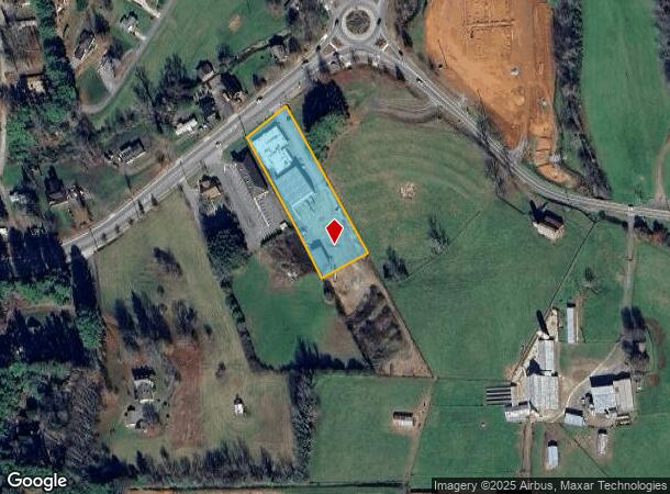
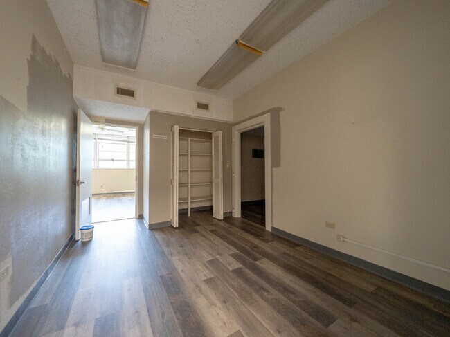
Property Record
1560 Asheville Rd, Waynesville, NC 28786
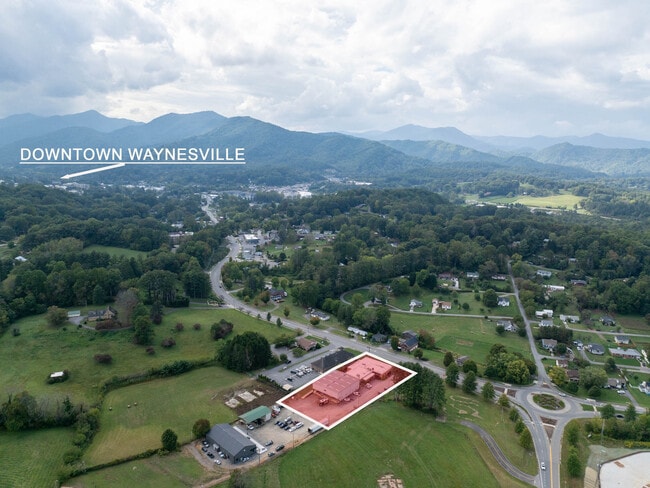
This Property Is For Sale
NEARBY LISTINGS FOR SALE OR LEASE
Property Detail
1560 Asheville Rd
Asheville, NC
1560 ASHEVILLE RD
8615-99-5698
Haywood
Officebuilding
North Carolina
0
1.58 AC
2025
Haywood County
921000
Asheville
9,231 SF
DEMOGRAPHICS near 1560 Asheville Rd
1 Mile
3 Mile
5 Mile
2024 Total Population
1,877
15,196
29,424
2029 Population
1,876
15,169
29,518
Pop Growth 2024-2029
(0.05%)
(0.18%)
+ 0.32%
Average Age
44
46
46
2024 Total Households
813
6,828
13,042
HH Growth 2024-2029
(0.12%)
(0.25%)
+ 0.29%
Median Household Inc
$62,286
$57,319
$58,719
Avg Household Size
2.20
2.10
2.20
2024 Avg HH Vehicles
2.00
2.00
2.00
Median Home Value
$308,333
$298,817
$297,229
Median Year Built
1965
1973
1980
Nearby Places
Map Layers
Map Styles
 Street
 Aerial
- Restaurants
- Banks
- Shops
- Fitness
- Groceries
PUBLIC TRANSPORTATION
AIRPORT
Asheville Regional
DRIVE
WALK
Distance
Asheville Regional
44 min
33.3 mi
Freight Ports
North Charleston Terminal
DRIVE
WALK
Distance
North Charleston Terminal
315 min
277.1 mi
Nearby Properties
Address
Land Use
TOTAL SIZE
Lot Size
Zoning
Address
Land Use
TOTAL SIZE
Lot Size
Zoning
52,051 SF
55.78 AC
Address
Land Use
TOTAL SIZE
Lot Size
Zoning
3,330 SF
3.73 AC
Address
Land Use
TOTAL SIZE
Lot Size
Zoning
1,500 SF
294.65 AC
Address
Land Use
TOTAL SIZE
Lot Size
Zoning
23,615 SF
7.17 AC
Address
Land Use
TOTAL SIZE
Lot Size
Zoning
5,800 SF
54.05 AC
COI
Address
Land Use
TOTAL SIZE
Lot Size
Zoning
17,244 SF
40.20 AC
Address
Land Use
TOTAL SIZE
Lot Size
Zoning
5,509 SF
7.12 AC
Address
Land Use
TOTAL SIZE
Lot Size
Zoning
37,508 SF
3.44 AC
DJAC
Address
Land Use
TOTAL SIZE
Lot Size
Zoning
16,764 SF
8.28 AC
HND
Address
Land Use
TOTAL SIZE
Lot Size
Zoning
87,969 SF
19.78 AC
RATC
Address
Land Use
TOTAL SIZE
Lot Size
Zoning
12,520 SF
3.26 AC
COI
Address
Land Use
TOTAL SIZE
Lot Size
Zoning
19,943 SF
13.52 AC
Address
Land Use
TOTAL SIZE
Lot Size
Zoning
94,031 SF
16.74 AC
RATC
Address
Land Use
TOTAL SIZE
Lot Size
Zoning
35,901 SF
12.80 AC
Address
Land Use
TOTAL SIZE
Lot Size
Zoning
16,836 SF
0.57 AC
Address
Land Use
TOTAL SIZE
Lot Size
Zoning
25,344 SF
1.16 AC
CBD
Address
Land Use
TOTAL SIZE
Lot Size
Zoning
3,248 SF
95.06 AC
CCND
Address
Land Use
TOTAL SIZE
Lot Size
Zoning
115,911 SF
16.92 AC
Address
Land Use
TOTAL SIZE
Lot Size
Zoning
71,831 SF
5.83 AC
SMBD
Address
Land Use
TOTAL SIZE
Lot Size
Zoning
49,732 SF
6.63 AC
Address
Land Use
TOTAL SIZE
Lot Size
Zoning
71,321 SF
19.56 AC
PCND
Address
Land Use
TOTAL SIZE
Lot Size
Zoning
13,608 SF
22.01 AC
RCND
Address
Land Use
TOTAL SIZE
Lot Size
Zoning
52,904 SF
23.08 AC
HMND
Address
Land Use
TOTAL SIZE
Lot Size
Zoning
277,784 SF
35.12 AC
HTD
Address
Land Use
TOTAL SIZE
Lot Size
Zoning
14,806 SF
9.76 AC
Address
Land Use
TOTAL SIZE
Lot Size
Zoning
30,460 SF
13.04 AC
Address
Land Use
TOTAL SIZE
Lot Size
Zoning
124,013 SF
11.81 AC
RATC
Address
Land Use
TOTAL SIZE
Lot Size
Zoning
5,152 SF
2.01 AC
Address
Land Use
TOTAL SIZE
Lot Size
Zoning
7,020 SF
2.22 AC
CBD
Address
Land Use
TOTAL SIZE
Lot Size
Zoning
4,368 SF
1.49 AC
MSND
The World's #1 Commercial Real Estate Marketplace
Connect with us
© 2025 CoStar Group
The information above has been obtained from sources believed reliable. While we do not doubt its accuracy we have not verified it and make no guarantee, warranty or representation about it. It is your responsibility to independently confirm its accuracy and completeness. Any projections, opinions, assumptions, or estimates used are for example only and do not represent the current or future performance of the property. The value of this transaction to you depends on tax and other factors which should be evaluated by your tax, financial, and legal advisors. You and your advisors should conduct a careful, independent investigation of the property to determine to your satisfaction the suitability of the property for your needs.