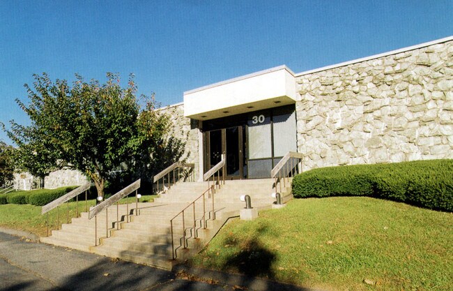
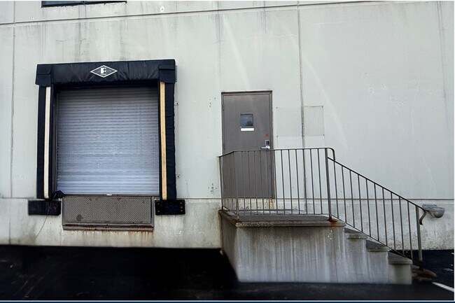
Property Record
30 Nutmeg Dr, Trumbull, CT 06611

Property Detail
30 Nutmeg Dr
TRUM-000009K-000000-000011
Greater Bridgeport
Industrialgeneral
Connecticut
I-L3
11
B and X Area of moderate flood hazard, usually the area between the limits of the 100-year and 500-year floods.
5.09 AC
2025
Trumbull
2025
Westchester/So Connecticut
090500
Bridgeport-Stamford-Danbury, CT
86,894 SF
NEARBY LISTINGS FOR SALE OR LEASE
DEMOGRAPHICS near 30 Nutmeg Dr
1 mile
3 mile
5 mile
2025 Total Population
4,059
71,480
250,706
2030 Population
4,179
74,085
257,953
Pop Growth 2025-2030
+ 2.96%
+ 3.64%
+ 2.89%
Average Age
44
43
41
2025 Total Households
1,416
26,886
93,273
HH Growth 2025-2030
+ 2.97%
+ 3.79%
+ 3.01%
Median Household Inc
$169,395
$110,428
$86,703
Avg Household Size
2.80
2.60
2.60
2025 Avg HH Vehicles
2.00
2.00
2.00
Median Home Value
$482,162
$387,914
$381,759
Median Year Built
1962
1962
1958
Nearby Places
Map Layers
Map Styles
 Street
 Aerial
Layers
 Traffic
 Biking
Places
Listings with unknown addresses are not visible on the map
- Restaurants
- Banks
- Shops
- Fitness
- Groceries
PUBLIC TRANSPORTATION
COMMUTER RAIL
Stratford Station (New Haven Line - Metro-North Commuter Railroad Company (Metro-North))
Drive
Walk
Distance
Stratford Station (New Haven Line - Metro-North Commuter Railroad Company (Metro-North))
12 min
5.4 mi
Derby-Shelton Station (New Haven Line - Metro-North Commuter Railroad Company (Metro-North))
Drive
Walk
Distance
Derby-Shelton Station (New Haven Line - Metro-North Commuter Railroad Company (Metro-North))
13 min
7.0 mi
AIRPORT
Tweed/New Haven
Drive
Walk
Distance
Tweed/New Haven
35 min
21.1 mi
Westchester County
Drive
Walk
Distance
Westchester County
59 min
40.3 mi
Long Island MacArthur
Drive
Walk
Distance
Long Island MacArthur
121 min
42.4 mi
Freight Ports
Port of New Haven
Drive
Walk
Distance
Port of New Haven
30 min
18.2 mi
SALE & LEASE HISTORY
LISTING DATE
SALE/LEASE

May 07, 2019
For Lease
Feb 20, 2025
For Lease
Dec 16, 2022
For Lease
Dec 01, 2016
For Lease
Apr 04, 2017
For Lease
Nearby Properties
Address
Land Use
TOTAL SIZE
Lot Size
Zoning
Address
Land Use
TOTAL SIZE
Lot Size
Zoning
8.24 AC
Address
Land Use
TOTAL SIZE
Lot Size
Zoning
187,983 SF
254.30 AC
H-3
Address
Land Use
TOTAL SIZE
Lot Size
Zoning
38.62 AC
Address
Land Use
TOTAL SIZE
Lot Size
Zoning
22,848 SF
16.84 AC
IL-2
Address
Land Use
TOTAL SIZE
Lot Size
Zoning
236,601 SF
12.85 AC
IA-3
Address
Land Use
TOTAL SIZE
Lot Size
Zoning
28.30 AC
HDD
Address
Land Use
TOTAL SIZE
Lot Size
Zoning
23 AC
RC
Address
Land Use
TOTAL SIZE
Lot Size
Zoning
273,968 SF
10 AC
AA
Address
Land Use
TOTAL SIZE
Lot Size
Zoning
287,760 SF
4.98 AC
PDD6
Address
Land Use
TOTAL SIZE
Lot Size
Zoning
287,760 SF
6.32 AC
PDD6
Address
Land Use
TOTAL SIZE
Lot Size
Zoning
271,336 SF
11.45 AC
PDD2
Address
Land Use
TOTAL SIZE
Lot Size
Zoning
23.70 AC
RB
Address
Land Use
TOTAL SIZE
Lot Size
Zoning
182,000 SF
12.10 AC
IL-2
Address
Land Use
TOTAL SIZE
Lot Size
Zoning
177,799 SF
27.55 AC
RS-3
Address
Land Use
TOTAL SIZE
Lot Size
Zoning
79,739 SF
1.53 AC
PDD
Address
Land Use
TOTAL SIZE
Lot Size
Zoning
56,762 SF
13.34 AC
BZZ
Address
Land Use
TOTAL SIZE
Lot Size
Zoning
722 SF
47.10 AC
RM-1
Address
Land Use
TOTAL SIZE
Lot Size
Zoning
630 SF
107.70 AC
RA
Address
Land Use
TOTAL SIZE
Lot Size
Zoning
3,040 SF
7.07 AC
PDD5
Address
Land Use
TOTAL SIZE
Lot Size
Zoning
90 AC
RA
Address
Land Use
TOTAL SIZE
Lot Size
Zoning
8.41 AC
RC
Address
Land Use
TOTAL SIZE
Lot Size
Zoning
4,715 SF
20.76 AC
PDD2
Address
Land Use
TOTAL SIZE
Lot Size
Zoning
78,692 SF
10.79 AC
MFO
Address
Land Use
TOTAL SIZE
Lot Size
Zoning
454,846 SF
36.10 AC
IA-3
Address
Land Use
TOTAL SIZE
Lot Size
Zoning
2,046 SF
625.72 AC
R-1
Address
Land Use
TOTAL SIZE
Lot Size
Zoning
158,266 SF
7.95 AC
PDD6
Address
Land Use
TOTAL SIZE
Lot Size
Zoning
226,848 SF
14.23 AC
BC
Address
Land Use
TOTAL SIZE
Lot Size
Zoning
2,966 SF
12.27 AC
E-6
Address
Land Use
TOTAL SIZE
Lot Size
Zoning
10,761 SF
11.72 AC
PDD
Address
Land Use
TOTAL SIZE
Lot Size
Zoning
33.57 AC
RC
The World's #1 Commercial Real Estate Marketplace
Connect with us
© 2026 CoStar Group
The information above has been obtained from sources believed reliable. While we do not doubt its accuracy we have not verified it and make no guarantee, warranty or representation about it. It is your responsibility to independently confirm its accuracy and completeness. Any projections, opinions, assumptions, or estimates used are for example only and do not represent the current or future performance of the property. The value of this transaction to you depends on tax and other factors which should be evaluated by your tax, financial, and legal advisors. You and your advisors should conduct a careful, independent investigation of the property to determine to your satisfaction the suitability of the property for your needs.