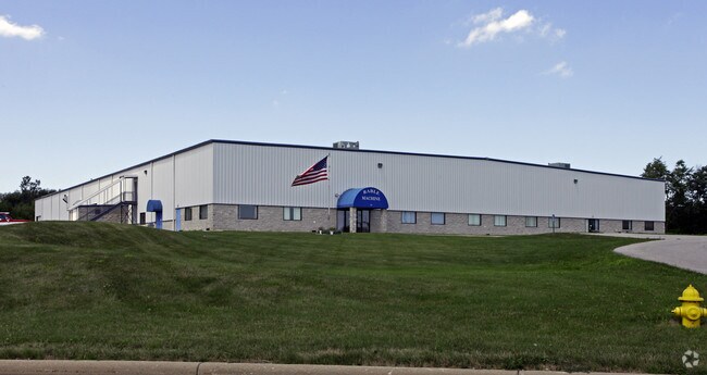
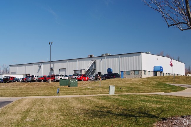
Property Record
30 Paragon Pky, Mansfield, OH 44903

NEARBY LISTINGS FOR SALE OR LEASE
Property Detail
30 Paragon Pky
Mansfield, OH
Acreage & Paragon Pkwy
028-90-036-17-003
SE A 5.551 LT 7 PT SURV PLAT TO LT 22769 6.148
Warehouse
Richland
X
Ohio
39139C0142E
7,22769
2024
6.15 AC
2024
Richland County
001700
Cleveland
61,272 SF
DEMOGRAPHICS near 30 Paragon Pky
1 Mile
3 Mile
5 Mile
2024 Total Population
97
25,909
63,594
2029 Population
106
26,239
64,069
Pop Growth 2024-2029
+ 9.28%
+ 1.27%
+ 0.75%
Average Age
34
39
40
2024 Total Households
23
8,666
25,275
HH Growth 2024-2029
+ 8.70%
+ 1.57%
+ 0.77%
Median Household Inc
$42,500
$33,128
$39,757
Avg Household Size
1.90
2.30
2.20
2024 Avg HH Vehicles
2.00
2.00
2.00
Median Home Value
$158,333
$73,910
$100,171
Median Year Built
1968
1956
1958
Nearby Places
Map Layers
Map Styles
 Street
 Aerial
- Restaurants
- Banks
- Shops
- Fitness
- Groceries
Nearby Properties
Address
Land Use
TOTAL SIZE
Lot Size
Zoning
Address
Land Use
TOTAL SIZE
Lot Size
Zoning
456.50 AC
Address
Land Use
TOTAL SIZE
Lot Size
Zoning
354,710 SF
7.07 AC
Address
Land Use
TOTAL SIZE
Lot Size
Zoning
0.06 AC
Address
Land Use
TOTAL SIZE
Lot Size
Zoning
148,135 SF
6.89 AC
Address
Land Use
TOTAL SIZE
Lot Size
Zoning
27,360 SF
63.77 AC
Address
Land Use
TOTAL SIZE
Lot Size
Zoning
2.31 AC
Address
Land Use
TOTAL SIZE
Lot Size
Zoning
404,200 SF
14.77 AC
Address
Land Use
TOTAL SIZE
Lot Size
Zoning
221,864 SF
20 AC
Address
Land Use
TOTAL SIZE
Lot Size
Zoning
318,366 SF
26.16 AC
Address
Land Use
TOTAL SIZE
Lot Size
Zoning
458,316 SF
27.90 AC
Address
Land Use
TOTAL SIZE
Lot Size
Zoning
4,950 SF
158.55 AC
Address
Land Use
TOTAL SIZE
Lot Size
Zoning
1.69 AC
Address
Land Use
TOTAL SIZE
Lot Size
Zoning
161,800 SF
15.87 AC
Address
Land Use
TOTAL SIZE
Lot Size
Zoning
47.90 AC
Address
Land Use
TOTAL SIZE
Lot Size
Zoning
44,718 SF
0.47 AC
Address
Land Use
TOTAL SIZE
Lot Size
Zoning
30,306 SF
5.63 AC
Address
Land Use
TOTAL SIZE
Lot Size
Zoning
106,361 SF
5.06 AC
Address
Land Use
TOTAL SIZE
Lot Size
Zoning
80,956 SF
17.24 AC
Address
Land Use
TOTAL SIZE
Lot Size
Zoning
75,157 SF
0.41 AC
Address
Land Use
TOTAL SIZE
Lot Size
Zoning
31,064 SF
9 AC
Address
Land Use
TOTAL SIZE
Lot Size
Zoning
71,606 SF
9.03 AC
Address
Land Use
TOTAL SIZE
Lot Size
Zoning
103,000 SF
17.38 AC
Address
Land Use
TOTAL SIZE
Lot Size
Zoning
25,540 SF
8.09 AC
Address
Land Use
TOTAL SIZE
Lot Size
Zoning
34,320 SF
20.54 AC
Address
Land Use
TOTAL SIZE
Lot Size
Zoning
43,356 SF
5.30 AC
Address
Land Use
TOTAL SIZE
Lot Size
Zoning
66,332 SF
0.49 AC
Address
Land Use
TOTAL SIZE
Lot Size
Zoning
163,292 SF
16.76 AC
Address
Land Use
TOTAL SIZE
Lot Size
Zoning
70,665 SF
10.56 AC
Address
Land Use
TOTAL SIZE
Lot Size
Zoning
80,000 SF
12.10 AC
Address
Land Use
TOTAL SIZE
Lot Size
Zoning
138,116 SF
21.57 AC
The World's #1 Commercial Real Estate Marketplace
Connect with us
© 2025 CoStar Group
The information above has been obtained from sources believed reliable. While we do not doubt its accuracy we have not verified it and make no guarantee, warranty or representation about it. It is your responsibility to independently confirm its accuracy and completeness. Any projections, opinions, assumptions, or estimates used are for example only and do not represent the current or future performance of the property. The value of this transaction to you depends on tax and other factors which should be evaluated by your tax, financial, and legal advisors. You and your advisors should conduct a careful, independent investigation of the property to determine to your satisfaction the suitability of the property for your needs.