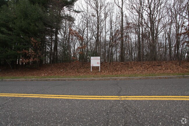
Property Record
30 Rado Dr, Naugatuck, CT 06770

Property Detail
30 Rado Dr
NAUG-000354B-E020194-000007
NEW HAVEN
Industrialacreage
Connecticut
R15
5952
B and X Area of moderate flood hazard, usually the area between the limits of the 100-year and 500-year floods.
6.80 AC
2025
Naugatuck
2025
Westchester/So Connecticut
345100
New Haven, CT
NEARBY LISTINGS FOR SALE OR LEASE
DEMOGRAPHICS near 30 Rado Dr
1 mile
3 mile
5 mile
2025 Total Population
5,030
74,211
154,294
2030 Population
5,138
75,834
157,976
Pop Growth 2025-2030
+ 2.15%
+ 2.19%
+ 2.39%
Average Age
41
40
40
2025 Total Households
1,860
29,190
60,389
HH Growth 2025-2030
+ 2.04%
+ 2.14%
+ 2.42%
Median Household Inc
$89,191
$69,193
$64,455
Avg Household Size
2.60
2.50
2.50
2025 Avg HH Vehicles
2.00
2.00
2.00
Median Home Value
$297,391
$246,015
$259,032
Median Year Built
1968
1962
1961
Nearby Places
Map Layers
Map Styles
 Street
 Aerial
Layers
 Traffic
 Biking
Places
Listings with unknown addresses are not visible on the map
- Restaurants
- Banks
- Shops
- Fitness
- Groceries
PUBLIC TRANSPORTATION
COMMUTER RAIL
Naugatuck Station (New Haven Line - Metro-North Commuter Railroad Company (Metro-North))
Drive
Walk
Distance
Naugatuck Station (New Haven Line - Metro-North Commuter Railroad Company (Metro-North))
7 min
2.9 mi
Waterbury Station (New Haven Line - Metro-North Commuter Railroad Company (Metro-North))
Drive
Walk
Distance
Waterbury Station (New Haven Line - Metro-North Commuter Railroad Company (Metro-North))
11 min
4.8 mi
AIRPORT
Tweed/New Haven
Drive
Walk
Distance
Tweed/New Haven
42 min
23.7 mi
Freight Ports
Port of New Haven
Drive
Walk
Distance
Port of New Haven
37 min
20.8 mi
Nearby Properties
Address
Land Use
TOTAL SIZE
Lot Size
Zoning
Address
Land Use
TOTAL SIZE
Lot Size
Zoning
156,279 SF
12.13 AC
RL
Address
Land Use
TOTAL SIZE
Lot Size
Zoning
29.92 AC
IG
Address
Land Use
TOTAL SIZE
Lot Size
Zoning
149,058 SF
31.04 AC
RS-12
Address
Land Use
TOTAL SIZE
Lot Size
Zoning
88,350 SF
9.50 AC
RS
Address
Land Use
TOTAL SIZE
Lot Size
Zoning
87,221 SF
46.28 AC
RA-1
Address
Land Use
TOTAL SIZE
Lot Size
Zoning
44.31 AC
CA
Address
Land Use
TOTAL SIZE
Lot Size
Zoning
45,605 SF
2.48 AC
RH
Address
Land Use
TOTAL SIZE
Lot Size
Zoning
17,181 SF
18.82 AC
R30
Address
Land Use
TOTAL SIZE
Lot Size
Zoning
268,279 SF
52.80 AC
RA1
Address
Land Use
TOTAL SIZE
Lot Size
Zoning
19.24 AC
CA
Address
Land Use
TOTAL SIZE
Lot Size
Zoning
63,288 SF
2.60 AC
RH
Address
Land Use
TOTAL SIZE
Lot Size
Zoning
12.49 AC
CA
Address
Land Use
TOTAL SIZE
Lot Size
Zoning
91,324 SF
22.27 AC
RM
Address
Land Use
TOTAL SIZE
Lot Size
Zoning
14,607 SF
9.24 AC
R8
Address
Land Use
TOTAL SIZE
Lot Size
Zoning
145,226 SF
28.56 AC
R8
Address
Land Use
TOTAL SIZE
Lot Size
Zoning
1.30 AC
CBD
Address
Land Use
TOTAL SIZE
Lot Size
Zoning
Address
Land Use
TOTAL SIZE
Lot Size
Zoning
7.15 AC
RM
Address
Land Use
TOTAL SIZE
Lot Size
Zoning
95,030 SF
14.30 AC
RA-1
Address
Land Use
TOTAL SIZE
Lot Size
Zoning
115,996 SF
19.57 AC
CA
Address
Land Use
TOTAL SIZE
Lot Size
Zoning
35,200 SF
8.55 AC
B
Address
Land Use
TOTAL SIZE
Lot Size
Zoning
105,480 SF
11.70 AC
CA
Address
Land Use
TOTAL SIZE
Lot Size
Zoning
4,368 SF
13.97 AC
RM
Address
Land Use
TOTAL SIZE
Lot Size
Zoning
8.24 AC
Address
Land Use
TOTAL SIZE
Lot Size
Zoning
21.65 AC
Address
Land Use
TOTAL SIZE
Lot Size
Zoning
112,055 SF
14.19 AC
RA1
Address
Land Use
TOTAL SIZE
Lot Size
Zoning
8.02 AC
CA
Address
Land Use
TOTAL SIZE
Lot Size
Zoning
4.76 AC
RM
Address
Land Use
TOTAL SIZE
Lot Size
Zoning
12.71 AC
RM
Address
Land Use
TOTAL SIZE
Lot Size
Zoning
45,193 SF
12.92 AC
B
The World's #1 Commercial Real Estate Marketplace
Connect with us
© 2026 CoStar Group
The information above has been obtained from sources believed reliable. While we do not doubt its accuracy we have not verified it and make no guarantee, warranty or representation about it. It is your responsibility to independently confirm its accuracy and completeness. Any projections, opinions, assumptions, or estimates used are for example only and do not represent the current or future performance of the property. The value of this transaction to you depends on tax and other factors which should be evaluated by your tax, financial, and legal advisors. You and your advisors should conduct a careful, independent investigation of the property to determine to your satisfaction the suitability of the property for your needs.