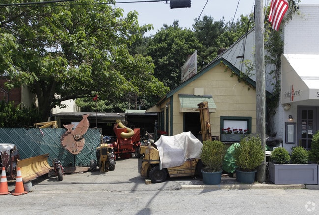
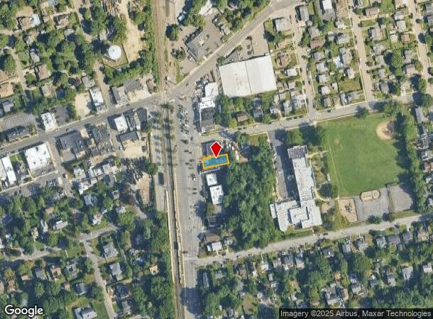
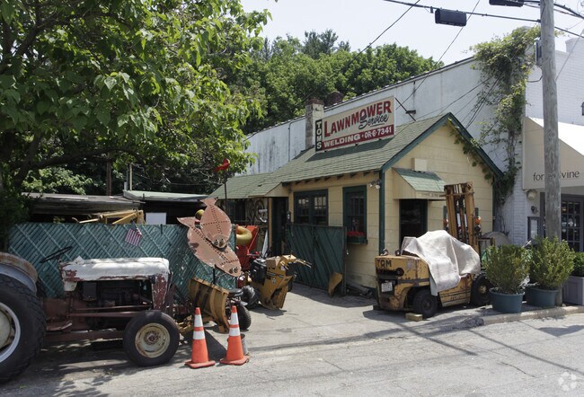
Property Record
30 Railroad Ave, Glen Head, NY 11545
NEARBY LISTINGS FOR SALE OR LEASE
Property Detail
30 Railroad Ave
2489-20-019-00-0021-0
21-22
Commercialnec
Nassau
X
New York
36059C0109G
21-22
2025
0.09 AC
2025
Northern Nassau
517600
Long Island (New York)
216 SF
Nassau County-Suffolk County, NY
DEMOGRAPHICS near 30 Railroad Ave
1 Mile
3 Mile
5 Mile
2024 Total Population
8,159
62,509
147,452
2029 Population
7,965
61,715
145,612
Pop Growth 2024-2029
(2.38%)
(1.27%)
(1.25%)
Average Age
43
42
43
2024 Total Households
2,827
21,799
50,325
HH Growth 2024-2029
(2.51%)
(1.30%)
(1.31%)
Median Household Inc
$123,980
$115,010
$141,799
Avg Household Size
2.90
2.70
2.80
2024 Avg HH Vehicles
2.00
2.00
2.00
Median Home Value
$803,993
$844,956
$912,928
Median Year Built
1955
1957
1957
Nearby Places
- Restaurants
- Banks
- Shops
- Fitness
- Groceries
PUBLIC TRANSPORTATION
COMMUTER RAIL
Glen Head Station (Oyster Bay Branch - Long Island Rail Road)
DRIVE
WALK
Distance
Glen Head Station (Oyster Bay Branch - Long Island Rail Road)
0 min
3 min
0.1 mi
Greenvale Station (Oyster Bay Branch - Long Island Rail Road)
DRIVE
WALK
Distance
Greenvale Station (Oyster Bay Branch - Long Island Rail Road)
3 min
2.2 mi
AIRPORT
LaGuardia
DRIVE
WALK
Distance
LaGuardia
31 min
19.9 mi
John F Kennedy International
DRIVE
WALK
Distance
John F Kennedy International
34 min
22.7 mi
Westchester County
DRIVE
WALK
Distance
Westchester County
61 min
38.8 mi
Freight Ports
NY - Red Hook Container Terminal
DRIVE
WALK
Distance
NY - Red Hook Container Terminal
43 min
28.0 mi
Nearby Properties
Address
Land Use
TOTAL SIZE
Lot Size
Zoning
Address
Land Use
TOTAL SIZE
Lot Size
Zoning
600 SF
2.68 AC
Address
Land Use
TOTAL SIZE
Lot Size
Zoning
95.70 AC
Address
Land Use
TOTAL SIZE
Lot Size
Zoning
251,828 SF
31.03 AC
Address
Land Use
TOTAL SIZE
Lot Size
Zoning
83,566 SF
38.12 AC
Address
Land Use
TOTAL SIZE
Lot Size
Zoning
121,473 SF
10.34 AC
Address
Land Use
TOTAL SIZE
Lot Size
Zoning
26,200 SF
186 AC
Address
Land Use
TOTAL SIZE
Lot Size
Zoning
158,725 SF
24.46 AC
Address
Land Use
TOTAL SIZE
Lot Size
Zoning
401,583 SF
17.93 AC
Address
Land Use
TOTAL SIZE
Lot Size
Zoning
50,252 SF
143.04 AC
Address
Land Use
TOTAL SIZE
Lot Size
Zoning
164,742 SF
3.54 AC
Address
Land Use
TOTAL SIZE
Lot Size
Zoning
387,645 SF
7.21 AC
Address
Land Use
TOTAL SIZE
Lot Size
Zoning
49,950 SF
51.02 AC
Address
Land Use
TOTAL SIZE
Lot Size
Zoning
237,994 SF
3.98 AC
Address
Land Use
TOTAL SIZE
Lot Size
Zoning
45,898 SF
85.13 AC
Address
Land Use
TOTAL SIZE
Lot Size
Zoning
98,439 SF
8.94 AC
Address
Land Use
TOTAL SIZE
Lot Size
Zoning
409,120 SF
20.85 AC
Address
Land Use
TOTAL SIZE
Lot Size
Zoning
56,663 SF
388.75 AC
Address
Land Use
TOTAL SIZE
Lot Size
Zoning
195,812 SF
2.30 AC
Address
Land Use
TOTAL SIZE
Lot Size
Zoning
161,595 SF
29.91 AC
Address
Land Use
TOTAL SIZE
Lot Size
Zoning
80,013 SF
51.03 AC
Address
Land Use
TOTAL SIZE
Lot Size
Zoning
51,868 SF
44.24 AC
Address
Land Use
TOTAL SIZE
Lot Size
Zoning
62,607 SF
2.63 AC
Address
Land Use
TOTAL SIZE
Lot Size
Zoning
125,184 SF
9.58 AC
Address
Land Use
TOTAL SIZE
Lot Size
Zoning
183,394 SF
18.70 AC
Address
Land Use
TOTAL SIZE
Lot Size
Zoning
18,626 SF
21.37 AC
Address
Land Use
TOTAL SIZE
Lot Size
Zoning
2,214 SF
131.50 AC
Address
Land Use
TOTAL SIZE
Lot Size
Zoning
95,147 SF
207.90 AC
Address
Land Use
TOTAL SIZE
Lot Size
Zoning
8,034 SF
15.75 AC
Address
Land Use
TOTAL SIZE
Lot Size
Zoning
18.03 AC
Address
Land Use
TOTAL SIZE
Lot Size
Zoning
487,862 SF
21.75 AC
The World's #1 Commercial Real Estate Marketplace
Connect with us
© 2025 CoStar Group
The information above has been obtained from sources believed reliable. While we do not doubt its accuracy we have not verified it and make no guarantee, warranty or representation about it. It is your responsibility to independently confirm its accuracy and completeness. Any projections, opinions, assumptions, or estimates used are for example only and do not represent the current or future performance of the property. The value of this transaction to you depends on tax and other factors which should be evaluated by your tax, financial, and legal advisors. You and your advisors should conduct a careful, independent investigation of the property to determine to your satisfaction the suitability of the property for your needs.