Property Record
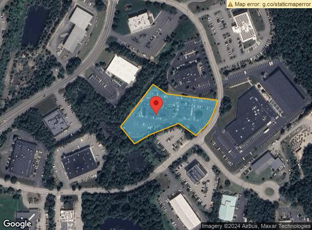
30 Resnik Rd, Plymouth, MA 02360


NEARBY LISTINGS FOR SALE OR LEASE
Property Detail
30 Resnik Rd
PLYM-000103-000000-000014K-000017
Plymouth
Commercialnec
Massachusetts
X
14k-17
25023C0354K
2.01 AC
2025
Route 3 South
2025
Boston
530100
Boston-Cambridge-Newton, MA-NH
DEMOGRAPHICS near 30 Resnik Rd
1 Mile
3 Mile
5 Mile
2024 Total Population
3,974
30,176
50,629
2029 Population
4,016
30,459
51,004
Pop Growth 2024-2029
+ 1.06%
+ 0.94%
+ 0.74%
Average Age
44
43
44
2024 Total Households
1,706
12,380
19,840
HH Growth 2024-2029
+ 1.06%
+ 0.85%
+ 0.70%
Median Household Inc
$113,701
$93,813
$98,344
Avg Household Size
2.30
2.30
2.40
2024 Avg HH Vehicles
2.00
2.00
2.00
Median Home Value
$451,499
$445,851
$462,269
Median Year Built
1983
1974
1975
Nearby Places
Map Layers
Map Styles
 Street
 Aerial
- Restaurants
- Banks
- Shops
- Fitness
- Groceries
PUBLIC TRANSPORTATION
COMMUTER RAIL
Kingston/Route 3 (Kingston/Plymouth Line - Massachusetts Bay Transportation Authority Commuter Rail (Purple Line))
DRIVE
WALK
Distance
Kingston/Route 3 (Kingston/Plymouth Line - Massachusetts Bay Transportation Authority Commuter Rail (Purple Line))
9 min
3.2 mi
AIRPORT
General Edward Lawrence Logan International
DRIVE
WALK
Distance
General Edward Lawrence Logan International
59 min
41.8 mi
Freight Ports
Port of New Bedford Harbor
DRIVE
WALK
Distance
Port of New Bedford Harbor
49 min
31.5 mi
SALE & LEASE HISTORY
LISTING DATE
SALE/LEASE

Oct 17, 2022
For Lease
Nearby Properties
Address
Land Use
TOTAL SIZE
Lot Size
Zoning
Address
Land Use
TOTAL SIZE
Lot Size
Zoning
14.60 AC
MC
Address
Land Use
TOTAL SIZE
Lot Size
Zoning
24.64 AC
HC
Address
Land Use
TOTAL SIZE
Lot Size
Zoning
82.62 AC
I
Address
Land Use
TOTAL SIZE
Lot Size
Zoning
375,020 SF
10.07 AC
Address
Land Use
TOTAL SIZE
Lot Size
Zoning
90,790 SF
16.04 AC
Address
Land Use
TOTAL SIZE
Lot Size
Zoning
205,540 SF
8.16 AC
LI
Address
Land Use
TOTAL SIZE
Lot Size
Zoning
4.67 AC
LI
Address
Land Use
TOTAL SIZE
Lot Size
Zoning
26.16 AC
MC
Address
Land Use
TOTAL SIZE
Lot Size
Zoning
27.31 AC
MC
Address
Land Use
TOTAL SIZE
Lot Size
Zoning
69.81 AC
Address
Land Use
TOTAL SIZE
Lot Size
Zoning
18.38 AC
AC
Address
Land Use
TOTAL SIZE
Lot Size
Zoning
214,442 SF
21.50 AC
MC
Address
Land Use
TOTAL SIZE
Lot Size
Zoning
98,501 SF
4.74 AC
R20M
Address
Land Use
TOTAL SIZE
Lot Size
Zoning
122,558 SF
17.44 AC
GC
Address
Land Use
TOTAL SIZE
Lot Size
Zoning
134,760 SF
13.18 AC
HC
Address
Land Use
TOTAL SIZE
Lot Size
Zoning
18.33 AC
LI
Address
Land Use
TOTAL SIZE
Lot Size
Zoning
233,971 SF
14.93 AC
R20M
Address
Land Use
TOTAL SIZE
Lot Size
Zoning
62,502 SF
0.92 AC
R20S
Address
Land Use
TOTAL SIZE
Lot Size
Zoning
12.71 AC
LI
Address
Land Use
TOTAL SIZE
Lot Size
Zoning
4.58 AC
R20M
Address
Land Use
TOTAL SIZE
Lot Size
Zoning
5.50 AC
HC
Address
Land Use
TOTAL SIZE
Lot Size
Zoning
9.41 AC
MC
Address
Land Use
TOTAL SIZE
Lot Size
Zoning
16.30 AC
GC
Address
Land Use
TOTAL SIZE
Lot Size
Zoning
97,390 SF
16.25 AC
LI
Address
Land Use
TOTAL SIZE
Lot Size
Zoning
13.88 AC
LI
Address
Land Use
TOTAL SIZE
Lot Size
Zoning
3.13 AC
R20M
Address
Land Use
TOTAL SIZE
Lot Size
Zoning
96,598 SF
8.47 AC
R20M
Address
Land Use
TOTAL SIZE
Lot Size
Zoning
138,240 SF
16.70 AC
Address
Land Use
TOTAL SIZE
Lot Size
Zoning
89,568 SF
3.52 AC
R20S
Address
Land Use
TOTAL SIZE
Lot Size
Zoning
95,228 SF
7.65 AC
HC
The World's #1 Commercial Real Estate Marketplace
Connect with us
© 2026 CoStar Group
The information above has been obtained from sources believed reliable. While we do not doubt its accuracy we have not verified it and make no guarantee, warranty or representation about it. It is your responsibility to independently confirm its accuracy and completeness. Any projections, opinions, assumptions, or estimates used are for example only and do not represent the current or future performance of the property. The value of this transaction to you depends on tax and other factors which should be evaluated by your tax, financial, and legal advisors. You and your advisors should conduct a careful, independent investigation of the property to determine to your satisfaction the suitability of the property for your needs.