Property Record
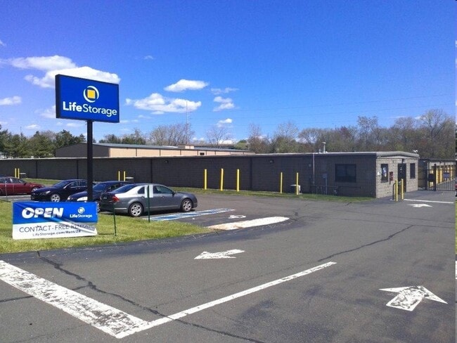
30 Stillman Rd, North Haven, CT 06473

Property Detail
30 Stillman Rd
NRHV-000066-000000-000093
South Central Ct
Commercialnec
Connecticut
IL80
93
AE The base floodplain where base flood elevations are provided. AE Zones are now used on new format FIRMs instead of A1-A30 Zones.
3.90 AC
2025
North Haven
2025
Westchester/So Connecticut
167202
New Haven, CT
NEARBY LISTINGS FOR SALE OR LEASE
-
-
View all North Haven listings for sale on LoopNet.com
DEMOGRAPHICS near 30 Stillman Rd
1 mile
3 mile
5 mile
2025 Total Population
5,055
43,332
116,945
2030 Population
5,132
44,007
118,427
Pop Growth 2025-2030
+ 1.52%
+ 1.56%
+ 1.27%
Average Age
44
43
42
2025 Total Households
2,126
16,839
46,478
HH Growth 2025-2030
+ 1.51%
+ 1.53%
+ 1.27%
Median Household Inc
$115,312
$104,954
$93,590
Avg Household Size
2.30
2.30
2.40
2025 Avg HH Vehicles
2.00
2.00
2.00
Median Home Value
$356,673
$355,395
$333,625
Median Year Built
1967
1967
1967
Nearby Places
Map Layers
Map Styles
 Street
 Aerial
Layers
 Traffic
 Biking
Places
Listings with unknown addresses are not visible on the map
- Restaurants
- Banks
- Shops
- Fitness
- Groceries
PUBLIC TRANSPORTATION
COMMUTER RAIL
Wallingford Amtrak (Amtrak Hartford Line - Amtrak, Northeast Regional - Amtrak, Valley Flyer - Amtrak)
Drive
Walk
Distance
Wallingford Amtrak (Amtrak Hartford Line - Amtrak, Northeast Regional - Amtrak, Valley Flyer - Amtrak)
10 min
6.5 mi
Wallingford (Hartford Line - CONN DOT)
Drive
Walk
Distance
Wallingford (Hartford Line - CONN DOT)
11 min
6.9 mi
AIRPORT
Tweed/New Haven
Drive
Walk
Distance
Tweed/New Haven
20 min
10.6 mi
Freight Ports
Port of New Haven
Drive
Walk
Distance
Port of New Haven
16 min
8.3 mi
Nearby Properties
Address
Land Use
TOTAL SIZE
Lot Size
Zoning
Address
Land Use
TOTAL SIZE
Lot Size
Zoning
100 AC
LO15
Address
Land Use
TOTAL SIZE
Lot Size
Zoning
268,989 SF
22.59 AC
R20
Address
Land Use
TOTAL SIZE
Lot Size
Zoning
855,000 SF
142.06 AC
IL80
Address
Land Use
TOTAL SIZE
Lot Size
Zoning
33,122 SF
23.06 AC
T4
Address
Land Use
TOTAL SIZE
Lot Size
Zoning
28,824 SF
44.93 AC
T4
Address
Land Use
TOTAL SIZE
Lot Size
Zoning
15.32 AC
T4
Address
Land Use
TOTAL SIZE
Lot Size
Zoning
66.68 AC
IG80
Address
Land Use
TOTAL SIZE
Lot Size
Zoning
30.46 AC
T5
Address
Land Use
TOTAL SIZE
Lot Size
Zoning
36,520 SF
4.64 AC
IL30
Address
Land Use
TOTAL SIZE
Lot Size
Zoning
17.71 AC
IL80
Address
Land Use
TOTAL SIZE
Lot Size
Zoning
18.85 AC
T5
Address
Land Use
TOTAL SIZE
Lot Size
Zoning
57,467 SF
3.72 AC
T4
Address
Land Use
TOTAL SIZE
Lot Size
Zoning
134,029 SF
27.54 AC
R20
Address
Land Use
TOTAL SIZE
Lot Size
Zoning
97,898 SF
11.40 AC
R20
Address
Land Use
TOTAL SIZE
Lot Size
Zoning
23.40 AC
IG80
Address
Land Use
TOTAL SIZE
Lot Size
Zoning
27.36 AC
IL80
Address
Land Use
TOTAL SIZE
Lot Size
Zoning
8.61 AC
R5
Address
Land Use
TOTAL SIZE
Lot Size
Zoning
10.70 AC
IL30
Address
Land Use
TOTAL SIZE
Lot Size
Zoning
119,658 SF
7.48 AC
O12
Address
Land Use
TOTAL SIZE
Lot Size
Zoning
3 AC
T5
Address
Land Use
TOTAL SIZE
Lot Size
Zoning
3.84 AC
CB40
Address
Land Use
TOTAL SIZE
Lot Size
Zoning
17,949 SF
8.02 AC
CB40
Address
Land Use
TOTAL SIZE
Lot Size
Zoning
15.57 AC
IL80
Address
Land Use
TOTAL SIZE
Lot Size
Zoning
85,974 SF
7.05 AC
T-4
Address
Land Use
TOTAL SIZE
Lot Size
Zoning
9.80 AC
CA20
Address
Land Use
TOTAL SIZE
Lot Size
Zoning
7.04 AC
R5
Address
Land Use
TOTAL SIZE
Lot Size
Zoning
15,432 SF
5.67 AC
CB40
Address
Land Use
TOTAL SIZE
Lot Size
Zoning
17.73 AC
IL30
Address
Land Use
TOTAL SIZE
Lot Size
Zoning
20.01 AC
R20
Address
Land Use
TOTAL SIZE
Lot Size
Zoning
4.45 AC
CB40
The World's #1 Commercial Real Estate Marketplace
Connect with us
© 2026 CoStar Group
The information above has been obtained from sources believed reliable. While we do not doubt its accuracy we have not verified it and make no guarantee, warranty or representation about it. It is your responsibility to independently confirm its accuracy and completeness. Any projections, opinions, assumptions, or estimates used are for example only and do not represent the current or future performance of the property. The value of this transaction to you depends on tax and other factors which should be evaluated by your tax, financial, and legal advisors. You and your advisors should conduct a careful, independent investigation of the property to determine to your satisfaction the suitability of the property for your needs.