Property Record
30 Stw Vic Ave E, Lancaster, CA 93536
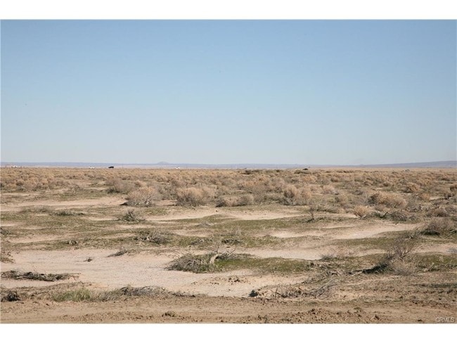

Property Detail
30 Stw Vic Ave E
Los Angeles-Long Beach-Glendale, CA
38.49 MORE OR LESS ACS BEING EX OF ST NW 1/4 OF SW 1/4 OF SEC 8 T 8N R 12W
3115-006-001
LOS ANGELES
Desertorbarrenland
California
LCD22*
8
2024
39.24 AC
2025
Antelope Valley
901214
Los Angeles
NEARBY LISTINGS FOR SALE OR LEASE
DEMOGRAPHICS near 30 Stw Vic Ave E
1 mile
3 mile
5 mile
2025 Total Population
4
562
15,279
2030 Population
4
598
15,736
Pop Growth 2025-2030
0.00%
+ 6.41%
+ 2.99%
Average Age
0
49
37
2025 Total Households
2
258
5,340
HH Growth 2025-2030
0.00%
+ 7.36%
+ 3.05%
Median Household Inc
$0
$44,411
$72,071
Avg Household Size
1.50
2.20
2.80
2025 Avg HH Vehicles
1.00
1.00
2.00
Median Home Value
$99,999
$126,500
$374,688
Median Year Built
1989
1998
1993
Nearby Places
Map Layers
Map Styles
 Street
 Aerial
Layers
 Traffic
 Biking
Places
Listings with unknown addresses are not visible on the map
- Restaurants
- Banks
- Shops
- Fitness
- Groceries
PUBLIC TRANSPORTATION
COMMUTER RAIL
Lancaster (Antelope Valley Line - Southern California Regional Rail Authority (Metrolink))
Drive
Walk
Distance
Lancaster (Antelope Valley Line - Southern California Regional Rail Authority (Metrolink))
16 min
9.7 mi
Freight Ports
Port of Long Beach
Drive
Walk
Distance
Port of Long Beach
120 min
101.1 mi
SALE & LEASE HISTORY
LISTING DATE
SALE/LEASE

Aug 29, 2017
For Sale
Nearby Properties
Address
Land Use
TOTAL SIZE
Lot Size
Zoning
Address
Land Use
TOTAL SIZE
Lot Size
Zoning
11,603 SF
475.12 AC
LCA2
Address
Land Use
TOTAL SIZE
Lot Size
Zoning
58.68 AC
LCD22*
Address
Land Use
TOTAL SIZE
Lot Size
Zoning
57.24 AC
LCD22*
Address
Land Use
TOTAL SIZE
Lot Size
Zoning
81.54 AC
LCD22*
Address
Land Use
TOTAL SIZE
Lot Size
Zoning
32.84 AC
LCD22*
Address
Land Use
TOTAL SIZE
Lot Size
Zoning
2.13 AC
C-2 PD
Address
Land Use
TOTAL SIZE
Lot Size
Zoning
60 SF
29.74 AC
LCA22*
Address
Land Use
TOTAL SIZE
Lot Size
Zoning
39.96 AC
LCD22*
Address
Land Use
TOTAL SIZE
Lot Size
Zoning
59.44 AC
LCA2
Address
Land Use
TOTAL SIZE
Lot Size
Zoning
1 SF
55.38 AC
LCA2
Address
Land Use
TOTAL SIZE
Lot Size
Zoning
79.05 AC
LCD22*
Address
Land Use
TOTAL SIZE
Lot Size
Zoning
38.95 AC
LCD22*
Address
Land Use
TOTAL SIZE
Lot Size
Zoning
154.58 AC
LCD22*
Address
Land Use
TOTAL SIZE
Lot Size
Zoning
76.61 AC
LCD22*
Address
Land Use
TOTAL SIZE
Lot Size
Zoning
377.35 AC
LCD22*
Address
Land Use
TOTAL SIZE
Lot Size
Zoning
19.59 AC
LCD22*
Address
Land Use
TOTAL SIZE
Lot Size
Zoning
40.79 AC
LCD22*
Address
Land Use
TOTAL SIZE
Lot Size
Zoning
39.22 AC
LCD22*
Address
Land Use
TOTAL SIZE
Lot Size
Zoning
818 SF
35.89 AC
LCD22*
Address
Land Use
TOTAL SIZE
Lot Size
Zoning
19.61 AC
LCD22*
Address
Land Use
TOTAL SIZE
Lot Size
Zoning
5.10 AC
LCD22*
Address
Land Use
TOTAL SIZE
Lot Size
Zoning
79.49 AC
LCD22*
Address
Land Use
TOTAL SIZE
Lot Size
Zoning
5.10 AC
LCD22*
Address
Land Use
TOTAL SIZE
Lot Size
Zoning
736 SF
47.27 AC
M-2 PD FPS
Address
Land Use
TOTAL SIZE
Lot Size
Zoning
14.93 AC
LCD22*
Address
Land Use
TOTAL SIZE
Lot Size
Zoning
19.97 AC
LCD22*
Address
Land Use
TOTAL SIZE
Lot Size
Zoning
40.61 AC
LCD22*
The World's #1 Commercial Real Estate Marketplace
Connect with us
© 2026 CoStar Group
The information above has been obtained from sources believed reliable. While we do not doubt its accuracy we have not verified it and make no guarantee, warranty or representation about it. It is your responsibility to independently confirm its accuracy and completeness. Any projections, opinions, assumptions, or estimates used are for example only and do not represent the current or future performance of the property. The value of this transaction to you depends on tax and other factors which should be evaluated by your tax, financial, and legal advisors. You and your advisors should conduct a careful, independent investigation of the property to determine to your satisfaction the suitability of the property for your needs.