Property Record
30 W State St, Eagle, ID 83616
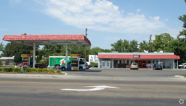


Property Detail
30 W State St
S0508417290
PAR #7290 OF E2SE4 SEC 8 4N 1E #96049492
Commercialnec
Ada
CBD
Idaho
B and X Area of moderate flood hazard, usually the area between the limits of the 100-year and 500-year floods.
0.87 AC
2024
Eagle
2025
Boise City/Nampa
010232
Boise City, ID
2,720 SF
NEARBY LISTINGS FOR SALE OR LEASE
DEMOGRAPHICS near 30 W State St
1 mile
3 mile
5 mile
2025 Total Population
8,567
41,113
136,383
2030 Population
9,092
43,356
143,247
Pop Growth 2025-2030
+ 6.13%
+ 5.46%
+ 5.03%
Average Age
45
44
42
2025 Total Households
3,465
15,449
49,883
HH Growth 2025-2030
+ 6.61%
+ 5.94%
+ 5.47%
Median Household Inc
$92,360
$110,721
$102,545
Avg Household Size
2.40
2.60
2.70
2025 Avg HH Vehicles
2.00
2.00
2.00
Median Home Value
$658,531
$755,797
$624,987
Median Year Built
1999
2002
2003
Nearby Places
Map Layers
Map Styles
 Street
 Aerial
Transit
 Traffic
 Biking
Places
Listings with unknown addresses are not visible on the map
- Restaurants
- Banks
- Shops
- Fitness
- Groceries
PUBLIC TRANSPORTATION
AIRPORT
Boise Air Trml/Gowen Field
Drive
Walk
Distance
Boise Air Trml/Gowen Field
37 min
19.2 mi
Freight Ports
Port of Portland
Drive
Walk
Distance
Port of Portland
472 min
424.5 mi
Nearby Properties
Address
Land Use
TOTAL SIZE
Lot Size
Zoning
Address
Land Use
TOTAL SIZE
Lot Size
Zoning
301,800 SF
12.70 AC
R-3D
Address
Land Use
TOTAL SIZE
Lot Size
Zoning
239,991 SF
8.09 AC
MU-DA
Address
Land Use
TOTAL SIZE
Lot Size
Zoning
98,738 SF
4.25 AC
CBD
Address
Land Use
TOTAL SIZE
Lot Size
Zoning
151,365 SF
12.03 AC
T-1D
Address
Land Use
TOTAL SIZE
Lot Size
Zoning
129,827 SF
3.08 AC
MU-DA
Address
Land Use
TOTAL SIZE
Lot Size
Zoning
152,123 SF
6 AC
MU-DA
Address
Land Use
TOTAL SIZE
Lot Size
Zoning
69,546 SF
4.26 AC
MU-DA
Address
Land Use
TOTAL SIZE
Lot Size
Zoning
65,034 SF
4.44 AC
MU-DA
Address
Land Use
TOTAL SIZE
Lot Size
Zoning
98,612 SF
5.38 AC
MU-DA
Address
Land Use
TOTAL SIZE
Lot Size
Zoning
97,655 SF
7.74 AC
T-1D
Address
Land Use
TOTAL SIZE
Lot Size
Zoning
36,454 SF
3.18 AC
MU
Address
Land Use
TOTAL SIZE
Lot Size
Zoning
81,591 SF
2.88 AC
MU-DA
Address
Land Use
TOTAL SIZE
Lot Size
Zoning
165,295 SF
7.01 AC
MU-DA
Address
Land Use
TOTAL SIZE
Lot Size
Zoning
66,322 SF
3.61 AC
T-1D
Address
Land Use
TOTAL SIZE
Lot Size
Zoning
59,778 SF
3.68 AC
C-3-DA
Address
Land Use
TOTAL SIZE
Lot Size
Zoning
125,400 SF
12.68 AC
C-4D
Address
Land Use
TOTAL SIZE
Lot Size
Zoning
68,707 SF
2.83 AC
C-3-DA
Address
Land Use
TOTAL SIZE
Lot Size
Zoning
74,296 SF
4.86 AC
CBD
Address
Land Use
TOTAL SIZE
Lot Size
Zoning
102,094 SF
7.15 AC
C-2
Address
Land Use
TOTAL SIZE
Lot Size
Zoning
112,281 SF
9.72 AC
C-3
Address
Land Use
TOTAL SIZE
Lot Size
Zoning
104,886 SF
12.51 AC
C-3
Address
Land Use
TOTAL SIZE
Lot Size
Zoning
12.71 AC
C-3
Address
Land Use
TOTAL SIZE
Lot Size
Zoning
34,602 SF
2.61 AC
MU-DA
Address
Land Use
TOTAL SIZE
Lot Size
Zoning
56,809 SF
5.95 AC
C-1-DA
Address
Land Use
TOTAL SIZE
Lot Size
Zoning
93,791 SF
6.41 AC
MU-DA
Address
Land Use
TOTAL SIZE
Lot Size
Zoning
183,445 SF
13.62 AC
BP
Address
Land Use
TOTAL SIZE
Lot Size
Zoning
104,234 SF
8 AC
MU-DA
Address
Land Use
TOTAL SIZE
Lot Size
Zoning
49,508 SF
1.34 AC
MU-DA
Address
Land Use
TOTAL SIZE
Lot Size
Zoning
85,672 SF
3.71 AC
R-1C
Address
Land Use
TOTAL SIZE
Lot Size
Zoning
85,852 SF
10.04 AC
MU
The World's #1 Commercial Real Estate Marketplace
Connect with us
© 2026 CoStar Group
The information above has been obtained from sources believed reliable. While we do not doubt its accuracy we have not verified it and make no guarantee, warranty or representation about it. It is your responsibility to independently confirm its accuracy and completeness. Any projections, opinions, assumptions, or estimates used are for example only and do not represent the current or future performance of the property. The value of this transaction to you depends on tax and other factors which should be evaluated by your tax, financial, and legal advisors. You and your advisors should conduct a careful, independent investigation of the property to determine to your satisfaction the suitability of the property for your needs.