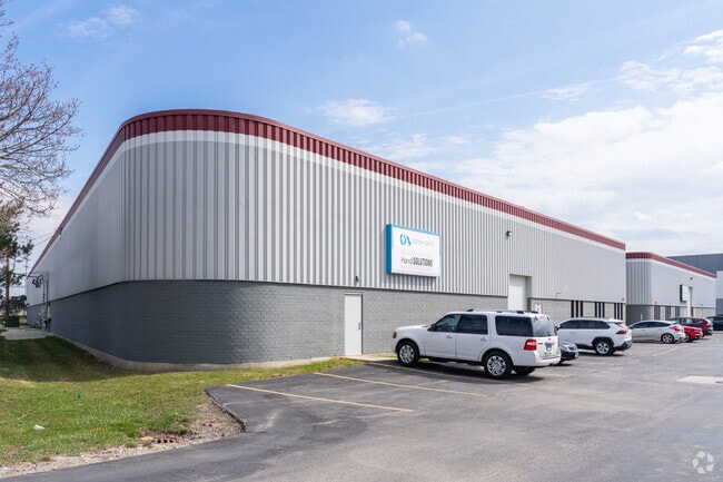
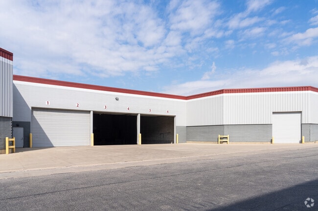
Property Record
300 County Line Rd, Bensenville, IL 60106

Current Lease Availabilities
NEARBY LISTINGS FOR SALE OR LEASE
Property Detail
300 County Line Rd
Chicago-Naperville-Elgin, IL-IN-WI
Amsted Assmt Plat
03-24-201-022
AMSTED ASSMT PLAT E 463 FT /EX HWY DESC 92-143109/ /EX HWY DESC 18-019372/ /EX HWY DESC 2022ED0000
Industrialgeneral
DuPage
X
Illinois
17043C0083J
3.01 AC
2024
O'Hare
2024
Chicago
840801
DEMOGRAPHICS near 300 County Line Rd
1 Mile
3 Mile
5 Mile
2024 Total Population
5,280
69,174
250,283
2029 Population
5,217
67,332
243,664
Pop Growth 2024-2029
(1.19%)
(2.66%)
(2.64%)
Average Age
42
40
40
2024 Total Households
1,956
23,322
88,001
HH Growth 2024-2029
(1.33%)
(2.86%)
(2.86%)
Median Household Inc
$60,854
$72,620
$75,083
Avg Household Size
2.40
2.80
2.80
2024 Avg HH Vehicles
2.00
2.00
2.00
Median Home Value
$259,899
$259,030
$273,248
Median Year Built
1973
1963
1963
Nearby Places
Map Layers
Map Styles
 Street
 Aerial
- Restaurants
- Banks
- Shops
- Fitness
- Groceries
PUBLIC TRANSPORTATION
COMMUTER RAIL
Bensenville Station (Milwaukee District West Line - Northeast Illinois Regional Commuter Railroad (Metra))
DRIVE
WALK
Distance
Bensenville Station (Milwaukee District West Line - Northeast Illinois Regional Commuter Railroad (Metra))
3 min
1.2 mi
Mannheim Station (Milwaukee District West Line - Northeast Illinois Regional Commuter Railroad (Metra))
DRIVE
WALK
Distance
Mannheim Station (Milwaukee District West Line - Northeast Illinois Regional Commuter Railroad (Metra))
6 min
3.1 mi
AIRPORT
Chicago O'Hare International
DRIVE
WALK
Distance
Chicago O'Hare International
14 min
7.5 mi
Chicago Midway International
DRIVE
WALK
Distance
Chicago Midway International
32 min
18.0 mi
Freight Ports
Port Milwaukee
DRIVE
WALK
Distance
Port Milwaukee
98 min
81.0 mi
Nearby Properties
Address
Land Use
TOTAL SIZE
Lot Size
Zoning
Address
Land Use
TOTAL SIZE
Lot Size
Zoning
1,089,750 SF
59.83 AC
I
Address
Land Use
TOTAL SIZE
Lot Size
Zoning
Address
Land Use
TOTAL SIZE
Lot Size
Zoning
820,106 SF
14.78 AC
Address
Land Use
TOTAL SIZE
Lot Size
Zoning
4,100 SF
PD 0
Address
Land Use
TOTAL SIZE
Lot Size
Zoning
17.73 AC
Address
Land Use
TOTAL SIZE
Lot Size
Zoning
969,696 SF
44.30 AC
Address
Land Use
TOTAL SIZE
Lot Size
Zoning
28.36 AC
Address
Land Use
TOTAL SIZE
Lot Size
Zoning
14.35 AC
Address
Land Use
TOTAL SIZE
Lot Size
Zoning
469,492 SF
14.87 AC
I
Address
Land Use
TOTAL SIZE
Lot Size
Zoning
14.37 AC
I
Address
Land Use
TOTAL SIZE
Lot Size
Zoning
4,100 SF
PD 0
Address
Land Use
TOTAL SIZE
Lot Size
Zoning
28,774 SF
4.30 AC
C
Address
Land Use
TOTAL SIZE
Lot Size
Zoning
139,923 SF
11.98 AC
I
Address
Land Use
TOTAL SIZE
Lot Size
Zoning
186,486 SF
2.43 AC
A
Address
Land Use
TOTAL SIZE
Lot Size
Zoning
250,870 SF
19.23 AC
Address
Land Use
TOTAL SIZE
Lot Size
Zoning
79,628 SF
9.31 AC
I
Address
Land Use
TOTAL SIZE
Lot Size
Zoning
588,533 SF
30.52 AC
Address
Land Use
TOTAL SIZE
Lot Size
Zoning
179,220 SF
9.29 AC
I
Address
Land Use
TOTAL SIZE
Lot Size
Zoning
67,564 SF
12.11 AC
I
Address
Land Use
TOTAL SIZE
Lot Size
Zoning
168,240 SF
2.25 AC
C
Address
Land Use
TOTAL SIZE
Lot Size
Zoning
152,928 SF
3.98 AC
A
Address
Land Use
TOTAL SIZE
Lot Size
Zoning
248,880 SF
23.80 AC
C
Address
Land Use
TOTAL SIZE
Lot Size
Zoning
214,652 SF
7.62 AC
I
Address
Land Use
TOTAL SIZE
Lot Size
Zoning
134,590 SF
9.92 AC
I
Address
Land Use
TOTAL SIZE
Lot Size
Zoning
2.79 AC
R-3
Address
Land Use
TOTAL SIZE
Lot Size
Zoning
138,060 SF
4 AC
A
Address
Land Use
TOTAL SIZE
Lot Size
Zoning
300,960 SF
11.90 AC
I
Address
Land Use
TOTAL SIZE
Lot Size
Zoning
10.94 AC
Address
Land Use
TOTAL SIZE
Lot Size
Zoning
121,107 SF
3.19 AC
I
Address
Land Use
TOTAL SIZE
Lot Size
Zoning
367,389 SF
17.64 AC
The World's #1 Commercial Real Estate Marketplace
Connect with us
© 2025 CoStar Group
The information above has been obtained from sources believed reliable. While we do not doubt its accuracy we have not verified it and make no guarantee, warranty or representation about it. It is your responsibility to independently confirm its accuracy and completeness. Any projections, opinions, assumptions, or estimates used are for example only and do not represent the current or future performance of the property. The value of this transaction to you depends on tax and other factors which should be evaluated by your tax, financial, and legal advisors. You and your advisors should conduct a careful, independent investigation of the property to determine to your satisfaction the suitability of the property for your needs.