Property Record
300 74Th St S, Saint Cloud, MN 56301


Property Detail
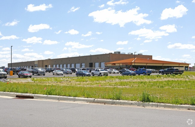
300 74Th St S
82.50617.0249
LOT 002 BLK 001 ST CLOUD I-94 BUSINESS PARK 12 SECTION 20 TOWNSHIP 123 RANGE 027 SECTION 20 TOWNSHIP 123 RANGE 027
Industrialgeneral
Stearns
I3
Minnesota
B and X Area of moderate flood hazard, usually the area between the limits of the 100-year and 500-year floods.
2
2026
50.85 AC
2025
Stearns County
011400
Minneapolis/St Paul
85,251 SF
St. Cloud, MN
NEARBY LISTINGS FOR SALE OR LEASE
-
-
View all Saint Cloud listings for sale on LoopNet.com
DEMOGRAPHICS near 300 74Th St S
1 mile
3 mile
5 mile
2025 Total Population
146
3,627
12,109
2030 Population
152
3,778
12,667
Pop Growth 2025-2030
+ 4.11%
+ 4.16%
+ 4.61%
Average Age
42
41
40
2025 Total Households
59
1,420
4,818
HH Growth 2025-2030
+ 3.39%
+ 4.15%
+ 4.61%
Median Household Inc
$93,749
$96,200
$90,427
Avg Household Size
2.40
2.50
2.50
2025 Avg HH Vehicles
3.00
2.00
2.00
Median Home Value
$376,922
$395,539
$340,811
Median Year Built
1992
1992
1995
Nearby Places
Map Layers
Map Styles
 Street
 Aerial
Layers
 Traffic
 Biking
Places
Listings with unknown addresses are not visible on the map
- Restaurants
- Banks
- Shops
- Fitness
- Groceries
PUBLIC TRANSPORTATION
COMMUTER RAIL
St. Cloud Amtrak Station (Empire Builder - Amtrak)
Drive
Walk
Distance
St. Cloud Amtrak Station (Empire Builder - Amtrak)
18 min
9.6 mi
Freight Ports
Port Milwaukee
Drive
Walk
Distance
Port Milwaukee
440 min
398.4 mi
Nearby Properties
Address
Land Use
TOTAL SIZE
Lot Size
Zoning
Address
Land Use
TOTAL SIZE
Lot Size
Zoning
278,850 SF
20.83 AC
Address
Land Use
TOTAL SIZE
Lot Size
Zoning
41.05 AC
Address
Land Use
TOTAL SIZE
Lot Size
Zoning
357,302 SF
59.30 AC
I3
Address
Land Use
TOTAL SIZE
Lot Size
Zoning
101,460 SF
54.63 AC
I3
Address
Land Use
TOTAL SIZE
Lot Size
Zoning
314,315 SF
49.58 AC
I3
Address
Land Use
TOTAL SIZE
Lot Size
Zoning
75,620 SF
16.80 AC
I3
Address
Land Use
TOTAL SIZE
Lot Size
Zoning
79,223 SF
15.58 AC
C5
Address
Land Use
TOTAL SIZE
Lot Size
Zoning
15.35 AC
Address
Land Use
TOTAL SIZE
Lot Size
Zoning
55,641 SF
18.77 AC
Address
Land Use
TOTAL SIZE
Lot Size
Zoning
Address
Land Use
TOTAL SIZE
Lot Size
Zoning
Address
Land Use
TOTAL SIZE
Lot Size
Zoning
26,561 SF
20 AC
Address
Land Use
TOTAL SIZE
Lot Size
Zoning
77,376 SF
15 AC
I3
Address
Land Use
TOTAL SIZE
Lot Size
Zoning
59.66 AC
Address
Land Use
TOTAL SIZE
Lot Size
Zoning
18,310 SF
25.85 AC
Address
Land Use
TOTAL SIZE
Lot Size
Zoning
77,219 SF
10.83 AC
I3
Address
Land Use
TOTAL SIZE
Lot Size
Zoning
76,800 SF
7.06 AC
I3
Address
Land Use
TOTAL SIZE
Lot Size
Zoning
12.15 AC
Address
Land Use
TOTAL SIZE
Lot Size
Zoning
29,773 SF
5.89 AC
Address
Land Use
TOTAL SIZE
Lot Size
Zoning
19.92 AC
Address
Land Use
TOTAL SIZE
Lot Size
Zoning
50,888 SF
8.38 AC
I3
Address
Land Use
TOTAL SIZE
Lot Size
Zoning
25,957 SF
9.74 AC
Address
Land Use
TOTAL SIZE
Lot Size
Zoning
Address
Land Use
TOTAL SIZE
Lot Size
Zoning
6,276 SF
2 AC
Address
Land Use
TOTAL SIZE
Lot Size
Zoning
33,328 SF
1 AC
Address
Land Use
TOTAL SIZE
Lot Size
Zoning
29,590 SF
4.60 AC
I1
Address
Land Use
TOTAL SIZE
Lot Size
Zoning
90.73 AC
RPMKT
Address
Land Use
TOTAL SIZE
Lot Size
Zoning
23,000 SF
1.46 AC
I1
The World's #1 Commercial Real Estate Marketplace
Connect with us
© 2026 CoStar Group
The information above has been obtained from sources believed reliable. While we do not doubt its accuracy we have not verified it and make no guarantee, warranty or representation about it. It is your responsibility to independently confirm its accuracy and completeness. Any projections, opinions, assumptions, or estimates used are for example only and do not represent the current or future performance of the property. The value of this transaction to you depends on tax and other factors which should be evaluated by your tax, financial, and legal advisors. You and your advisors should conduct a careful, independent investigation of the property to determine to your satisfaction the suitability of the property for your needs.