Property Record
300 Chestnut St, Franklin, OH 45005
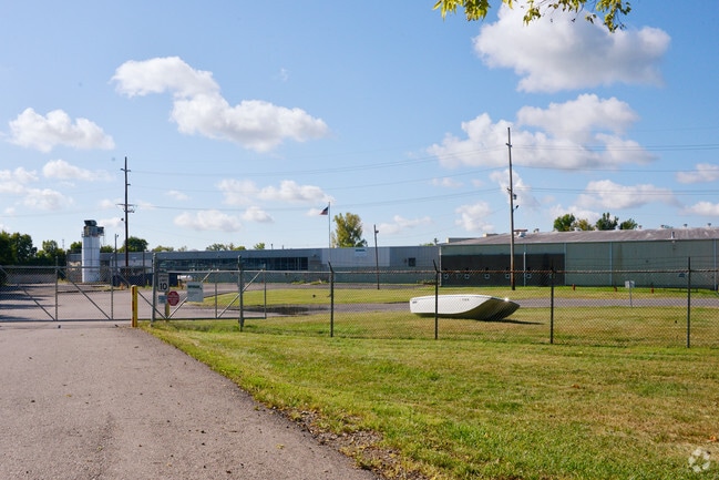


Property Detail
300 Chestnut St
Cincinnati, OH-KY-IN
CHESTNUT
02-04-257-003
Warren
Lightindustrial
Ohio
AE The base floodplain where base flood elevations are provided. AE Zones are now used on new format FIRMs instead of A1-A30 Zones.
14.05 AC
2024
Monroe/Middletown
2025
Cincinnati/Dayton
030200
NEARBY LISTINGS FOR SALE OR LEASE
DEMOGRAPHICS near 300 Chestnut St
1 mile
3 mile
5 mile
2025 Total Population
5,004
29,032
77,312
2030 Population
5,228
30,266
79,738
Pop Growth 2025-2030
+ 4.48%
+ 4.25%
+ 3.14%
Average Age
40
42
42
2025 Total Households
2,148
11,641
30,972
HH Growth 2025-2030
+ 4.42%
+ 4.30%
+ 3.18%
Median Household Inc
$44,131
$67,732
$73,476
Avg Household Size
2.30
2.50
2.40
2025 Avg HH Vehicles
2.00
2.00
2.00
Median Home Value
$157,049
$209,419
$227,338
Median Year Built
1958
1971
1971
Nearby Places
Map Layers
Map Styles
 Street
 Aerial
Layers
 Traffic
 Biking
Places
Listings with unknown addresses are not visible on the map
- Restaurants
- Banks
- Shops
- Fitness
- Groceries
PUBLIC TRANSPORTATION
AIRPORT
James M Cox Dayton International
Drive
Walk
Distance
James M Cox Dayton International
44 min
30.4 mi
SALE & LEASE HISTORY
LISTING DATE
SALE/LEASE

Sep 28, 2016
For Sale
Sep 24, 2016
For Sale
Nearby Properties
Address
Land Use
TOTAL SIZE
Lot Size
Zoning
Address
Land Use
TOTAL SIZE
Lot Size
Zoning
33,671 SF
8.49 AC
Address
Land Use
TOTAL SIZE
Lot Size
Zoning
36,570 SF
20.29 AC
Address
Land Use
TOTAL SIZE
Lot Size
Zoning
15,228 SF
37.19 AC
R1
Address
Land Use
TOTAL SIZE
Lot Size
Zoning
17.47 AC
Address
Land Use
TOTAL SIZE
Lot Size
Zoning
11,847 SF
5.96 AC
Address
Land Use
TOTAL SIZE
Lot Size
Zoning
32,550 SF
26.11 AC
Address
Land Use
TOTAL SIZE
Lot Size
Zoning
217,679 SF
25.16 AC
Address
Land Use
TOTAL SIZE
Lot Size
Zoning
868 SF
36.06 AC
Address
Land Use
TOTAL SIZE
Lot Size
Zoning
13.19 AC
Address
Land Use
TOTAL SIZE
Lot Size
Zoning
12,480 SF
14.98 AC
Address
Land Use
TOTAL SIZE
Lot Size
Zoning
147,116 SF
12.07 AC
Address
Land Use
TOTAL SIZE
Lot Size
Zoning
19,622 SF
2.94 AC
Address
Land Use
TOTAL SIZE
Lot Size
Zoning
37.26 AC
Address
Land Use
TOTAL SIZE
Lot Size
Zoning
29,500 SF
10 AC
Address
Land Use
TOTAL SIZE
Lot Size
Zoning
28,038 SF
11.69 AC
Address
Land Use
TOTAL SIZE
Lot Size
Zoning
51,048 SF
48.12 AC
Address
Land Use
TOTAL SIZE
Lot Size
Zoning
11,764 SF
5.05 AC
Address
Land Use
TOTAL SIZE
Lot Size
Zoning
90,816 SF
10 AC
Address
Land Use
TOTAL SIZE
Lot Size
Zoning
158,792 SF
17.30 AC
Address
Land Use
TOTAL SIZE
Lot Size
Zoning
68,392 SF
6.61 AC
Address
Land Use
TOTAL SIZE
Lot Size
Zoning
50,389 SF
5.84 AC
Address
Land Use
TOTAL SIZE
Lot Size
Zoning
90,000 SF
17.11 AC
R1
Address
Land Use
TOTAL SIZE
Lot Size
Zoning
115,000 SF
18.19 AC
Address
Land Use
TOTAL SIZE
Lot Size
Zoning
157,387 SF
15.31 AC
Address
Land Use
TOTAL SIZE
Lot Size
Zoning
12,429 SF
2.19 AC
Address
Land Use
TOTAL SIZE
Lot Size
Zoning
161,525 SF
7.84 AC
Address
Land Use
TOTAL SIZE
Lot Size
Zoning
170,753 SF
12.10 AC
Address
Land Use
TOTAL SIZE
Lot Size
Zoning
38,880 SF
4.09 AC
Address
Land Use
TOTAL SIZE
Lot Size
Zoning
45,404 SF
8.61 AC
Address
Land Use
TOTAL SIZE
Lot Size
Zoning
20,006 SF
9.48 AC
The World's #1 Commercial Real Estate Marketplace
Connect with us
© 2026 CoStar Group
The information above has been obtained from sources believed reliable. While we do not doubt its accuracy we have not verified it and make no guarantee, warranty or representation about it. It is your responsibility to independently confirm its accuracy and completeness. Any projections, opinions, assumptions, or estimates used are for example only and do not represent the current or future performance of the property. The value of this transaction to you depends on tax and other factors which should be evaluated by your tax, financial, and legal advisors. You and your advisors should conduct a careful, independent investigation of the property to determine to your satisfaction the suitability of the property for your needs.