Property Record
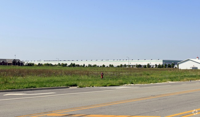
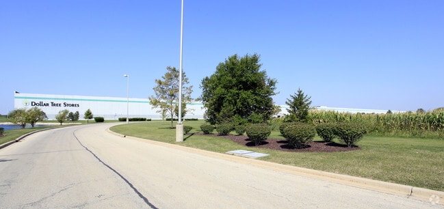
300 Dollar Tree Ln, Joliet, IL 60436

Property Detail
300 Dollar Tree Ln
Chicago-Naperville-Elgin, IL-IN
THE W1/2 OF THE NE1/4 OF SEC. 33, T35N-R10E, (EX THRFRM THE N'LY 474.19 FT) THAT PRT OF THE E1/2 OF THE NW1/4 OF SD SEC. 33,
30-07-33-200-023
WILL
Industrialgeneral
Illinois
B and X Area of moderate flood hazard, usually the area between the limits of the 100-year and 500-year floods.
81.93 AC
2025
Joliet Area
2024
Chicago
883100
NEARBY LISTINGS FOR SALE OR LEASE
DEMOGRAPHICS near 300 Dollar Tree Ln
1 mile
3 mile
5 mile
2025 Total Population
282
15,549
90,729
2030 Population
294
15,929
92,261
Pop Growth 2025-2030
+ 4.26%
+ 2.44%
+ 1.69%
Average Age
39
39
38
2025 Total Households
102
5,637
32,134
HH Growth 2025-2030
+ 4.90%
+ 2.50%
+ 1.68%
Median Household Inc
$68,124
$63,891
$67,020
Avg Household Size
2.70
2.60
2.70
2025 Avg HH Vehicles
2.00
2.00
2.00
Median Home Value
$147,500
$177,607
$206,006
Median Year Built
1969
1957
1958
Nearby Places
Map Layers
Map Styles
 Street
 Aerial
Layers
 Traffic
 Biking
Places
Listings with unknown addresses are not visible on the map
- Restaurants
- Banks
- Shops
- Fitness
- Groceries
PUBLIC TRANSPORTATION
COMMUTER RAIL
Joliet Station (Heritage Corridor Line - Northeast Illinois Regional Commuter Railroad (Metra), Rock Island District Line - Northeast Illinois Regional Commuter Railroad (Metra))
Drive
Walk
Distance
Joliet Station (Heritage Corridor Line - Northeast Illinois Regional Commuter Railroad (Metra), Rock Island District Line - Northeast Illinois Regional Commuter Railroad (Metra))
9 min
4.1 mi
Manhattan Station (SouthWest Service - Northeast Illinois Regional Commuter Railroad (Metra))
Drive
Walk
Distance
Manhattan Station (SouthWest Service - Northeast Illinois Regional Commuter Railroad (Metra))
15 min
8.7 mi
AIRPORT
Chicago Midway International
Drive
Walk
Distance
Chicago Midway International
54 min
39.8 mi
Freight Ports
Port Milwaukee
Drive
Walk
Distance
Port Milwaukee
152 min
123.0 mi
Nearby Properties
Address
Land Use
TOTAL SIZE
Lot Size
Zoning
Address
Land Use
TOTAL SIZE
Lot Size
Zoning
88.74 AC
Address
Land Use
TOTAL SIZE
Lot Size
Zoning
67.82 AC
Address
Land Use
TOTAL SIZE
Lot Size
Zoning
59.92 AC
Address
Land Use
TOTAL SIZE
Lot Size
Zoning
128.88 AC
Address
Land Use
TOTAL SIZE
Lot Size
Zoning
40.74 AC
Address
Land Use
TOTAL SIZE
Lot Size
Zoning
64.27 AC
Address
Land Use
TOTAL SIZE
Lot Size
Zoning
41.70 AC
Address
Land Use
TOTAL SIZE
Lot Size
Zoning
51.81 AC
Address
Land Use
TOTAL SIZE
Lot Size
Zoning
49.35 AC
Address
Land Use
TOTAL SIZE
Lot Size
Zoning
37.57 AC
Address
Land Use
TOTAL SIZE
Lot Size
Zoning
44.25 AC
Address
Land Use
TOTAL SIZE
Lot Size
Zoning
52.66 AC
Address
Land Use
TOTAL SIZE
Lot Size
Zoning
24.66 AC
Address
Land Use
TOTAL SIZE
Lot Size
Zoning
22.24 AC
Address
Land Use
TOTAL SIZE
Lot Size
Zoning
34.48 AC
Address
Land Use
TOTAL SIZE
Lot Size
Zoning
Address
Land Use
TOTAL SIZE
Lot Size
Zoning
36.54 AC
Address
Land Use
TOTAL SIZE
Lot Size
Zoning
16.02 AC
Address
Land Use
TOTAL SIZE
Lot Size
Zoning
18.88 AC
Address
Land Use
TOTAL SIZE
Lot Size
Zoning
30.14 AC
Address
Land Use
TOTAL SIZE
Lot Size
Zoning
16.04 AC
Address
Land Use
TOTAL SIZE
Lot Size
Zoning
5.12 AC
Address
Land Use
TOTAL SIZE
Lot Size
Zoning
26.83 AC
Address
Land Use
TOTAL SIZE
Lot Size
Zoning
44.81 AC
Address
Land Use
TOTAL SIZE
Lot Size
Zoning
10.73 AC
Address
Land Use
TOTAL SIZE
Lot Size
Zoning
20.74 AC
Address
Land Use
TOTAL SIZE
Lot Size
Zoning
30.77 AC
Address
Land Use
TOTAL SIZE
Lot Size
Zoning
47.34 AC
Address
Land Use
TOTAL SIZE
Lot Size
Zoning
60.70 AC
The World's #1 Commercial Real Estate Marketplace
Connect with us
© 2026 CoStar Group
The information above has been obtained from sources believed reliable. While we do not doubt its accuracy we have not verified it and make no guarantee, warranty or representation about it. It is your responsibility to independently confirm its accuracy and completeness. Any projections, opinions, assumptions, or estimates used are for example only and do not represent the current or future performance of the property. The value of this transaction to you depends on tax and other factors which should be evaluated by your tax, financial, and legal advisors. You and your advisors should conduct a careful, independent investigation of the property to determine to your satisfaction the suitability of the property for your needs.