Property Record
300 E 20Th St, Alton, IL 62002
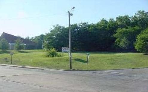

This Property Is For Sale
Property Detail
300 E 20Th St
St. Louis, MO-IL
N1/2 SE PT NE NE LESS TR DEEDED TO CITY
23-1-07-11-08-202-002
MADISON
Residentialacreage
Illinois
2024
1.32 AC
2024
Illinois
402000
St. Louis
NEARBY LISTINGS FOR SALE OR LEASE
DEMOGRAPHICS near 300 E 20Th St
1 mile
3 mile
5 mile
2025 Total Population
7,640
33,230
50,524
2030 Population
7,704
33,172
50,460
Pop Growth 2025-2030
+ 0.84%
(0.17%)
(0.13%)
Average Age
40
43
43
2025 Total Households
3,286
14,719
21,846
HH Growth 2025-2030
+ 0.82%
(0.24%)
(0.18%)
Median Household Inc
$48,065
$58,826
$60,098
Avg Household Size
2.20
2.20
2.20
2025 Avg HH Vehicles
1.00
2.00
2.00
Median Home Value
$101,097
$133,568
$140,211
Median Year Built
1950
1956
1959
Nearby Places
Map Layers
Map Styles
 Street
 Aerial
Transit
 Traffic
 Biking
Places
Listings with unknown addresses are not visible on the map
- Restaurants
- Banks
- Shops
- Fitness
- Groceries
PUBLIC TRANSPORTATION
COMMUTER RAIL
Drive
Walk
Distance
5 min
2.3 mi
AIRPORT
St Louis Lambert International
Drive
Walk
Distance
St Louis Lambert International
30 min
20.4 mi
Scott AFB/Midamerica St Louis
Drive
Walk
Distance
Scott AFB/Midamerica St Louis
64 min
45.0 mi
Nearby Properties
Address
Land Use
TOTAL SIZE
Lot Size
Zoning
Address
Land Use
TOTAL SIZE
Lot Size
Zoning
16.14 AC
Address
Land Use
TOTAL SIZE
Lot Size
Zoning
117,520 SF
2.29 AC
Address
Land Use
TOTAL SIZE
Lot Size
Zoning
132,494 SF
18.48 AC
Address
Land Use
TOTAL SIZE
Lot Size
Zoning
Address
Land Use
TOTAL SIZE
Lot Size
Zoning
Address
Land Use
TOTAL SIZE
Lot Size
Zoning
26.24 AC
Address
Land Use
TOTAL SIZE
Lot Size
Zoning
45,834 SF
7.10 AC
Address
Land Use
TOTAL SIZE
Lot Size
Zoning
114,461 SF
9.13 AC
Address
Land Use
TOTAL SIZE
Lot Size
Zoning
87,624 SF
4.28 AC
Address
Land Use
TOTAL SIZE
Lot Size
Zoning
57,492 SF
6.54 AC
Address
Land Use
TOTAL SIZE
Lot Size
Zoning
435.80 AC
AA9
Address
Land Use
TOTAL SIZE
Lot Size
Zoning
6,146 SF
9 AC
Address
Land Use
TOTAL SIZE
Lot Size
Zoning
1.90 AC
Address
Land Use
TOTAL SIZE
Lot Size
Zoning
64,260 SF
3.90 AC
Address
Land Use
TOTAL SIZE
Lot Size
Zoning
58,218 SF
2.82 AC
Address
Land Use
TOTAL SIZE
Lot Size
Zoning
56,684 SF
2.19 AC
Address
Land Use
TOTAL SIZE
Lot Size
Zoning
1.90 AC
Address
Land Use
TOTAL SIZE
Lot Size
Zoning
320.80 AC
AA1
Address
Land Use
TOTAL SIZE
Lot Size
Zoning
28,193 SF
4.23 AC
Address
Land Use
TOTAL SIZE
Lot Size
Zoning
Address
Land Use
TOTAL SIZE
Lot Size
Zoning
155,147 SF
14.37 AC
Address
Land Use
TOTAL SIZE
Lot Size
Zoning
105,137 SF
2.60 AC
Address
Land Use
TOTAL SIZE
Lot Size
Zoning
76,022 SF
4.69 AC
Address
Land Use
TOTAL SIZE
Lot Size
Zoning
100,645 SF
8.32 AC
Address
Land Use
TOTAL SIZE
Lot Size
Zoning
38,748 SF
2.32 AC
Address
Land Use
TOTAL SIZE
Lot Size
Zoning
235.26 AC
AA9
Address
Land Use
TOTAL SIZE
Lot Size
Zoning
68,870 SF
9.49 AC
Address
Land Use
TOTAL SIZE
Lot Size
Zoning
51,752 SF
1.53 AC
Address
Land Use
TOTAL SIZE
Lot Size
Zoning
20,684 SF
1.32 AC
Address
Land Use
TOTAL SIZE
Lot Size
Zoning
The World's #1 Commercial Real Estate Marketplace
Connect with us
© 2026 CoStar Group
The information above has been obtained from sources believed reliable. While we do not doubt its accuracy we have not verified it and make no guarantee, warranty or representation about it. It is your responsibility to independently confirm its accuracy and completeness. Any projections, opinions, assumptions, or estimates used are for example only and do not represent the current or future performance of the property. The value of this transaction to you depends on tax and other factors which should be evaluated by your tax, financial, and legal advisors. You and your advisors should conduct a careful, independent investigation of the property to determine to your satisfaction the suitability of the property for your needs.