Property Record
300 Emerson Rd, High Ridge, MO 63049


NEARBY LISTINGS FOR SALE OR LEASE
-
-
View all High Ridge listings for lease on LoopNet.com
Property Detail
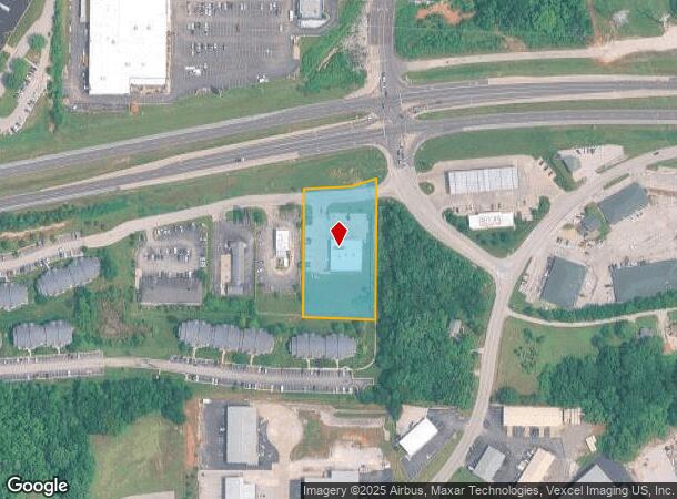
300 Emerson Rd
St. Louis, MO-IL
Walden Pond Commercial
02-3.0-07.0-2-001-005.04
WALDEN POND COMMERCIAL LOT 1
Storebuilding
Jefferson
X
Missouri
29099C0082F
1
2024
1.69 AC
2025
Jefferson County
700211
St. Louis
7,396 SF
DEMOGRAPHICS near 300 Emerson Rd
1 Mile
3 Mile
5 Mile
2024 Total Population
4,954
37,803
76,545
2029 Population
5,104
38,123
77,379
Pop Growth 2024-2029
+ 3.03%
+ 0.85%
+ 1.09%
Average Age
41
41
41
2024 Total Households
1,979
14,555
29,914
HH Growth 2024-2029
+ 3.08%
+ 1.02%
+ 1.16%
Median Household Inc
$69,838
$81,645
$80,835
Avg Household Size
2.50
2.50
2.50
2024 Avg HH Vehicles
2.00
2.00
2.00
Median Home Value
$197,406
$243,532
$241,450
Median Year Built
1986
1983
1985
Nearby Places
Map Layers
Map Styles
 Street
 Aerial
- Restaurants
- Banks
- Shops
- Fitness
- Groceries
PUBLIC TRANSPORTATION
AIRPORT
St Louis Lambert International
DRIVE
WALK
Distance
St Louis Lambert International
38 min
31.4 mi
Freight Ports
Port of Shreveport
DRIVE
WALK
Distance
Port of Shreveport
1 min
458.4 mi
SALE & LEASE HISTORY
LISTING DATE
SALE/LEASE

Sep 24, 2016
For Sale
Jul 05, 2017
For Lease
Feb 24, 2017
For Sale
Nearby Properties
Address
Land Use
TOTAL SIZE
Lot Size
Zoning
Address
Land Use
TOTAL SIZE
Lot Size
Zoning
28,790 SF
1,196.80 AC
NU
Address
Land Use
TOTAL SIZE
Lot Size
Zoning
62.50 AC
NU
Address
Land Use
TOTAL SIZE
Lot Size
Zoning
258,312 SF
16.34 AC
CC2
Address
Land Use
TOTAL SIZE
Lot Size
Zoning
26.56 AC
NU
Address
Land Use
TOTAL SIZE
Lot Size
Zoning
211,612 SF
41.36 AC
PB
Address
Land Use
TOTAL SIZE
Lot Size
Zoning
155,242 SF
22.76 AC
R09
Address
Land Use
TOTAL SIZE
Lot Size
Zoning
108,535 SF
14.09 AC
PUD
Address
Land Use
TOTAL SIZE
Lot Size
Zoning
85,150 SF
8.62 AC
21R-6A
Address
Land Use
TOTAL SIZE
Lot Size
Zoning
7.41 AC
R3
Address
Land Use
TOTAL SIZE
Lot Size
Zoning
88,379 SF
8.97 AC
C-8
Address
Land Use
TOTAL SIZE
Lot Size
Zoning
9.03 AC
R3
Address
Land Use
TOTAL SIZE
Lot Size
Zoning
5.98 AC
21IP-1
Address
Land Use
TOTAL SIZE
Lot Size
Zoning
30,189 SF
7.80 AC
CC2
Address
Land Use
TOTAL SIZE
Lot Size
Zoning
58,131 SF
6.37 AC
21R-6A
Address
Land Use
TOTAL SIZE
Lot Size
Zoning
1,910 SF
5.19 AC
R40
Address
Land Use
TOTAL SIZE
Lot Size
Zoning
132,848 SF
11.43 AC
PB
Address
Land Use
TOTAL SIZE
Lot Size
Zoning
273,663 SF
18.81 AC
R09
Address
Land Use
TOTAL SIZE
Lot Size
Zoning
84,744 SF
6.42 AC
R6A
Address
Land Use
TOTAL SIZE
Lot Size
Zoning
61,540 SF
5.19 AC
R6A
Address
Land Use
TOTAL SIZE
Lot Size
Zoning
65,940 SF
5.85 AC
CC2
Address
Land Use
TOTAL SIZE
Lot Size
Zoning
76,636 SF
8.41 AC
CC2
Address
Land Use
TOTAL SIZE
Lot Size
Zoning
31,193 SF
4.52 AC
CC2
Address
Land Use
TOTAL SIZE
Lot Size
Zoning
57,518 SF
4.88 AC
R09
Address
Land Use
TOTAL SIZE
Lot Size
Zoning
22,768 SF
2.91 AC
Address
Land Use
TOTAL SIZE
Lot Size
Zoning
75,099 SF
2.74 AC
CC2
Address
Land Use
TOTAL SIZE
Lot Size
Zoning
93,250 SF
2.63 AC
PUD
Address
Land Use
TOTAL SIZE
Lot Size
Zoning
1,726 SF
3.97 AC
R3
Address
Land Use
TOTAL SIZE
Lot Size
Zoning
14,612 SF
2.19 AC
CC2
Address
Land Use
TOTAL SIZE
Lot Size
Zoning
4,280 SF
1.70 AC
R-2
Address
Land Use
TOTAL SIZE
Lot Size
Zoning
3.20 AC
R2
The World's #1 Commercial Real Estate Marketplace
Connect with us
© 2025 CoStar Group
The information above has been obtained from sources believed reliable. While we do not doubt its accuracy we have not verified it and make no guarantee, warranty or representation about it. It is your responsibility to independently confirm its accuracy and completeness. Any projections, opinions, assumptions, or estimates used are for example only and do not represent the current or future performance of the property. The value of this transaction to you depends on tax and other factors which should be evaluated by your tax, financial, and legal advisors. You and your advisors should conduct a careful, independent investigation of the property to determine to your satisfaction the suitability of the property for your needs.