Property Record
300 Hilary Way, Vallejo, CA 94591
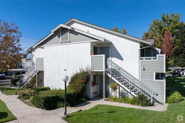

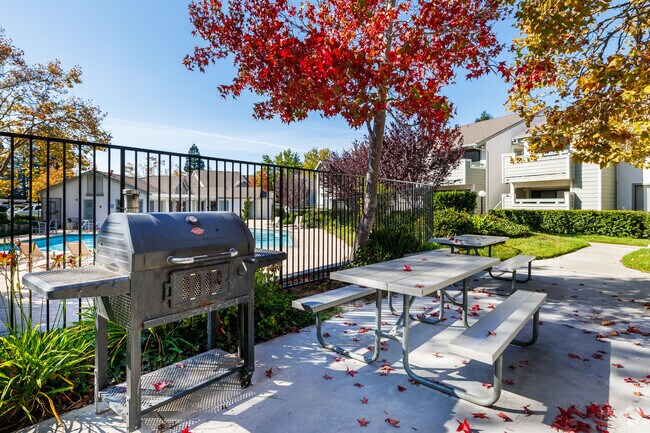
Property Detail
300 Hilary Way
0082-030-220
BK-BG 00-00
Multifamilydwelling
Solano
B and X Area of moderate flood hazard, usually the area between the limits of the 100-year and 500-year floods.
California
2024
9.54 AC
2025
East Vallejo
252103
North Bay/Santa Rosa
140,712 SF
Vallejo, CA
NEARBY LISTINGS FOR SALE OR LEASE
DEMOGRAPHICS near 300 Hilary Way
1 mile
3 mile
5 mile
2025 Total Population
13,041
94,088
168,359
2030 Population
13,078
94,699
169,184
Pop Growth 2025-2030
+ 0.28%
+ 0.65%
+ 0.49%
Average Age
42
42
42
2025 Total Households
4,693
33,130
59,419
HH Growth 2025-2030
+ 0.45%
+ 0.73%
+ 0.60%
Median Household Inc
$88,560
$98,371
$97,442
Avg Household Size
2.70
2.80
2.70
2025 Avg HH Vehicles
2.00
2.00
2.00
Median Home Value
$710,753
$691,862
$684,793
Median Year Built
1980
1974
1975
Nearby Places
Map Layers
Map Styles
 Street
 Aerial
Layers
 Traffic
 Biking
Places
Listings with unknown addresses are not visible on the map
- Restaurants
- Banks
- Shops
- Fitness
- Groceries
PUBLIC TRANSPORTATION
AIRPORT
Metro Oakland International
Drive
Walk
Distance
Metro Oakland International
49 min
37.0 mi
Freight Ports
Port of Richmond
Drive
Walk
Distance
Port of Richmond
33 min
22.7 mi
Nearby Properties
Address
Land Use
TOTAL SIZE
Lot Size
Zoning
Address
Land Use
TOTAL SIZE
Lot Size
Zoning
432,550 SF
29.70 AC
Address
Land Use
TOTAL SIZE
Lot Size
Zoning
108.37 AC
Address
Land Use
TOTAL SIZE
Lot Size
Zoning
92,043 SF
8.99 AC
Address
Land Use
TOTAL SIZE
Lot Size
Zoning
Address
Land Use
TOTAL SIZE
Lot Size
Zoning
266,792 SF
26.29 AC
Address
Land Use
TOTAL SIZE
Lot Size
Zoning
17.66 AC
Address
Land Use
TOTAL SIZE
Lot Size
Zoning
80,512 SF
6.88 AC
Address
Land Use
TOTAL SIZE
Lot Size
Zoning
4.23 AC
COMM
Address
Land Use
TOTAL SIZE
Lot Size
Zoning
175,831 SF
8.63 AC
Address
Land Use
TOTAL SIZE
Lot Size
Zoning
200,888 SF
19.11 AC
MR25
Address
Land Use
TOTAL SIZE
Lot Size
Zoning
151,720 SF
8 AC
HDR
Address
Land Use
TOTAL SIZE
Lot Size
Zoning
121,070 SF
11.12 AC
Address
Land Use
TOTAL SIZE
Lot Size
Zoning
27,653 SF
3.85 AC
Address
Land Use
TOTAL SIZE
Lot Size
Zoning
73,819 SF
5.64 AC
Address
Land Use
TOTAL SIZE
Lot Size
Zoning
178,265 SF
10.87 AC
Address
Land Use
TOTAL SIZE
Lot Size
Zoning
266,792 SF
3.32 AC
Address
Land Use
TOTAL SIZE
Lot Size
Zoning
125,720 SF
11.72 AC
Address
Land Use
TOTAL SIZE
Lot Size
Zoning
55,537 SF
7.84 AC
COMMERCIAL
Address
Land Use
TOTAL SIZE
Lot Size
Zoning
86,116 SF
4.64 AC
Address
Land Use
TOTAL SIZE
Lot Size
Zoning
82,058 SF
6.45 AC
Address
Land Use
TOTAL SIZE
Lot Size
Zoning
113,152 SF
9.71 AC
Address
Land Use
TOTAL SIZE
Lot Size
Zoning
69,011 SF
3.67 AC
PUBLIC-PF
Address
Land Use
TOTAL SIZE
Lot Size
Zoning
124,000 SF
8.21 AC
Address
Land Use
TOTAL SIZE
Lot Size
Zoning
97,377 SF
6.75 AC
Address
Land Use
TOTAL SIZE
Lot Size
Zoning
65,856 SF
3.49 AC
Address
Land Use
TOTAL SIZE
Lot Size
Zoning
307,400 SF
5.52 AC
Address
Land Use
TOTAL SIZE
Lot Size
Zoning
29,773 SF
9.29 AC
Address
Land Use
TOTAL SIZE
Lot Size
Zoning
49,896 SF
4.40 AC
Address
Land Use
TOTAL SIZE
Lot Size
Zoning
52,350 SF
3.88 AC
The World's #1 Commercial Real Estate Marketplace
Connect with us
© 2026 CoStar Group
The information above has been obtained from sources believed reliable. While we do not doubt its accuracy we have not verified it and make no guarantee, warranty or representation about it. It is your responsibility to independently confirm its accuracy and completeness. Any projections, opinions, assumptions, or estimates used are for example only and do not represent the current or future performance of the property. The value of this transaction to you depends on tax and other factors which should be evaluated by your tax, financial, and legal advisors. You and your advisors should conduct a careful, independent investigation of the property to determine to your satisfaction the suitability of the property for your needs.