Property Record
300 Kitty Hawk Rd, Universal City, TX 78148
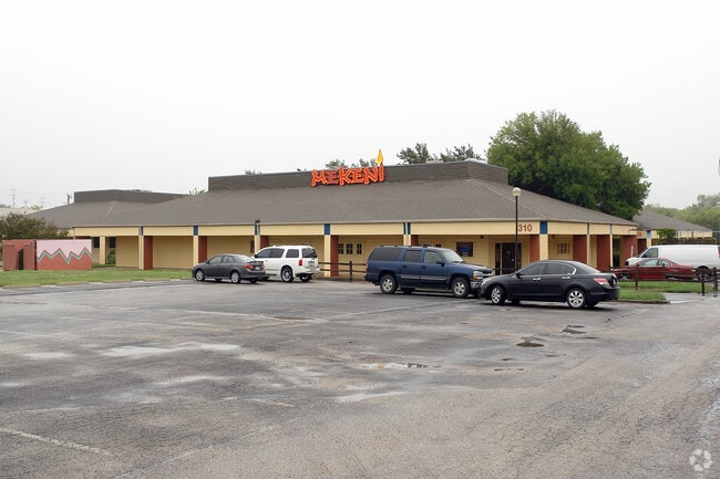


Property Detail
300 Kitty Hawk Rd
San Antonio-New Braunfels, TX
CB 5053N BLK LOTS 5 & 6 (SCHLUETER SUBD UT-3)
05053-840-0051
BEXAR
Officebuilding
Texas
B and X Area of moderate flood hazard, usually the area between the limits of the 100-year and 500-year floods.
51
2025
3.99 AC
2025
Northeast
121601
San Antonio
32,914 SF
NEARBY LISTINGS FOR SALE OR LEASE
DEMOGRAPHICS near 300 Kitty Hawk Rd
1 mile
3 mile
5 mile
2025 Total Population
10,872
83,073
218,835
2030 Population
11,327
88,377
233,476
Pop Growth 2025-2030
+ 4.19%
+ 6.38%
+ 6.69%
Average Age
39
39
38
2025 Total Households
4,507
31,494
78,252
HH Growth 2025-2030
+ 4.37%
+ 6.62%
+ 6.90%
Median Household Inc
$68,587
$84,063
$85,530
Avg Household Size
2.40
2.60
2.70
2025 Avg HH Vehicles
2.00
2.00
2.00
Median Home Value
$265,597
$269,509
$270,378
Median Year Built
1983
1995
1997
Nearby Places
Map Layers
Map Styles
 Street
 Aerial
Layers
 Traffic
 Biking
Places
Listings with unknown addresses are not visible on the map
- Restaurants
- Banks
- Shops
- Fitness
- Groceries
PUBLIC TRANSPORTATION
AIRPORT
San Antonio International
Drive
Walk
Distance
San Antonio International
19 min
12.4 mi
SALE & LEASE HISTORY
LISTING DATE
SALE/LEASE

Jan 03, 2024
For Lease
Nearby Properties
Address
Land Use
TOTAL SIZE
Lot Size
Zoning
Address
Land Use
TOTAL SIZE
Lot Size
Zoning
538,168 SF
176.13 AC
Address
Land Use
TOTAL SIZE
Lot Size
Zoning
402,370 SF
45.49 AC
Address
Land Use
TOTAL SIZE
Lot Size
Zoning
116.47 AC
Address
Land Use
TOTAL SIZE
Lot Size
Zoning
350,805 SF
20.85 AC
Address
Land Use
TOTAL SIZE
Lot Size
Zoning
246,965 SF
11.73 AC
Address
Land Use
TOTAL SIZE
Lot Size
Zoning
223,185 SF
16.85 AC
Address
Land Use
TOTAL SIZE
Lot Size
Zoning
199,756 SF
19.75 AC
Address
Land Use
TOTAL SIZE
Lot Size
Zoning
281,145 SF
29.26 AC
Address
Land Use
TOTAL SIZE
Lot Size
Zoning
242,267 SF
15.77 AC
Address
Land Use
TOTAL SIZE
Lot Size
Zoning
251,110 SF
12.26 AC
Address
Land Use
TOTAL SIZE
Lot Size
Zoning
240,077 SF
16.92 AC
Address
Land Use
TOTAL SIZE
Lot Size
Zoning
218,379 SF
9.65 AC
Address
Land Use
TOTAL SIZE
Lot Size
Zoning
277,887 SF
14.14 AC
Address
Land Use
TOTAL SIZE
Lot Size
Zoning
251,707 SF
20.22 AC
Address
Land Use
TOTAL SIZE
Lot Size
Zoning
214,405 SF
11.85 AC
Address
Land Use
TOTAL SIZE
Lot Size
Zoning
412,136 SF
49 AC
Address
Land Use
TOTAL SIZE
Lot Size
Zoning
490,283 SF
38.97 AC
Address
Land Use
TOTAL SIZE
Lot Size
Zoning
200,940 SF
10.31 AC
Address
Land Use
TOTAL SIZE
Lot Size
Zoning
245,993 SF
23.82 AC
Address
Land Use
TOTAL SIZE
Lot Size
Zoning
198,868 SF
15.15 AC
Address
Land Use
TOTAL SIZE
Lot Size
Zoning
511,000 SF
32.40 AC
Address
Land Use
TOTAL SIZE
Lot Size
Zoning
271,018 SF
13.75 AC
Address
Land Use
TOTAL SIZE
Lot Size
Zoning
172,080 SF
17 AC
Address
Land Use
TOTAL SIZE
Lot Size
Zoning
190,134 SF
10.54 AC
Address
Land Use
TOTAL SIZE
Lot Size
Zoning
154,641 SF
9.07 AC
Address
Land Use
TOTAL SIZE
Lot Size
Zoning
156,381 SF
8.29 AC
Address
Land Use
TOTAL SIZE
Lot Size
Zoning
113,091 SF
12.60 AC
Address
Land Use
TOTAL SIZE
Lot Size
Zoning
190,717 SF
9.99 AC
Address
Land Use
TOTAL SIZE
Lot Size
Zoning
145,811 SF
10.36 AC
Address
Land Use
TOTAL SIZE
Lot Size
Zoning
342,612 SF
28.49 AC
The World's #1 Commercial Real Estate Marketplace
Connect with us
© 2026 CoStar Group
The information above has been obtained from sources believed reliable. While we do not doubt its accuracy we have not verified it and make no guarantee, warranty or representation about it. It is your responsibility to independently confirm its accuracy and completeness. Any projections, opinions, assumptions, or estimates used are for example only and do not represent the current or future performance of the property. The value of this transaction to you depends on tax and other factors which should be evaluated by your tax, financial, and legal advisors. You and your advisors should conduct a careful, independent investigation of the property to determine to your satisfaction the suitability of the property for your needs.