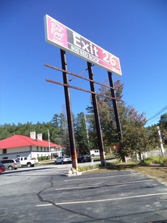
Property Record
300 Main St, Plymouth, NH 03264


NEARBY LISTINGS FOR SALE OR LEASE
Property Detail
300 Main St
Officebuilding
Grafton
X
New Hampshire
33009C0843F
1.31 AC
2024
Other Market Areas
2024
Claremont-Lebanon, NH-VT
961001
PLMH-000209-000022
9,386 SF
DEMOGRAPHICS near 300 Main St
1 Mile
3 Mile
5 Mile
2024 Total Population
2,078
7,503
10,090
2029 Population
2,159
7,792
10,489
Pop Growth 2024-2029
+ 3.90%
+ 3.85%
+ 3.95%
Average Age
32
38
40
2024 Total Households
488
2,581
3,708
HH Growth 2024-2029
+ 5.53%
+ 4.18%
+ 4.13%
Median Household Inc
$72,321
$82,274
$80,842
Avg Household Size
2.20
2.20
2.20
2024 Avg HH Vehicles
2.00
2.00
2.00
Median Home Value
$206,250
$248,839
$249,225
Median Year Built
1983
1980
1981
Nearby Places
Map Layers
Map Styles
 Street
 Aerial
- Restaurants
- Banks
- Shops
- Fitness
- Groceries
SALE & LEASE HISTORY
LISTING DATE
SALE/LEASE

Sep 24, 2016
For Sale
May 17, 2018
For Sale
Nearby Properties
Address
Land Use
TOTAL SIZE
Lot Size
Zoning
Address
Land Use
TOTAL SIZE
Lot Size
Zoning
244,977 SF
16 AC
C/I
Address
Land Use
TOTAL SIZE
Lot Size
Zoning
14 AC
301 OT
Address
Land Use
TOTAL SIZE
Lot Size
Zoning
230,097 SF
7.90 AC
C/I
Address
Land Use
TOTAL SIZE
Lot Size
Zoning
9,369 SF
40 AC
300 DO
Address
Land Use
TOTAL SIZE
Lot Size
Zoning
110,867 SF
6.20 AC
C/I
Address
Land Use
TOTAL SIZE
Lot Size
Zoning
120,187 SF
6 AC
C/I
Address
Land Use
TOTAL SIZE
Lot Size
Zoning
200,995 SF
8.80 AC
C/I
Address
Land Use
TOTAL SIZE
Lot Size
Zoning
84,289 SF
3.20 AC
C/I
Address
Land Use
TOTAL SIZE
Lot Size
Zoning
109,533 SF
4.80 AC
VC
Address
Land Use
TOTAL SIZE
Lot Size
Zoning
149,387 SF
22 AC
ICD
Address
Land Use
TOTAL SIZE
Lot Size
Zoning
215,150 SF
46.62 AC
C/I
Address
Land Use
TOTAL SIZE
Lot Size
Zoning
120,467 SF
17.43 AC
C/I
Address
Land Use
TOTAL SIZE
Lot Size
Zoning
97,595 SF
41.02 AC
301 OT
Address
Land Use
TOTAL SIZE
Lot Size
Zoning
32,393 SF
8.90 AC
ICD
Address
Land Use
TOTAL SIZE
Lot Size
Zoning
68,171 SF
Address
Land Use
TOTAL SIZE
Lot Size
Zoning
95,768 SF
3.60 AC
CI
Address
Land Use
TOTAL SIZE
Lot Size
Zoning
44,195 SF
2.67 AC
HC
Address
Land Use
TOTAL SIZE
Lot Size
Zoning
4,080 SF
67 AC
114 N
Address
Land Use
TOTAL SIZE
Lot Size
Zoning
65,048 SF
3.83 AC
HC
Address
Land Use
TOTAL SIZE
Lot Size
Zoning
53,608 SF
1 AC
VC
Address
Land Use
TOTAL SIZE
Lot Size
Zoning
39,654 SF
284 AC
300 DO
Address
Land Use
TOTAL SIZE
Lot Size
Zoning
16,501 SF
15.38 AC
114 N
Address
Land Use
TOTAL SIZE
Lot Size
Zoning
8,945 SF
46.10 AC
HC
Address
Land Use
TOTAL SIZE
Lot Size
Zoning
37,555 SF
14.23 AC
ICD
Address
Land Use
TOTAL SIZE
Lot Size
Zoning
18,120 SF
1.74 AC
ICD
Address
Land Use
TOTAL SIZE
Lot Size
Zoning
29,412 SF
4.30 AC
HC
Address
Land Use
TOTAL SIZE
Lot Size
Zoning
32,988 SF
42.30 AC
SFR
Address
Land Use
TOTAL SIZE
Lot Size
Zoning
26 AC
ICD
Address
Land Use
TOTAL SIZE
Lot Size
Zoning
24,344 SF
15.49 AC
A
Address
Land Use
TOTAL SIZE
Lot Size
Zoning
44,458 SF
1.10 AC
C/I
The World's #1 Commercial Real Estate Marketplace
Connect with us
© 2026 CoStar Group
The information above has been obtained from sources believed reliable. While we do not doubt its accuracy we have not verified it and make no guarantee, warranty or representation about it. It is your responsibility to independently confirm its accuracy and completeness. Any projections, opinions, assumptions, or estimates used are for example only and do not represent the current or future performance of the property. The value of this transaction to you depends on tax and other factors which should be evaluated by your tax, financial, and legal advisors. You and your advisors should conduct a careful, independent investigation of the property to determine to your satisfaction the suitability of the property for your needs.