Property Record
300 Maple St, Smyrna, TN 37167


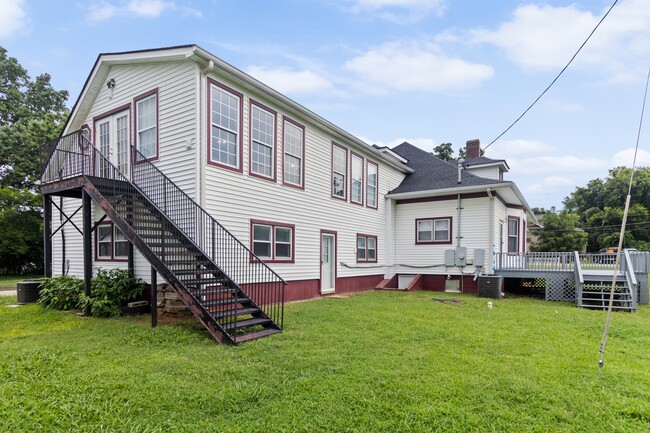
This Property Is For Sale
Property Detail
300 Maple St
027I-D-017.00-000
200 X 200
Commercialnec
Rutherford
B and X Area of moderate flood hazard, usually the area between the limits of the 100-year and 500-year floods.
Tennessee
2025
0.92 AC
2025
Rutherford County
042200
Nashville
3,604 SF
Nashville-Davidson--Murfreesboro--Franklin, TN
NEARBY LISTINGS FOR SALE OR LEASE
DEMOGRAPHICS near 300 Maple St
1 mile
3 mile
5 mile
2025 Total Population
8,522
52,208
108,404
2030 Population
9,297
56,476
117,291
Pop Growth 2025-2030
+ 9.09%
+ 8.17%
+ 8.20%
Average Age
38
37
36
2025 Total Households
3,140
19,322
37,910
HH Growth 2025-2030
+ 9.20%
+ 8.28%
+ 8.31%
Median Household Inc
$72,063
$76,800
$82,386
Avg Household Size
2.60
2.70
2.80
2025 Avg HH Vehicles
2.00
2.00
2.00
Median Home Value
$362,836
$353,059
$357,048
Median Year Built
1986
1995
1999
Nearby Places
Map Layers
Map Styles
 Street
 Aerial
Transit
 Traffic
 Biking
Places
Listings with unknown addresses are not visible on the map
- Restaurants
- Banks
- Shops
- Fitness
- Groceries
PUBLIC TRANSPORTATION
AIRPORT
Nashville International
Drive
Walk
Distance
Nashville International
23 min
14.0 mi
Nearby Properties
Address
Land Use
TOTAL SIZE
Lot Size
Zoning
Address
Land Use
TOTAL SIZE
Lot Size
Zoning
5,405,737 SF
713 AC
Address
Land Use
TOTAL SIZE
Lot Size
Zoning
1,505,000 SF
66 AC
Address
Land Use
TOTAL SIZE
Lot Size
Zoning
505,945 SF
67.22 AC
Address
Land Use
TOTAL SIZE
Lot Size
Zoning
404,723 SF
1,495 AC
Address
Land Use
TOTAL SIZE
Lot Size
Zoning
302,040 SF
60 AC
Address
Land Use
TOTAL SIZE
Lot Size
Zoning
228,493 SF
Address
Land Use
TOTAL SIZE
Lot Size
Zoning
618,332 SF
45.75 AC
Address
Land Use
TOTAL SIZE
Lot Size
Zoning
564,124 SF
37.66 AC
Address
Land Use
TOTAL SIZE
Lot Size
Zoning
377,869 SF
26.47 AC
Address
Land Use
TOTAL SIZE
Lot Size
Zoning
22,099 SF
18.58 AC
Address
Land Use
TOTAL SIZE
Lot Size
Zoning
5,352 SF
30 AC
RMF
Address
Land Use
TOTAL SIZE
Lot Size
Zoning
301,272 SF
26.09 AC
Address
Land Use
TOTAL SIZE
Lot Size
Zoning
4,109 SF
21.84 AC
Address
Land Use
TOTAL SIZE
Lot Size
Zoning
99,209 SF
44.41 AC
Address
Land Use
TOTAL SIZE
Lot Size
Zoning
235,015 SF
3.50 AC
Address
Land Use
TOTAL SIZE
Lot Size
Zoning
202,737 SF
41 AC
Address
Land Use
TOTAL SIZE
Lot Size
Zoning
132,470 SF
42.16 AC
Address
Land Use
TOTAL SIZE
Lot Size
Zoning
223,445 SF
57.60 AC
Address
Land Use
TOTAL SIZE
Lot Size
Zoning
212,268 SF
49 AC
Address
Land Use
TOTAL SIZE
Lot Size
Zoning
304,456 SF
40.14 AC
Address
Land Use
TOTAL SIZE
Lot Size
Zoning
3,142 SF
11.40 AC
C2
Address
Land Use
TOTAL SIZE
Lot Size
Zoning
123,482 SF
29.50 AC
Address
Land Use
TOTAL SIZE
Lot Size
Zoning
3,296 SF
14.63 AC
Address
Land Use
TOTAL SIZE
Lot Size
Zoning
22,500 SF
23.38 AC
RM16
Address
Land Use
TOTAL SIZE
Lot Size
Zoning
121,104 SF
43.60 AC
Address
Land Use
TOTAL SIZE
Lot Size
Zoning
161,678 SF
4.18 AC
C2
Address
Land Use
TOTAL SIZE
Lot Size
Zoning
149,351 SF
5.80 AC
Address
Land Use
TOTAL SIZE
Lot Size
Zoning
189,968 SF
41.84 AC
Address
Land Use
TOTAL SIZE
Lot Size
Zoning
97,781 SF
17.17 AC
Address
Land Use
TOTAL SIZE
Lot Size
Zoning
60,504 SF
5.41 AC
The World's #1 Commercial Real Estate Marketplace
Connect with us
© 2026 CoStar Group
The information above has been obtained from sources believed reliable. While we do not doubt its accuracy we have not verified it and make no guarantee, warranty or representation about it. It is your responsibility to independently confirm its accuracy and completeness. Any projections, opinions, assumptions, or estimates used are for example only and do not represent the current or future performance of the property. The value of this transaction to you depends on tax and other factors which should be evaluated by your tax, financial, and legal advisors. You and your advisors should conduct a careful, independent investigation of the property to determine to your satisfaction the suitability of the property for your needs.