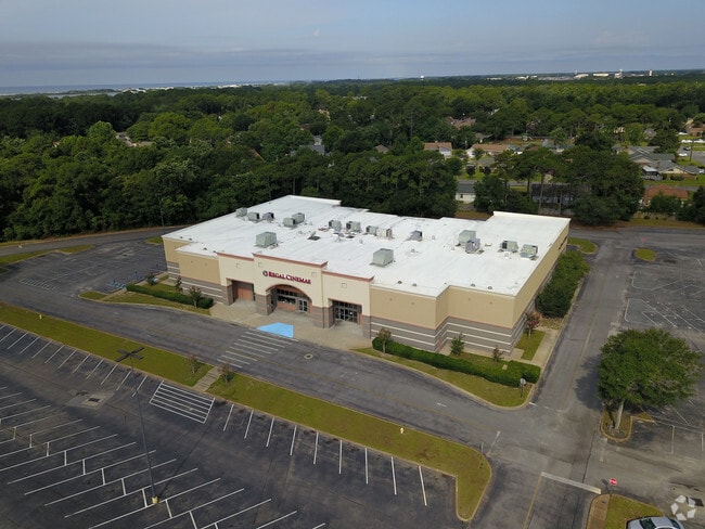
Property Record
300 Mary Esther Blvd, Mary Esther, FL 32569

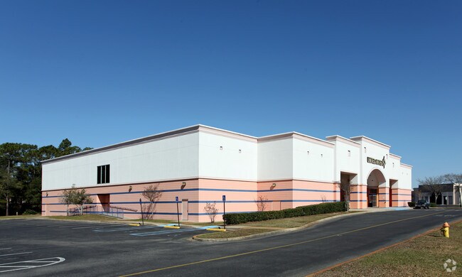
NEARBY LISTINGS FOR SALE OR LEASE
Property Detail
300 Mary Esther Blvd
Other Market Areas
Mary Est
Crestview-Fort Walton Beach-Destin, FL
MAIN MALL AS SURVEYED 60 AC AS OR 702-543 & 2.72 AC AS 795-878 EX ANY NEW SURVEYED AREAS & EX PARTS SOLD
16-2S-24-0000-0001-001A
Okaloosa
Regionalshoppingcenterormallwithanchorstore
Florida
2025
1a
2025
24.91 AC
022900
Fort Walton Beach
408,316 SF
DEMOGRAPHICS near 300 Mary Esther Blvd
1 Mile
3 Mile
5 Mile
2024 Total Population
6,208
37,261
67,720
2029 Population
6,520
39,102
71,222
Pop Growth 2024-2029
+ 5.03%
+ 4.94%
+ 5.17%
Average Age
39
39
40
2024 Total Households
2,512
15,632
28,947
HH Growth 2024-2029
+ 4.98%
+ 5.04%
+ 5.37%
Median Household Inc
$60,298
$58,515
$58,770
Avg Household Size
2.40
2.30
2.20
2024 Avg HH Vehicles
2.00
2.00
2.00
Median Home Value
$229,599
$256,166
$270,217
Median Year Built
1978
1980
1981
Nearby Places
Map Layers
Map Styles
 Street
 Aerial
- Restaurants
- Banks
- Shops
- Fitness
- Groceries
PUBLIC TRANSPORTATION
AIRPORT
Eglin AFB/Destin-Ft Walton Beach
DRIVE
WALK
Distance
Eglin AFB/Destin-Ft Walton Beach
34 min
13.6 mi
Pensacola International
DRIVE
WALK
Distance
Pensacola International
73 min
42.6 mi
Nearby Properties
Address
Land Use
TOTAL SIZE
Lot Size
Zoning
Address
Land Use
TOTAL SIZE
Lot Size
Zoning
1,954.92 AC
Address
Land Use
TOTAL SIZE
Lot Size
Zoning
173,879 SF
9 AC
Address
Land Use
TOTAL SIZE
Lot Size
Zoning
120,159 SF
14.82 AC
Address
Land Use
TOTAL SIZE
Lot Size
Zoning
8,066.36 AC
Address
Land Use
TOTAL SIZE
Lot Size
Zoning
282,804 SF
78.70 AC
Address
Land Use
TOTAL SIZE
Lot Size
Zoning
216,839 SF
9.63 AC
Address
Land Use
TOTAL SIZE
Lot Size
Zoning
55,566 SF
5.40 AC
Address
Land Use
TOTAL SIZE
Lot Size
Zoning
Address
Land Use
TOTAL SIZE
Lot Size
Zoning
182,844 SF
20.62 AC
Address
Land Use
TOTAL SIZE
Lot Size
Zoning
159,550 SF
31.10 AC
Address
Land Use
TOTAL SIZE
Lot Size
Zoning
140,945 SF
80.64 AC
Address
Land Use
TOTAL SIZE
Lot Size
Zoning
62,097 SF
4.86 AC
Address
Land Use
TOTAL SIZE
Lot Size
Zoning
75,892 SF
1.72 AC
Address
Land Use
TOTAL SIZE
Lot Size
Zoning
50,294 SF
0.94 AC
Address
Land Use
TOTAL SIZE
Lot Size
Zoning
3,894 SF
315.07 AC
Address
Land Use
TOTAL SIZE
Lot Size
Zoning
121,164 SF
5.78 AC
Address
Land Use
TOTAL SIZE
Lot Size
Zoning
108,284 SF
5.47 AC
Address
Land Use
TOTAL SIZE
Lot Size
Zoning
287,257 SF
13.86 AC
Address
Land Use
TOTAL SIZE
Lot Size
Zoning
229,805 SF
19.31 AC
Address
Land Use
TOTAL SIZE
Lot Size
Zoning
Address
Land Use
TOTAL SIZE
Lot Size
Zoning
71,050 SF
2.52 AC
Address
Land Use
TOTAL SIZE
Lot Size
Zoning
78,958 SF
7.88 AC
Address
Land Use
TOTAL SIZE
Lot Size
Zoning
146,143 SF
19.39 AC
Address
Land Use
TOTAL SIZE
Lot Size
Zoning
51,195 SF
6.10 AC
Address
Land Use
TOTAL SIZE
Lot Size
Zoning
16,204 SF
254.05 AC
Address
Land Use
TOTAL SIZE
Lot Size
Zoning
65,995 SF
6.53 AC
Address
Land Use
TOTAL SIZE
Lot Size
Zoning
28,816 SF
1.71 AC
Address
Land Use
TOTAL SIZE
Lot Size
Zoning
47,490 SF
13.69 AC
Address
Land Use
TOTAL SIZE
Lot Size
Zoning
202,335 SF
17.41 AC
Address
Land Use
TOTAL SIZE
Lot Size
Zoning
184,310 SF
10.09 AC
The World's #1 Commercial Real Estate Marketplace
Connect with us
© 2026 CoStar Group
The information above has been obtained from sources believed reliable. While we do not doubt its accuracy we have not verified it and make no guarantee, warranty or representation about it. It is your responsibility to independently confirm its accuracy and completeness. Any projections, opinions, assumptions, or estimates used are for example only and do not represent the current or future performance of the property. The value of this transaction to you depends on tax and other factors which should be evaluated by your tax, financial, and legal advisors. You and your advisors should conduct a careful, independent investigation of the property to determine to your satisfaction the suitability of the property for your needs.