Property Record
300 Maxfield Dr, Paducah, KY 42001

Current Lease Availabilities
NEARBY LISTINGS FOR SALE OR LEASE
Property Detail
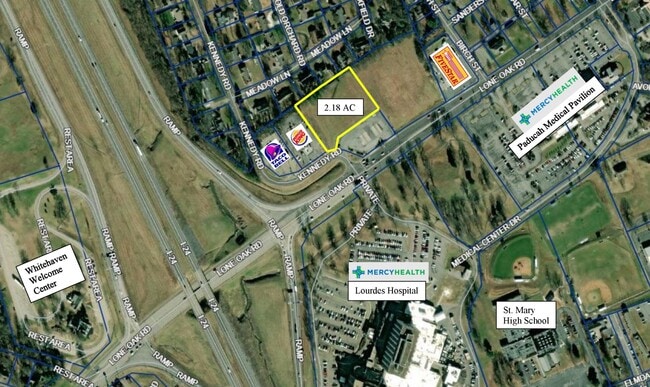
300 Maxfield Dr
Paducah, KY-IL
Plat Of Sub Of The Bellemeade Co Ltd
096-41-00-012
Mccracken
Singlefamilyresidentialassumed
Kentucky
X
1.23 AC
21145C0142F
Kentucky West Area
3,111 SF
Other Market Areas
DEMOGRAPHICS near 300 Maxfield Dr
1 Mile
3 Mile
5 Mile
2024 Total Population
4,683
32,037
49,845
2029 Population
4,653
31,868
49,719
Pop Growth 2024-2029
(0.64%)
(0.53%)
(0.25%)
Average Age
44
41
42
2024 Total Households
2,121
14,006
21,586
HH Growth 2024-2029
(0.66%)
(0.54%)
(0.24%)
Median Household Inc
$67,096
$64,291
$63,183
Avg Household Size
2.10
2.20
2.20
2024 Avg HH Vehicles
2.00
2.00
2.00
Median Home Value
$232,189
$173,372
$169,550
Median Year Built
1972
1974
1976
Nearby Places
Map Layers
Map Styles
 Street
 Aerial
- Restaurants
- Banks
- Shops
- Fitness
- Groceries
Nearby Properties
Address
Land Use
TOTAL SIZE
Lot Size
Zoning
Address
Land Use
TOTAL SIZE
Lot Size
Zoning
Address
Land Use
TOTAL SIZE
Lot Size
Zoning
35.07 AC
Address
Land Use
TOTAL SIZE
Lot Size
Zoning
33.35 AC
Address
Land Use
TOTAL SIZE
Lot Size
Zoning
65.20 AC
Address
Land Use
TOTAL SIZE
Lot Size
Zoning
Address
Land Use
TOTAL SIZE
Lot Size
Zoning
11.84 AC
Address
Land Use
TOTAL SIZE
Lot Size
Zoning
Address
Land Use
TOTAL SIZE
Lot Size
Zoning
10.39 AC
Address
Land Use
TOTAL SIZE
Lot Size
Zoning
Address
Land Use
TOTAL SIZE
Lot Size
Zoning
13.34 AC
Address
Land Use
TOTAL SIZE
Lot Size
Zoning
25.56 AC
Address
Land Use
TOTAL SIZE
Lot Size
Zoning
10.17 AC
Address
Land Use
TOTAL SIZE
Lot Size
Zoning
27.89 AC
Address
Land Use
TOTAL SIZE
Lot Size
Zoning
Address
Land Use
TOTAL SIZE
Lot Size
Zoning
8.54 AC
Address
Land Use
TOTAL SIZE
Lot Size
Zoning
13.03 AC
Address
Land Use
TOTAL SIZE
Lot Size
Zoning
5.17 AC
Address
Land Use
TOTAL SIZE
Lot Size
Zoning
11.81 AC
Address
Land Use
TOTAL SIZE
Lot Size
Zoning
5.08 AC
Address
Land Use
TOTAL SIZE
Lot Size
Zoning
24.38 AC
Address
Land Use
TOTAL SIZE
Lot Size
Zoning
28.04 AC
Address
Land Use
TOTAL SIZE
Lot Size
Zoning
10.45 AC
Address
Land Use
TOTAL SIZE
Lot Size
Zoning
Address
Land Use
TOTAL SIZE
Lot Size
Zoning
Address
Land Use
TOTAL SIZE
Lot Size
Zoning
37.34 AC
Address
Land Use
TOTAL SIZE
Lot Size
Zoning
5.66 AC
Address
Land Use
TOTAL SIZE
Lot Size
Zoning
Address
Land Use
TOTAL SIZE
Lot Size
Zoning
Address
Land Use
TOTAL SIZE
Lot Size
Zoning
4,000 SF
18 AC
Address
Land Use
TOTAL SIZE
Lot Size
Zoning
2.84 AC
The World's #1 Commercial Real Estate Marketplace
Connect with us
© 2026 CoStar Group
The information above has been obtained from sources believed reliable. While we do not doubt its accuracy we have not verified it and make no guarantee, warranty or representation about it. It is your responsibility to independently confirm its accuracy and completeness. Any projections, opinions, assumptions, or estimates used are for example only and do not represent the current or future performance of the property. The value of this transaction to you depends on tax and other factors which should be evaluated by your tax, financial, and legal advisors. You and your advisors should conduct a careful, independent investigation of the property to determine to your satisfaction the suitability of the property for your needs.