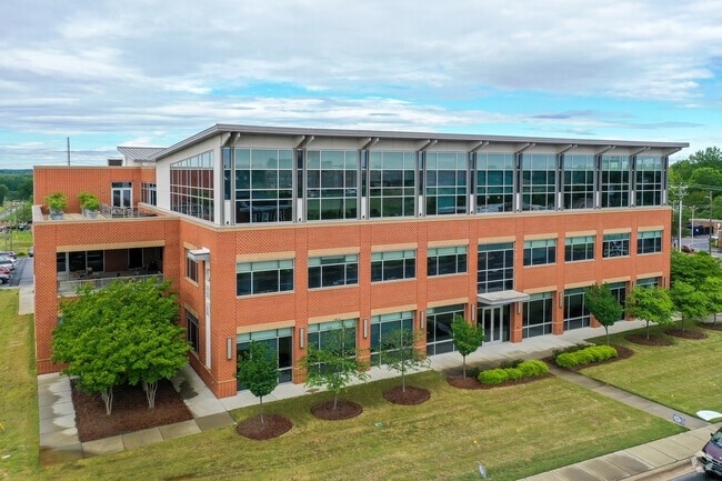
Property Record
300 Mooresville Rd, Kannapolis, NC 28081


NEARBY LISTINGS FOR SALE OR LEASE
Property Detail
300 Mooresville Rd
5614-40-4536-0000
Ncrckannapolis Downtown
Govtadministrativeoffice
PUBLIC HEALTH AUTHORITY OF CABARRUS CO
X
Cabarrus
3710561400K
North Carolina
0
2.94 AC
2025
Cabarrus County
041002
Charlotte
66,194 SF
Charlotte-Concord-Gastonia, NC-SC
DEMOGRAPHICS near 300 Mooresville Rd
1 Mile
3 Mile
5 Mile
2024 Total Population
8,932
50,897
83,473
2029 Population
10,196
56,758
92,826
Pop Growth 2024-2029
+ 14.15%
+ 11.52%
+ 11.20%
Average Age
37
39
39
2024 Total Households
3,559
19,735
32,753
HH Growth 2024-2029
+ 12.90%
+ 10.48%
+ 10.22%
Median Household Inc
$46,214
$57,121
$58,469
Avg Household Size
2.50
2.50
2.50
2024 Avg HH Vehicles
2.00
2.00
2.00
Median Home Value
$146,495
$173,365
$194,709
Median Year Built
1958
1975
1983
Nearby Places
Map Layers
Map Styles
 Street
 Aerial
- Restaurants
- Banks
- Shops
- Fitness
- Groceries
PUBLIC TRANSPORTATION
TRANSIT/SUBWAY
Kannapolis Station (Piedmont - North Carolina by Train (NC Train))
DRIVE
WALK
Distance
Kannapolis Station (Piedmont - North Carolina by Train (NC Train))
3 min
10 min
0.5 mi
COMMUTER RAIL
Kannapolis Station (Piedmont - North Carolina by Train (NC Train))
DRIVE
WALK
Distance
Kannapolis Station (Piedmont - North Carolina by Train (NC Train))
2 min
11 min
0.6 mi
AIRPORT
Concord-Padgett Regional
DRIVE
WALK
Distance
Concord-Padgett Regional
23 min
14.0 mi
Charlotte/Douglas International
DRIVE
WALK
Distance
Charlotte/Douglas International
49 min
34.3 mi
Nearby Properties
Address
Land Use
TOTAL SIZE
Lot Size
Zoning
Address
Land Use
TOTAL SIZE
Lot Size
Zoning
40,519 SF
20.12 AC
PD-TND
Address
Land Use
TOTAL SIZE
Lot Size
Zoning
39,678 SF
25.80 AC
GC
Address
Land Use
TOTAL SIZE
Lot Size
Zoning
276,070 SF
CC
Address
Land Use
TOTAL SIZE
Lot Size
Zoning
114,382 SF
24.64 AC
R4
Address
Land Use
TOTAL SIZE
Lot Size
Zoning
176,676 SF
31.80 AC
R4
Address
Land Use
TOTAL SIZE
Lot Size
Zoning
128,064 SF
2.68 AC
CC
Address
Land Use
TOTAL SIZE
Lot Size
Zoning
121,156 SF
3.57 AC
CC
Address
Land Use
TOTAL SIZE
Lot Size
Zoning
106,804 SF
1.81 AC
CC
Address
Land Use
TOTAL SIZE
Lot Size
Zoning
44,136 SF
15.42 AC
R18
Address
Land Use
TOTAL SIZE
Lot Size
Zoning
83,152 SF
7.11 AC
CC
Address
Land Use
TOTAL SIZE
Lot Size
Zoning
15,924 SF
16.90 AC
RC
Address
Land Use
TOTAL SIZE
Lot Size
Zoning
176,075 SF
2.35 AC
CC
Address
Land Use
TOTAL SIZE
Lot Size
Zoning
114,250 SF
18.50 AC
RM-2
Address
Land Use
TOTAL SIZE
Lot Size
Zoning
5,308 SF
15.16 AC
RC
Address
Land Use
TOTAL SIZE
Lot Size
Zoning
85,422 SF
6.30 AC
R8
Address
Land Use
TOTAL SIZE
Lot Size
Zoning
67,862 SF
1.77 AC
CC
Address
Land Use
TOTAL SIZE
Lot Size
Zoning
74,058 SF
11.75 AC
GC
Address
Land Use
TOTAL SIZE
Lot Size
Zoning
12,010 SF
0.40 AC
CC
Address
Land Use
TOTAL SIZE
Lot Size
Zoning
101,014 SF
1.84 AC
CC
Address
Land Use
TOTAL SIZE
Lot Size
Zoning
56,923 SF
2 AC
CC
Address
Land Use
TOTAL SIZE
Lot Size
Zoning
43,682 SF
11.02 AC
O-I
Address
Land Use
TOTAL SIZE
Lot Size
Zoning
68,257 SF
8.26 AC
R8
Address
Land Use
TOTAL SIZE
Lot Size
Zoning
64,554 SF
2.67 AC
CC
Address
Land Use
TOTAL SIZE
Lot Size
Zoning
26,069 SF
12.33 AC
C-1
Address
Land Use
TOTAL SIZE
Lot Size
Zoning
22,898 SF
10 AC
R18
Address
Land Use
TOTAL SIZE
Lot Size
Zoning
115,509 SF
4.90 AC
R8
Address
Land Use
TOTAL SIZE
Lot Size
Zoning
84,608 SF
23.75 AC
R8
Address
Land Use
TOTAL SIZE
Lot Size
Zoning
12,415 SF
25.46 AC
R8
Address
Land Use
TOTAL SIZE
Lot Size
Zoning
13,689 SF
8.56 AC
R4
The World's #1 Commercial Real Estate Marketplace
Connect with us
© 2026 CoStar Group
The information above has been obtained from sources believed reliable. While we do not doubt its accuracy we have not verified it and make no guarantee, warranty or representation about it. It is your responsibility to independently confirm its accuracy and completeness. Any projections, opinions, assumptions, or estimates used are for example only and do not represent the current or future performance of the property. The value of this transaction to you depends on tax and other factors which should be evaluated by your tax, financial, and legal advisors. You and your advisors should conduct a careful, independent investigation of the property to determine to your satisfaction the suitability of the property for your needs.