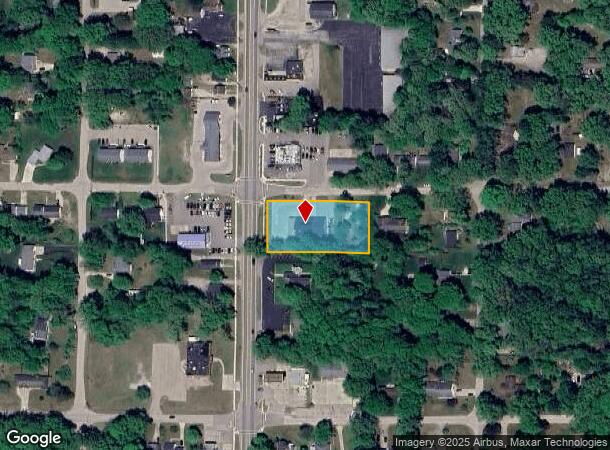
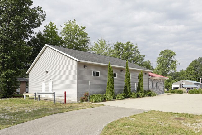
Property Record
300 N 3Rd Ave, Fruitport, MI 49415

NEARBY LISTINGS FOR SALE OR LEASE
-
-
View all Fruitport listings for sale on LoopNet.com
Property Detail
300 N 3Rd Ave
Muskegon, MI
Village Of Fruitport
41-150-014-0008-00
VILLAGE OF FRUITPORT SEC 36 T9N R16W BLK 14 LOT 8 .99 AC (SPLIT W/41-150-014-0008-10 FOR 2008 ROLL) (COMBINED 41-150-014-00
Commercialnec
Muskegon
X
Michigan
26121C0294E
8
2024
0.99 AC
2025
Norton Shores
002800
West Michigan
4,896 SF
DEMOGRAPHICS near 300 N 3Rd Ave
1 Mile
3 Mile
5 Mile
2024 Total Population
2,436
12,682
41,376
2029 Population
2,470
13,105
42,690
Pop Growth 2024-2029
+ 1.40%
+ 3.34%
+ 3.18%
Average Age
42
42
43
2024 Total Households
955
4,939
16,588
HH Growth 2024-2029
+ 1.47%
+ 3.42%
+ 3.31%
Median Household Inc
$86,912
$74,442
$71,819
Avg Household Size
2.50
2.50
2.40
2024 Avg HH Vehicles
2.00
2.00
2.00
Median Home Value
$199,596
$266,576
$245,903
Median Year Built
1973
1989
1983
Nearby Places
Map Layers
Map Styles
 Street
 Aerial
- Restaurants
- Banks
- Shops
- Fitness
- Groceries
PUBLIC TRANSPORTATION
AIRPORT
Gerald R Ford International
DRIVE
WALK
Distance
Gerald R Ford International
55 min
45.0 mi
SALE & LEASE HISTORY
LISTING DATE
SALE/LEASE

Jul 12, 2017
For Sale
Nearby Properties
Address
Land Use
TOTAL SIZE
Lot Size
Zoning
Address
Land Use
TOTAL SIZE
Lot Size
Zoning
273,059 SF
30.59 AC
PUD
Address
Land Use
TOTAL SIZE
Lot Size
Zoning
207,571 SF
22 AC
LI
Address
Land Use
TOTAL SIZE
Lot Size
Zoning
65,152 SF
9.77 AC
PUD
Address
Land Use
TOTAL SIZE
Lot Size
Zoning
55,600 SF
LI
Address
Land Use
TOTAL SIZE
Lot Size
Zoning
250,000 SF
19.08 AC
GI
Address
Land Use
TOTAL SIZE
Lot Size
Zoning
169,420 SF
15.20 AC
PUD
Address
Land Use
TOTAL SIZE
Lot Size
Zoning
118,532 SF
8.16 AC
REC
Address
Land Use
TOTAL SIZE
Lot Size
Zoning
63,512 SF
6.22 AC
PUD
Address
Land Use
TOTAL SIZE
Lot Size
Zoning
356,647 SF
53.83 AC
PUD
Address
Land Use
TOTAL SIZE
Lot Size
Zoning
54,100 SF
6.60 AC
PUD
Address
Land Use
TOTAL SIZE
Lot Size
Zoning
88,970 SF
6.46 AC
PUD
Address
Land Use
TOTAL SIZE
Lot Size
Zoning
25,250 SF
2.81 AC
PUD
Address
Land Use
TOTAL SIZE
Lot Size
Zoning
38,563 SF
B-3
Address
Land Use
TOTAL SIZE
Lot Size
Zoning
71,360 SF
8.27 AC
B-3
Address
Land Use
TOTAL SIZE
Lot Size
Zoning
60,762 SF
4.61 AC
PUD
Address
Land Use
TOTAL SIZE
Lot Size
Zoning
19,108 SF
2 AC
PUD
Address
Land Use
TOTAL SIZE
Lot Size
Zoning
107,120 SF
5.93 AC
PUD
Address
Land Use
TOTAL SIZE
Lot Size
Zoning
27,184 SF
3.89 AC
PUD
Address
Land Use
TOTAL SIZE
Lot Size
Zoning
13 AC
MHP
Address
Land Use
TOTAL SIZE
Lot Size
Zoning
105,948 SF
6.71 AC
PUD
Address
Land Use
TOTAL SIZE
Lot Size
Zoning
167,290 SF
33.43 AC
B-3
Address
Land Use
TOTAL SIZE
Lot Size
Zoning
32,797 SF
B-3
Address
Land Use
TOTAL SIZE
Lot Size
Zoning
103,604 SF
14.65 AC
GI
Address
Land Use
TOTAL SIZE
Lot Size
Zoning
47,319 SF
2 AC
PUD
Address
Land Use
TOTAL SIZE
Lot Size
Zoning
16,290 SF
16.74 AC
R-6
Address
Land Use
TOTAL SIZE
Lot Size
Zoning
75,791 SF
5.58 AC
GI
Address
Land Use
TOTAL SIZE
Lot Size
Zoning
133,800 SF
10 AC
B-3
Address
Land Use
TOTAL SIZE
Lot Size
Zoning
12,518 SF
4.76 AC
PUD
Address
Land Use
TOTAL SIZE
Lot Size
Zoning
1,200 SF
150.19 AC
MLTPZ
Address
Land Use
TOTAL SIZE
Lot Size
Zoning
29,492 SF
3.53 AC
PUD
The World's #1 Commercial Real Estate Marketplace
Connect with us
© 2026 CoStar Group
The information above has been obtained from sources believed reliable. While we do not doubt its accuracy we have not verified it and make no guarantee, warranty or representation about it. It is your responsibility to independently confirm its accuracy and completeness. Any projections, opinions, assumptions, or estimates used are for example only and do not represent the current or future performance of the property. The value of this transaction to you depends on tax and other factors which should be evaluated by your tax, financial, and legal advisors. You and your advisors should conduct a careful, independent investigation of the property to determine to your satisfaction the suitability of the property for your needs.