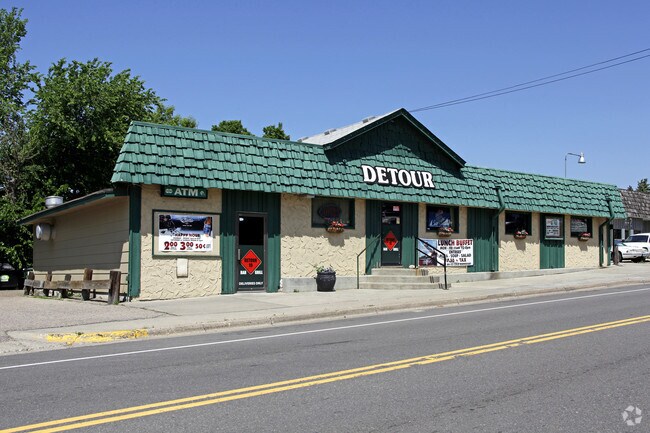
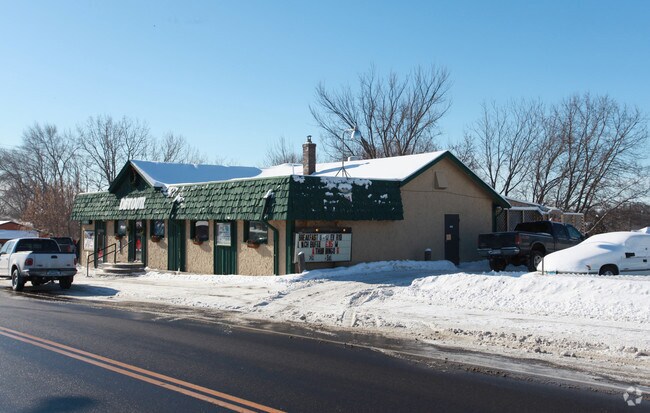
Property Record
300 N Medina St, Loretto, MN 55357
NEARBY LISTINGS FOR SALE OR LEASE
-
-
View all Loretto listings for sale on LoopNet.com
Property Detail
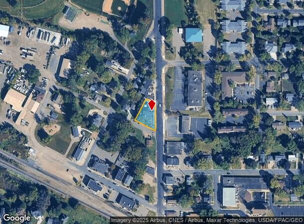
300 N Medina St
Minneapolis-St. Paul-Bloomington, MN-WI
Loretto
06-118-23-31-0014
LOT 005 BLOCK 001 A LORETTO THAT PART OF LOTS 4 AND 5 LYING SELY OF THE NWLY 100 FT THEREOF AND THAT PART OF THE SWLY 32.6 FT OF LOT 3 LYING SELY OF NWLY 100 FT THEREOF T E146X127X133X60
Commercialnec
Hennepin
X
Minnesota
27053C0142F
5
2024
0.28 AC
2024
Ridgedale
027101
Minneapolis/St Paul
DEMOGRAPHICS near 300 N Medina St
1 Mile
3 Mile
5 Mile
2024 Total Population
861
4,181
13,733
2029 Population
845
4,096
13,541
Pop Growth 2024-2029
(1.86%)
(2.03%)
(1.40%)
Average Age
41
42
41
2024 Total Households
339
1,468
4,856
HH Growth 2024-2029
(1.77%)
(2.18%)
(1.44%)
Median Household Inc
$112,500
$147,931
$143,541
Avg Household Size
2.50
2.80
2.80
2024 Avg HH Vehicles
2.00
3.00
2.00
Median Home Value
$353,636
$513,661
$532,628
Median Year Built
1986
1981
1986
Nearby Places
Map Layers
Map Styles
 Street
 Aerial
- Restaurants
- Banks
- Shops
- Fitness
- Groceries
PUBLIC TRANSPORTATION
AIRPORT
Minneapolis-St Paul International/Wold-Chamberlain
DRIVE
WALK
Distance
Minneapolis-St Paul International/Wold-Chamberlain
46 min
33.2 mi
Freight Ports
Port Milwaukee
DRIVE
WALK
Distance
Port Milwaukee
405 min
362.3 mi
Nearby Properties
Address
Land Use
TOTAL SIZE
Lot Size
Zoning
Address
Land Use
TOTAL SIZE
Lot Size
Zoning
21.09 AC
Address
Land Use
TOTAL SIZE
Lot Size
Zoning
Address
Land Use
TOTAL SIZE
Lot Size
Zoning
25.53 AC
Address
Land Use
TOTAL SIZE
Lot Size
Zoning
33.02 AC
Address
Land Use
TOTAL SIZE
Lot Size
Zoning
42.54 AC
Address
Land Use
TOTAL SIZE
Lot Size
Zoning
26.54 AC
Address
Land Use
TOTAL SIZE
Lot Size
Zoning
11.52 AC
Address
Land Use
TOTAL SIZE
Lot Size
Zoning
Address
Land Use
TOTAL SIZE
Lot Size
Zoning
10.29 AC
Address
Land Use
TOTAL SIZE
Lot Size
Zoning
15.21 AC
Address
Land Use
TOTAL SIZE
Lot Size
Zoning
10.01 AC
Address
Land Use
TOTAL SIZE
Lot Size
Zoning
17.91 AC
Address
Land Use
TOTAL SIZE
Lot Size
Zoning
2.02 AC
Address
Land Use
TOTAL SIZE
Lot Size
Zoning
0.95 AC
Address
Land Use
TOTAL SIZE
Lot Size
Zoning
4.59 AC
Address
Land Use
TOTAL SIZE
Lot Size
Zoning
8.40 AC
Address
Land Use
TOTAL SIZE
Lot Size
Zoning
1,582 SF
74 AC
Address
Land Use
TOTAL SIZE
Lot Size
Zoning
17.04 AC
Address
Land Use
TOTAL SIZE
Lot Size
Zoning
63.67 AC
Address
Land Use
TOTAL SIZE
Lot Size
Zoning
60.18 AC
Address
Land Use
TOTAL SIZE
Lot Size
Zoning
1.89 AC
Address
Land Use
TOTAL SIZE
Lot Size
Zoning
Address
Land Use
TOTAL SIZE
Lot Size
Zoning
4.67 AC
Address
Land Use
TOTAL SIZE
Lot Size
Zoning
5.85 AC
Address
Land Use
TOTAL SIZE
Lot Size
Zoning
41.66 AC
Address
Land Use
TOTAL SIZE
Lot Size
Zoning
1.25 AC
Address
Land Use
TOTAL SIZE
Lot Size
Zoning
22.75 AC
Address
Land Use
TOTAL SIZE
Lot Size
Zoning
17.60 AC
Address
Land Use
TOTAL SIZE
Lot Size
Zoning
53.19 AC
Address
Land Use
TOTAL SIZE
Lot Size
Zoning
29.90 AC
The World's #1 Commercial Real Estate Marketplace
Connect with us
© 2025 CoStar Group
The information above has been obtained from sources believed reliable. While we do not doubt its accuracy we have not verified it and make no guarantee, warranty or representation about it. It is your responsibility to independently confirm its accuracy and completeness. Any projections, opinions, assumptions, or estimates used are for example only and do not represent the current or future performance of the property. The value of this transaction to you depends on tax and other factors which should be evaluated by your tax, financial, and legal advisors. You and your advisors should conduct a careful, independent investigation of the property to determine to your satisfaction the suitability of the property for your needs.