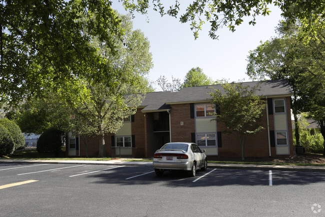
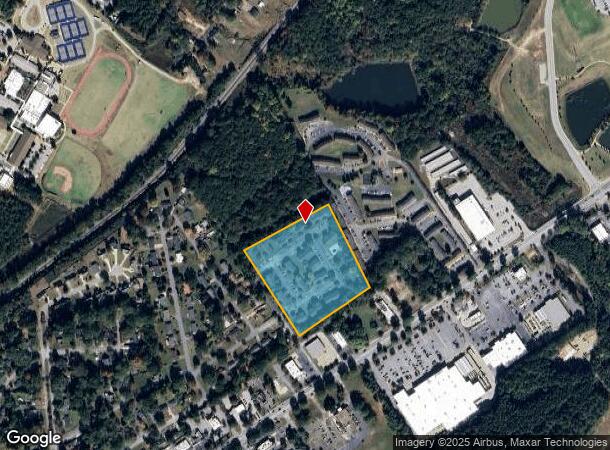
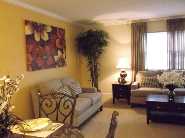
Property Record
300 Regency Rd, Spartanburg, SC 29307

NEARBY LISTINGS FOR SALE OR LEASE
Property Detail
300 Regency Rd
7-09-11-001.02
East Rdg Apt Llc
Commercialnec
N SIDE OLD CHARLOTTE RD & E SIDE REGENCY RD PB 67-342 REGENCY APTS PB 160-531
X
Spartanburg
45083C0257D
South Carolina
0
8.33 AC
2025
Hillcrest
021301
Greenville/Spartanburg
522 SF
Spartanburg, SC
DEMOGRAPHICS near 300 Regency Rd
1 Mile
3 Mile
5 Mile
2024 Total Population
4,721
32,832
75,183
2029 Population
5,340
36,934
85,292
Pop Growth 2024-2029
+ 13.11%
+ 12.49%
+ 13.45%
Average Age
43
40
40
2024 Total Households
2,222
13,841
30,445
HH Growth 2024-2029
+ 13.50%
+ 13.19%
+ 13.94%
Median Household Inc
$55,131
$55,208
$46,636
Avg Household Size
2.00
2.20
2.30
2024 Avg HH Vehicles
2.00
2.00
2.00
Median Home Value
$196,095
$192,832
$164,640
Median Year Built
1978
1973
1973
Nearby Places
Map Layers
Map Styles
 Street
 Aerial
- Restaurants
- Banks
- Shops
- Fitness
- Groceries
PUBLIC TRANSPORTATION
COMMUTER RAIL
Spartanburg Amtrak Station (Crescent - Amtrak)
DRIVE
WALK
Distance
Spartanburg Amtrak Station (Crescent - Amtrak)
9 min
3.7 mi
AIRPORT
Greenville Spartanburg International
DRIVE
WALK
Distance
Greenville Spartanburg International
37 min
24.4 mi
Freight Ports
North Charleston Terminal
DRIVE
WALK
Distance
North Charleston Terminal
228 min
197.3 mi
Nearby Properties
Address
Land Use
TOTAL SIZE
Lot Size
Zoning
Address
Land Use
TOTAL SIZE
Lot Size
Zoning
9,312 SF
9.06 AC
Address
Land Use
TOTAL SIZE
Lot Size
Zoning
5,672 SF
10.20 AC
Address
Land Use
TOTAL SIZE
Lot Size
Zoning
15,108 SF
16.27 AC
Address
Land Use
TOTAL SIZE
Lot Size
Zoning
18,600 SF
3.41 AC
Address
Land Use
TOTAL SIZE
Lot Size
Zoning
106,100 SF
24.56 AC
Address
Land Use
TOTAL SIZE
Lot Size
Zoning
6,517 SF
6.68 AC
Address
Land Use
TOTAL SIZE
Lot Size
Zoning
44,301 SF
7.47 AC
Address
Land Use
TOTAL SIZE
Lot Size
Zoning
31,913 SF
1.03 AC
Address
Land Use
TOTAL SIZE
Lot Size
Zoning
9,146 SF
51.62 AC
Address
Land Use
TOTAL SIZE
Lot Size
Zoning
6,798 SF
31.44 AC
Address
Land Use
TOTAL SIZE
Lot Size
Zoning
155,031 SF
12.58 AC
Address
Land Use
TOTAL SIZE
Lot Size
Zoning
19,796 SF
3.56 AC
Address
Land Use
TOTAL SIZE
Lot Size
Zoning
16.45 AC
Address
Land Use
TOTAL SIZE
Lot Size
Zoning
3,648 SF
20.77 AC
Address
Land Use
TOTAL SIZE
Lot Size
Zoning
18,443 SF
0.58 AC
Address
Land Use
TOTAL SIZE
Lot Size
Zoning
106,389 SF
3.15 AC
Address
Land Use
TOTAL SIZE
Lot Size
Zoning
11,402 SF
7.21 AC
Address
Land Use
TOTAL SIZE
Lot Size
Zoning
214,026 SF
29.83 AC
Address
Land Use
TOTAL SIZE
Lot Size
Zoning
27,608 SF
17.61 AC
Address
Land Use
TOTAL SIZE
Lot Size
Zoning
3,363 SF
8.10 AC
Address
Land Use
TOTAL SIZE
Lot Size
Zoning
36,047 SF
0.60 AC
Address
Land Use
TOTAL SIZE
Lot Size
Zoning
173,817 SF
0.85 AC
Address
Land Use
TOTAL SIZE
Lot Size
Zoning
675,179 SF
0.07 AC
Address
Land Use
TOTAL SIZE
Lot Size
Zoning
7,570 SF
24.50 AC
Address
Land Use
TOTAL SIZE
Lot Size
Zoning
156,683 SF
11.23 AC
Address
Land Use
TOTAL SIZE
Lot Size
Zoning
6,454 SF
0.70 AC
Address
Land Use
TOTAL SIZE
Lot Size
Zoning
26,086 SF
12.95 AC
Address
Land Use
TOTAL SIZE
Lot Size
Zoning
77,960 SF
2.44 AC
Address
Land Use
TOTAL SIZE
Lot Size
Zoning
3,254 SF
0.83 AC
Address
Land Use
TOTAL SIZE
Lot Size
Zoning
27,579 SF
3.08 AC
The World's #1 Commercial Real Estate Marketplace
Connect with us
© 2025 CoStar Group
The information above has been obtained from sources believed reliable. While we do not doubt its accuracy we have not verified it and make no guarantee, warranty or representation about it. It is your responsibility to independently confirm its accuracy and completeness. Any projections, opinions, assumptions, or estimates used are for example only and do not represent the current or future performance of the property. The value of this transaction to you depends on tax and other factors which should be evaluated by your tax, financial, and legal advisors. You and your advisors should conduct a careful, independent investigation of the property to determine to your satisfaction the suitability of the property for your needs.