Property Record
300 Route 16, Ossipee, NH 03864


Property Detail
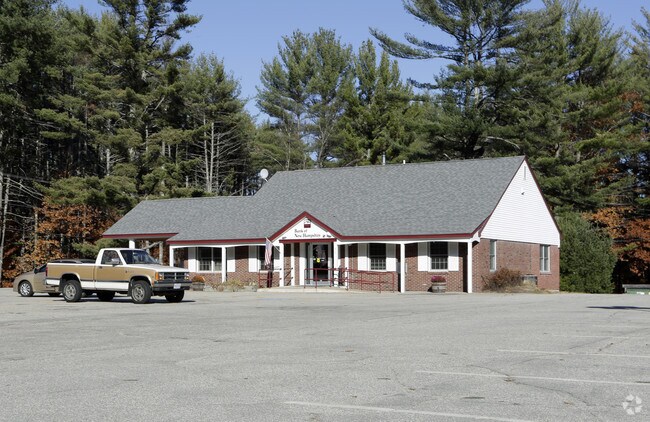
300 Route 16
Commercialbuilding
CARROLL
COM
New Hampshire
B and X Area of moderate flood hazard, usually the area between the limits of the 100-year and 500-year floods.
106000
2025
0.93 AC
2025
Concord/New Hampshire North Area
955902
Other Market Areas
3,073 SF
OSSI-000073-000000-106000
NEARBY LISTINGS FOR SALE OR LEASE
DEMOGRAPHICS near 300 Route 16
1 mile
3 mile
5 mile
2025 Total Population
378
3,004
6,354
2030 Population
407
3,189
6,756
Pop Growth 2025-2030
+ 7.67%
+ 6.16%
+ 6.33%
Average Age
51
49
49
2025 Total Households
181
1,451
2,948
HH Growth 2025-2030
+ 7.73%
+ 6.82%
+ 6.75%
Median Household Inc
$105,469
$66,258
$72,507
Avg Household Size
2.00
2.00
2.10
2025 Avg HH Vehicles
2.00
2.00
2.00
Median Home Value
$384,615
$372,384
$384,180
Median Year Built
1984
1986
1985
Nearby Places
Map Layers
Map Styles
 Street
 Aerial
Layers
 Traffic
 Biking
Places
Listings with unknown addresses are not visible on the map
- Restaurants
- Banks
- Shops
- Fitness
- Groceries
Nearby Properties
Address
Land Use
TOTAL SIZE
Lot Size
Zoning
Address
Land Use
TOTAL SIZE
Lot Size
Zoning
390.81 AC
RUR OS
Address
Land Use
TOTAL SIZE
Lot Size
Zoning
63,847 SF
13.93 AC
VIL DC
Address
Land Use
TOTAL SIZE
Lot Size
Zoning
4,197 SF
30.10 AC
OSSIPE
Address
Land Use
TOTAL SIZE
Lot Size
Zoning
5.91 AC
VIL DC
Address
Land Use
TOTAL SIZE
Lot Size
Zoning
4.69 AC
RSC
Address
Land Use
TOTAL SIZE
Lot Size
Zoning
1,718 SF
8.31 AC
OSSIPE
Address
Land Use
TOTAL SIZE
Lot Size
Zoning
1,111 SF
OSSIPE
Address
Land Use
TOTAL SIZE
Lot Size
Zoning
100.08 AC
COM
Address
Land Use
TOTAL SIZE
Lot Size
Zoning
8.20 AC
VIL DC
Address
Land Use
TOTAL SIZE
Lot Size
Zoning
3,280 SF
12.70 AC
OSSIPE
Address
Land Use
TOTAL SIZE
Lot Size
Zoning
8.80 AC
C/I GR
Address
Land Use
TOTAL SIZE
Lot Size
Zoning
9.33 AC
VIL DC
Address
Land Use
TOTAL SIZE
Lot Size
Zoning
6.73 AC
VIL DC
Address
Land Use
TOTAL SIZE
Lot Size
Zoning
3,772 SF
0.46 AC
RUR LO
Address
Land Use
TOTAL SIZE
Lot Size
Zoning
202 SF
107 AC
RUR OS
Address
Land Use
TOTAL SIZE
Lot Size
Zoning
26.70 AC
RUR OS
Address
Land Use
TOTAL SIZE
Lot Size
Zoning
429 AC
RUR OS
Address
Land Use
TOTAL SIZE
Lot Size
Zoning
4,577 SF
0.47 AC
OSSIPE
Address
Land Use
TOTAL SIZE
Lot Size
Zoning
10.78 AC
COM
Address
Land Use
TOTAL SIZE
Lot Size
Zoning
2,324 SF
0.43 AC
OSSIPE
Address
Land Use
TOTAL SIZE
Lot Size
Zoning
3,107 SF
0.52 AC
RUR LO
Address
Land Use
TOTAL SIZE
Lot Size
Zoning
3,152 SF
0.50 AC
OSSIPE
Address
Land Use
TOTAL SIZE
Lot Size
Zoning
2.57 AC
VIL DC
Address
Land Use
TOTAL SIZE
Lot Size
Zoning
0.70 AC
RUR OS
Address
Land Use
TOTAL SIZE
Lot Size
Zoning
2,251 SF
0.56 AC
OSSIPE
Address
Land Use
TOTAL SIZE
Lot Size
Zoning
5,611 SF
3.03 AC
RUR OS
Address
Land Use
TOTAL SIZE
Lot Size
Zoning
13,633 SF
5.01 AC
RSC
Address
Land Use
TOTAL SIZE
Lot Size
Zoning
1,826 SF
0.53 AC
OSSIPE
Address
Land Use
TOTAL SIZE
Lot Size
Zoning
13,142 SF
0.71 AC
VIL DC
Address
Land Use
TOTAL SIZE
Lot Size
Zoning
3.20 AC
COM
The World's #1 Commercial Real Estate Marketplace
Connect with us
© 2026 CoStar Group
The information above has been obtained from sources believed reliable. While we do not doubt its accuracy we have not verified it and make no guarantee, warranty or representation about it. It is your responsibility to independently confirm its accuracy and completeness. Any projections, opinions, assumptions, or estimates used are for example only and do not represent the current or future performance of the property. The value of this transaction to you depends on tax and other factors which should be evaluated by your tax, financial, and legal advisors. You and your advisors should conduct a careful, independent investigation of the property to determine to your satisfaction the suitability of the property for your needs.