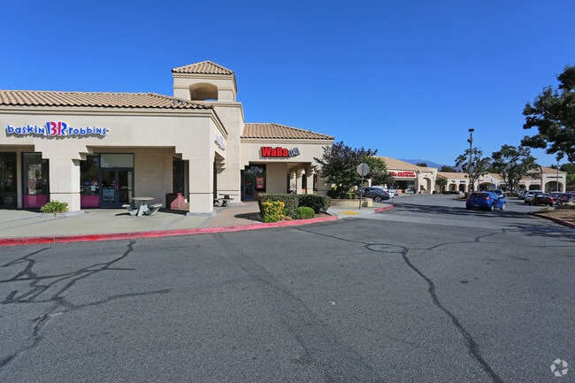
Property Record
300 S Highland Springs Ave, Banning, CA 92220


NEARBY LISTINGS FOR SALE OR LEASE
Property Detail
300 S Highland Springs Ave
Riverside-San Bernardino-Ontario, CA
Map No 23921
419-140-032
2.52 ACRES IN PAR 9 PM 159/068 PM 23921
Regionalshoppingcenterormallwithanchorstore
Riverside
X
California
06065C0812G
9
2024
2.52 AC
2025
Beaumont/Hemet
043812
Inland Empire (California)
27,608 SF
DEMOGRAPHICS near 300 S Highland Springs Ave
1 Mile
3 Mile
5 Mile
2024 Total Population
10,670
54,181
86,105
2029 Population
11,244
57,335
91,040
Pop Growth 2024-2029
+ 5.38%
+ 5.82%
+ 5.73%
Average Age
51
42
41
2024 Total Households
4,548
19,246
29,308
HH Growth 2024-2029
+ 4.95%
+ 5.43%
+ 5.35%
Median Household Inc
$65,831
$71,341
$73,115
Avg Household Size
2.30
2.80
2.80
2024 Avg HH Vehicles
2.00
2.00
2.00
Median Home Value
$341,588
$361,998
$370,905
Median Year Built
2000
1997
1995
Nearby Places
Map Layers
Map Styles
 Street
 Aerial
- Restaurants
- Banks
- Shops
- Fitness
- Groceries
PUBLIC TRANSPORTATION
AIRPORT
Palm Springs International
DRIVE
WALK
Distance
Palm Springs International
37 min
30.4 mi
Freight Ports
Port of Long Beach
DRIVE
WALK
Distance
Port of Long Beach
106 min
82.3 mi
SALE & LEASE HISTORY
LISTING DATE
SALE/LEASE

Jul 11, 2018
For Lease
Nearby Properties
Address
Land Use
TOTAL SIZE
Lot Size
Zoning
Address
Land Use
TOTAL SIZE
Lot Size
Zoning
600,000 SF
30.81 AC
RA
Address
Land Use
TOTAL SIZE
Lot Size
Zoning
146,056 SF
15.95 AC
Address
Land Use
TOTAL SIZE
Lot Size
Zoning
444,455 SF
19.89 AC
IND
Address
Land Use
TOTAL SIZE
Lot Size
Zoning
95,590 SF
7.48 AC
Address
Land Use
TOTAL SIZE
Lot Size
Zoning
211,062 SF
11.02 AC
Address
Land Use
TOTAL SIZE
Lot Size
Zoning
216,071 SF
21.90 AC
Address
Land Use
TOTAL SIZE
Lot Size
Zoning
174,418 SF
46.93 AC
Address
Land Use
TOTAL SIZE
Lot Size
Zoning
116,175 SF
4.86 AC
RA
Address
Land Use
TOTAL SIZE
Lot Size
Zoning
44,506 SF
2.35 AC
Address
Land Use
TOTAL SIZE
Lot Size
Zoning
97,103 SF
8 AC
Address
Land Use
TOTAL SIZE
Lot Size
Zoning
39,866 SF
3.55 AC
Address
Land Use
TOTAL SIZE
Lot Size
Zoning
43,105 SF
4.23 AC
Address
Land Use
TOTAL SIZE
Lot Size
Zoning
42,325 SF
2.31 AC
Address
Land Use
TOTAL SIZE
Lot Size
Zoning
44,506 SF
2.84 AC
Address
Land Use
TOTAL SIZE
Lot Size
Zoning
141,286 SF
10.72 AC
Address
Land Use
TOTAL SIZE
Lot Size
Zoning
103,087 SF
8.52 AC
Address
Land Use
TOTAL SIZE
Lot Size
Zoning
27,359 SF
1.97 AC
C2
Address
Land Use
TOTAL SIZE
Lot Size
Zoning
90,184 SF
4.81 AC
C1
Address
Land Use
TOTAL SIZE
Lot Size
Zoning
42,602 SF
3.91 AC
RA
Address
Land Use
TOTAL SIZE
Lot Size
Zoning
59,641 SF
2.02 AC
CPS
Address
Land Use
TOTAL SIZE
Lot Size
Zoning
24,542 SF
3.02 AC
Address
Land Use
TOTAL SIZE
Lot Size
Zoning
39,250 SF
1.38 AC
C2
Address
Land Use
TOTAL SIZE
Lot Size
Zoning
62,796 SF
1.48 AC
Address
Land Use
TOTAL SIZE
Lot Size
Zoning
26,882 SF
7.88 AC
W2
Address
Land Use
TOTAL SIZE
Lot Size
Zoning
53,021 SF
5.40 AC
Address
Land Use
TOTAL SIZE
Lot Size
Zoning
20,800 SF
1.10 AC
C2
Address
Land Use
TOTAL SIZE
Lot Size
Zoning
66,528 SF
4.95 AC
RSF
Address
Land Use
TOTAL SIZE
Lot Size
Zoning
44,335 SF
4 AC
Address
Land Use
TOTAL SIZE
Lot Size
Zoning
6,589 SF
1.33 AC
C2
The World's #1 Commercial Real Estate Marketplace
Connect with us
© 2026 CoStar Group
The information above has been obtained from sources believed reliable. While we do not doubt its accuracy we have not verified it and make no guarantee, warranty or representation about it. It is your responsibility to independently confirm its accuracy and completeness. Any projections, opinions, assumptions, or estimates used are for example only and do not represent the current or future performance of the property. The value of this transaction to you depends on tax and other factors which should be evaluated by your tax, financial, and legal advisors. You and your advisors should conduct a careful, independent investigation of the property to determine to your satisfaction the suitability of the property for your needs.